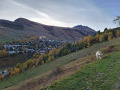
A short circular loop starting from La Balme

A circular route starting from the hamlet of La Balme, taking in the La Foune fountain, which has been restored by the Daurienchons Association. The route is partially signposted with orange-painted signs, cairns and wooden arrows.
This route can also be combined with other existing routes listed on the app.
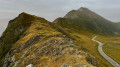
You may spot some chamois. The circular route leads to a place known as ‘Le Coin’, more commonly called ‘So Cougne’ in the local dialect. It is a charming little plateau where it is lovely to stroll; a magnificent, breathtaking view awaits those who make their way to the end of So Cougne.

Details

n°41864931
Creation:
Last update:
Last review:
  • Walking
    Activity: Walking
  • ↔
    Distance: 1.19 mi
  • ◔
    Average duration: 0h 55 
  • ▲
    Difficulty: Easy

  • ⚐
    Back to start: Yes
  • ↗
    Ascent: + 420 ft
  • ↘
    Descent: - 417 ft

  • ▲
    Highest point: 4,183 ft
  • ▼
    Lowest point: 3,806 ft

Description of the walk

Park near the La Balme car park, at the foot of the wash house.

(S/E) Head towards the signpost (on the right). Follow the signs for Le Coin and Plancet, indicated on a sign, and take the tarmac road to the end. Continue left onto the wide track. Then turn right uphill to reach a crossroads, where there is a wooden sign.

(1) Turn left to follow the sign for La Foune, written in orange paint. Head down this narrow path to reach the lowest point directly beneath the power line. Then head back up to reach a cairn at the edge of the copse.

(2) Enter a copse and the Fontaine de la Foune will appear on your right. The path descends for a few metres before beginning an ascent, which is a little steep in places. Signposts and cairns help you follow the path. After the first two cairns, wooden steps lead you upwards. There are several cairns here; after the hairpin bend, pass between two cairns. After the two cairns (at the same level), turn left and look out for the next cairns. After a short climb, you’ll reach Le Coin.

(3) Turn left onto the So Cougne plateau, a very picturesque stretch, to reach the edge of the cliff at So Cougne.

(4) Return to the previous junction by taking a path on the left.

(3) Head towards La Balme (north-east), continuing along a fairly wide path. You’ll reach the junction you passed on the way out.

(1) Follow the path you took on the way out in the opposite direction to return to the La Balme car park (S/E)

Waypoints

  1. S/E : mi 0 - alt. 3,990 ft - Car park at the washhouse in the hamlet of La Balme
  2. 1 : mi 0.18 - alt. 3,993 ft - Crossroads at the end of the circular loop
  3. 2 : mi 0.47 - alt. 3,970 ft - Cairn crossroads
  4. 3 : mi 0.55 - alt. 4,101 ft - Le Coin
  5. 4 : mi 0.63 - alt. 4,121 ft - So Cougne
  6. S/E : mi 1.19 - alt. 3,990 ft - Car park at the wash house in the hamlet of La Balme

Notes

Water is available at the wash house in the hamlet of La Balme.
You may spot some chamois.

Worth a visit

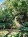
(2) The Fontaine de la Foune, recently restored by the Daurienchons Association. In summer, this shaded spot is ideal for a picnic under the trees.
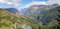
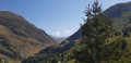
(4) A remarkable viewpoint at the far end of the So Cougne plateau, where a breathtaking view takes in the Venéon valley below (500 m) as well as the deep blue-green Lac du Buclet.
Between (3) and (1) A lovely view of the hamlets of Les Certs and La Balme as you head back, as well as of La Meije.

Reviews and comments

4.7 / 5
Based on 1 review

Reliability of the description
4 / 5
Ease of following the route
5 / 5
Route interest
5 / 5
Fouyan
Fouyan
• Edited:

Overall rating : 4.7 / 5

Date of your route : Feb 26, 2024
Reliability of the description : ★★★★☆ Good
Ease of following the route : ★★★★★ Very good
Route interest : ★★★★★ Very good
Very busy route : No

A lovely walk with incredible views of the surrounding area!

Machine-translated

Other walks in the area

For more walks, use our search engine .

The GPS track and description are the property of this route's author. Please do not copy them without permission.