Country:

 City:
City:


Park in the small dirt car park near the Col de Cluy.
(S/E) Head towards the ruined house and, immediately afterwards, take the wide grassy path above the sheep track. Follow this path for 1 km to the Compalou chalet.
(1) Leave it on your left and begin the ascent, which is quite steep at first, straight ahead. The path is clearly marked, with no risk of going astray; at the start, there are markers (wooden posts) to prevent any confusion. Partway up, a cairn indicates the direction to follow. You’ll reach the sign for “Sous les Grandes Buffes”.
(2) Continue straight on, heading towards the Col de Grange Pellorce, and walk on largely level ground. For those wishing to stop at the Grandes Buffes on the way there, there is no marked path. You must climb almost straight up, then veer off to the right.
(3) Leave the path leading to Les Grandes Buffes on your left and carry on to reach the Col de Grange Pellorce (incorrectly marked on the IGN map).
(4) At the pass, a sign points straight ahead towards the Croix de Cassini. The climb begins shortly afterwards; it is quite steep at first, then levels off, reaching the summit after about an hour.
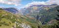
(5) Superb views; in good weather, you can see Mont Blanc. Return to the Col de Grange Pellorce.
(4) Continue along the same path you took on the way up.
(3) Leave the path by keeping to the right and head up towards Les Grandes Buffes, initially aiming for the clearly visible avalanche-trigger hut. Several tracks actually lead to the summit.
(6) At Les Grandes Buffes, the path is not marked, but it is difficult to go wrong. Initially, cross the valleys, heading south-south-east to south. The slope then becomes steeper; descend almost directly down it to rejoin the path taken on the way there, not far from the sign for “Sous les Grandes Buffes”.
(2) Carry on to the right and you’ll come back to the Compalou chalet.
(1) Follow the grassy track/road for about one kilometre to the stone house at the Col de Cluy, then return to the car park where you started (S/E).

 Visorando Member
 Moderate
 Easy
Easy 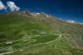
 Very difficult