Country:

 City:
City:


Park in the car park at the entrance to the hamlet of Les Cours (Souze car park).
(S/E) Head east along Rue du Pissaille, which leads to the village, and ignore Rue du Tepas, which descends to the right. At the next junction, turn left, leaving the Chapelle des Cours on your left, then take the Chemin de Violette (signposted) directly ahead of you, which climbs slightly, and continue until you reach the D211e.
(1) Follow it for about a hundred metres and turn right onto the track heading towards the hamlets of Puy le Haut and Puy le Bas. Continue along the hillside (flat track) and cross the Ruisseau de la Combe de la Gilarde.
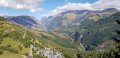
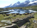
(2) At the sign for the mine (1,448 m), take the path climbing up to the left towards Cluy. There is a picnic table at the hairpin bend with a lovely view of the Écrins Massif.
(3) Continue north-west on a gentle climb until you reach the road leading to the Col de Cluy (see alternative route in ‘Practical Information’).
(4) Turn left and begin the descent towards the Cluy Chapel, which is open to visitors.
(5) Continue the descent along the pastoral road. 50 m before the tarmac road, turn right onto the signposted path leading to the Chapelle Saint-Giraud.
(6) Continue along the hillside path, then take the path on the left (which goes downhill) leading to the hamlet of Les Cours. Cross the county road leading to the resort with care, then head down the path on the other side of the road (the start is moderately visible, directly opposite the point where the path joins the tarmac road). Continue along the path which descends to the level of the tarmac road. At the sign for Sainte-Marie 1400 m (it is possible to reach the Les Cours car park by crossing the departmental road and taking the street opposite on the left, heading down towards the east).
(7) At the sign, without crossing the tarmac road, take the path on the right leading uphill towards the resort. When you reach the picnic table, continue along the path on the left. The path on the right leads to the resort after a climb of around 600 m.
(8) At the crossroads, take the forest track on the left towards Plancet (a very gentle descent). The path on the right leads to the resort (around 300 to 400 m). Continue along the path until you reach the forest track and take this on the right as far as the Plancet area.
(9) After the two picnic tables on the esplanade, take the path leading down towards Les Certs and La Balme (signposted).
(10) At the junction, turn onto the path on the left towards Le Certs. Make sure you close the gate properly by putting the electric wire back in place to enclose the cow paddock. Follow the narrow path, which descends slightly before widening out.
(11) Walk through the hamlet of Le Certs, then turn left (on the left, you’ll see a chapel near the wash house). Continue left along the Chemin de Sainte-Barbe and head towards the hamlet of Les Courts. At the end of the tarmac road, take the fairly wide track on the left. At the end of the path (about 1 km), turn right and follow the departmental road for about 100 m, then turn left at the junction onto the Route des Grands Arbres, which leads to the hamlet of Les Cours. It is another 600 m to the Souze car park (S/E).

 Visorando Member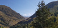

 Easy
Easy 
 Difficult
 Very difficult