The Croix de Cassini circular loop via the three passes

This circular route starts at the car park below the Saint-Géraud Chapel and takes you to the summit of the Croix de Cassini, passing over two passes on the ascent and one on the descent.
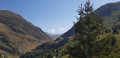
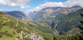
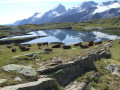
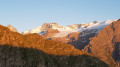
Throughout the route, hikers are treated to magnificent views of the peaks and the Écrins National Park.

Details

n°63410754
Creation:
Last update:
Last review:
  • Walking
    Activity: Walking
  • ↔
    Distance: 9.79 mi
  • ◔
    Average duration: 7h 15 
  • ▲
    Difficulty: Difficult

  • ⚐
    Back to start: Yes
  • ↗
    Ascent: + 3,182 ft
  • ↘
    Descent: - 3,179 ft

  • ▲
    Highest point: 7,772 ft
  • ▼
    Lowest point: 5,013 ft

Photos

Description of the walk

The starting point is on the D211e road linking Freney-d’Oisans and the resort of Auris-en-Oisans. The car park is situated in a wide bend approximately 1 km from the resort of Auris, 50 metres from the pastoral road leading to the Col de Cluy and the Col de Sarenne. About fifty metres from the car park, above the road, stands the Chapelle Saint-Géraud (spelt Saint-Giraud on IGN maps).

(S/E) Head north and take the sheep track leading to the Col de Cluy. Pass through the hamlet of Cluy (chapel) and continue along the track for about a hundred metres.

(1) At the start of a right-hand bend, leave the track and take a path on the left. Head straight on (north-north-east) and climb up a valley until you reach an alpine chalet.

(2) Follow a sheep track due north. Cross the Col de Cluy and continue along the track until you reach a Fork in the road.

(3) Take the track on the right, which descends slightly, towards the Col de Sarenne. Head north, ignoring the paths branching off to the left, then turn north-east. Descend, reach a river and follow it on your left.

(4) At a junction, continue east-north-east, keeping the river on your left. Climb up to a small tarmac road.

(5) Follow the road to the right towards the Col de Sarenne. This road is rarely used and you can walk along the grassy verge. This will take you to the Col de Sarenne.

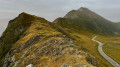
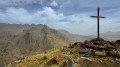
(6) Turn sharply right onto a path that quickly leads to an orientation table. Continue south-west and follow the ridge line upwards (yellow markings; stunning views throughout the ascent, over the Emparis plateau and the Écrins massif to the left, and the Rousses and Belledonne massifs to the right). There are two or three harmless sections where you’ll need to use your hands. Reach the Croix de Cassini (panoramic view).

(7) Descend on the other side, following the markings. Ignore the paths on the right and reach the Col de Grange Pellorce.

(8) Continue along the path, keeping to the left, and go round the Grandes Buffes on the left. Climb slightly; ignore the turn-off to the Grandes Buffes on the right (sign) and continue the descent towards the Bergerie de Campalou along a very well-marked path.

(9) At the sheepfold, turn right and follow a grassy track to an alpine chalet you saw at the start of the walk.

(2) Turn left (south-south-east) onto the path you took on the way up.

(1) You’ll come out onto the track you took at the start of the walk; follow it to the right, cross the hamlet of Cluy and head back down to the car park (S/E).

Waypoints

  1. S/E : mi 0 - alt. 5,013 ft - Car park on the D211e road - Chapelle Saint-Géraud (Auris)
  2. 1 : mi 0.74 - alt. 5,377 ft - Start of the trail. Towards the - Col de Cluy (1802m)
  3. 2 : mi 1.19 - alt. 5,896 ft - Junction of the circular loop – Alpine chalet
  4. 3 : mi 1.37 - alt. 5,896 ft - Fork in the road
  5. 4 : mi 2.65 - alt. 5,709 ft - Junction
  6. 5 : mi 3.32 - alt. 5,991 ft - Small road - Sarenne (torrent) - Affluent de la Romanche
  7. 6 : mi 4.56 - alt. 6,555 ft - Col de Sarenne
  8. 7 : mi 5.94 - alt. 7,772 ft - La Croix de Cassini (2373 m)
  9. 8 : mi 6.88 - alt. 6,811 ft - Col de Grange Pelorce (2086m)
  10. 9 : mi 7.96 - alt. 5,991 ft - Campalou Sheepfold
  11. S/E : mi 9.79 - alt. 5,013 ft - Car park on the D211e road - Chapelle Saint-Géraud (Auris)

Notes

There are no water sources along the route, except occasionally in July and August near the Col de Sarenne, at the sheepfold situated 150 metres below the pass, on the left-hand side of the road leading up to the pass. Food and drink are sometimes available.

You may come across flocks of sheep; be careful of the dogs (Patou), which may come up to sniff you, simply to make sure you mean no harm to the sheep.

You can start this walk at the Col de Cluy, which can be reached via the pastoral track, reducing the walking time by about an hour.

Worth a visit

At the start or finish, take a moment to admire the Saint-Géraud Chapel, situated just above the starting junction, from where there is a beautiful view of the Écrins massif.

Shortly after the hamlet of Cluy, you can visit the Chapel of Saint-Ilpise and Saint-Arcon.

Throughout the ascent along the ridge leading to the Croix de Cassini, there are magnificent views of the Emparis plateau, La Meije and its glaciers. On the descent, there are views of the lake created by the Chambon dam.

Reviews and comments

4.7 / 5
Based on 1 review

Reliability of the description
5 / 5
Ease of following the route
5 / 5
Route interest
4 / 5
Jeanloic
Jeanloic

Overall rating : 4.7 / 5

Date of your route : Aug 27, 2026
Reliability of the description : ★★★★★ Very good
Ease of following the route : ★★★★★ Very good
Route interest : ★★★★☆ Good
Very busy route : No

An easy walk. The climb up to the Col de Sarenne is a bit monotonous along long tracks suitable for vehicles
But after that, you’ll be on footpaths and the 360° panoramic view is truly lovely.

Machine-translated

Other walks in the area

For more walks, use our search engine .

The GPS track and description are the property of this route's author. Please do not copy them without permission.