


mtf

 Visorando Member
 Premium user
 Sign up:
Published route(s)
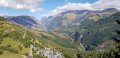
 A short tour of the hamlets of Auris starting from Les Cours
 3.27 mi
 +768 ft
 -787 ft
 2h 10
2h 10
 Easy
Easy
 Departure from Auris (Isère)
A short walk starting from the village of Les Cours, taking you through six hamlets. An easy route taking less than 2 hours.
You can extend the route with other circular loops using the various signposted waypoints.
The Auris Chapel Route
6.64 mi
+1,493 ft
-1,512 ft
4h 20
 Moderate
Departure from Auris (Isère)
Moderate
Departure from Auris (Isère)
This route offers magnificent views of the Écrins Massif and La Meije, as well as the Bourg-d’Oisans valley. There are four chapels along the route: those in the hamlets of Les Cours and Cluy, the Saint-Géraud Chapel and the chapel in the hamlet of Les Certs.
This is an easy walk with several picnic spots along the way.
There are several alternative routes available, allowing you to extend the route. You can start from the resort.
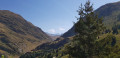
Circular of the grand tour of Signal de l'Homme and view of five mountain ranges.
 8.34 mi
+1,509 ft
-1,509 ft
5h 10
Moderate
Departure from Auris (Isère)
8.34 mi
+1,509 ft
-1,509 ft
5h 10
Moderate
Departure from Auris (Isère)
This easy circular offers superb 360° views of five mountain ranges during the journeyOisans with a view of La MeijeThe Aiguilles d'Arves, symbol of the MaurienneThe Grandes Rousses mountain rangeThe Belledonne rangeThe Taillefer massifnot forgetting the Emparis plateau.
From the Col de Cluy to the Croix de Cassini and back via the Grandes Buffes
5.47 mi
+2,205 ft
-2,211 ft
4h 25
 Difficult
Departure from Le Freney-d'Oisans (Isère)
Difficult
Departure from Le Freney-d'Oisans (Isère)
This walk takes you to the Croix de Cassini (2,361 m), offering a magnificent 360° view of La Meije, the Aiguilles d’Arves, the Grandes Rousses, Belledonne, Le Taillefer and the Muzelle Glacier. In good weather, you may be able to see Mont Blanc, and blueberries can be picked in season.