Country:

 City:
City:



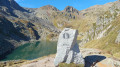
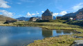
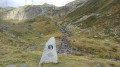
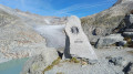
Hike undertaken by the author from 13 to 17 September 2026
Public transport:
Andermatt is served by trains to many Swiss towns: change at Brig (VS) or Göschenen (UR).
See timetables.
This hike follows the Vier-Quellen-Weg, which is marked on Swiss maps.
Signposting: at every major junction, you will find signposts:
- Sign No. 49 or P49 with a sticker No. 49 indicating this trail.
- R sign: yellow sign with a hiker pictogram
Before setting off, it is advisable to check the Suisse Topo website for any trail closures and diversions. This information is updated in real time. As well as the Visorando app, you can also download the free swisstopo app, where you will find this information too.
Transport: Timetables
Before setting off, check the Swiss Weather Service or Météo Blue
Hiking kit, including good walking boots.
Accommodation:
- Andermatt: The River House Hotel
- Vermigel Hütte: Vermigel Hütte
- Gotthard Pass: Ospizio Gottardo
- Capanna Piansecco: Capanna Piansecco
- Obergesteln: Hotel Hubertus
- Oberwald: Hotel Furka
 Visorando Member
 Moderate