


Refine your search for walks in Grisons
Grisons walks


 Vier Quellen Weg
 Visorando Member
 50.77 mi
 +15,958 ft
 -15,315 ft
 5 days
 Difficult
 Departure from Tujetsch (Grisons)
This magnificent Four Springs Trail (Vier Quellen Weg) will take you to the headwaters of the Rhine, the Reuss, the Ticino and the Rhône. You’ll pass through the cantons of Uri, Graubünden, Ticino and Valais, crossing six major mountain passes: the Maighels Pass, the Sella Pass, the Gotthard Pass, the Lucendro Pass, the Nufenen Pass and the Furka Pass.
Oberalppass – Vermigel Hütte
8.47 mi
+2,612 ft
-2,621 ft
6h 10
Difficult
Departure from Tujetsch (Grisons)
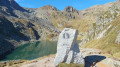
This first stage of the Vier Quellen Weg will take you from the Oberalppass to the Capanna Vermigel. During the day, you’ll discover Lake Tuma, one of the sources of the Rhine. An engraved marker indicates this source. As you climb towards the Col de Maighels, you’ll walk alongside another branch of the Rhine (Rein da Maighels), which has its source at the Maighels Glacier.
Circular Chod’Valletta starting from Samedan
 5.80 mi
+2,543 ft
-2,536 ft
4h 55
 Easy
Departure from Samedan (Grisons)
A family hike along a ridge above Samedan, with magnificent views of the Graubünden glaciers. The route winds through the forest and across the mountain pastures of Chod’Valletta. The network of paths offers a choice of routes of varying lengths and elevation gains. A significant advantage of this route is that it is far less crowded than the region’s more popular tourist trails!
Rossa - San Bernardino
 9.59 mi
+3,799 ft
-2,005 ft
7h 45
Difficult
Departure from Grisons
Final stage to reach San Bernardino. From Rossa, follow the road to the hamlet of Valbella (bottom of Val Calanca). The trail continues on the right bank of the Calancacasca torrent. At Alpe de Lögna, turn right towards Pass di Passit. In a chaotic setting, after a first lake, Pass di Passit is easily reached. After the pass, reach the second lake and continue along the high-altitude trail. Descend towards Lago d'Isola. Head towards Ponte di Cal and descend towards San Bernardino along the Ri di Confin.Markings: White-Red-White.
 Arosa, Schwellisee, Alpenblick, Langwieser and Aussicht
14.16 mi
+2,149 ft
-2,126 ft
3 hrs
 Moderate
Departure from Arosa (Grisons)
Circular from Prätschlistrasse via Alter Kirchliweg, where you will need to push your bike. The route then follows the Mittelbünden Panoramaweg to Schwellisee. Take the path to the last Arole (caution: steep slope) and then return via the other side of the lake.
Route du Val Trupchun in the Swiss National Park
8.38 mi
+1,719 ft
-1,726 ft
5h 20
Moderate
Departure from S-chanf (Grisons)
A classic walk in the Swiss National Park, this route leads to the bottom of the remarkably picturesque Trupchun Valley, where you’re very likely to spot ibex, chamois, deer and, of course, the ever-present marmots, as well as various species of birds.
The elevation gain is relatively low, the path is easy, the scenery is superb – a real family walk.
Champlönch and Grimmels circular loop in the Swiss National Park
5.36 mi
+1,614 ft
-1,637 ft
3h 50
Easy
Departure from Zernez (Grisons)
A lovely and very easy walk in the exceptional setting of the Swiss National Park, home to marmots, ibex, chamois and the park’s iconic bird, the spotted nutcracker. The atmosphere is quite wooded, with alpine pastures and clearings, dead trees… In the national park, nature is allowed to evolve with as little human intervention as possible, resulting in often stunning landscapes.
Munt La Schera in the Swiss National Park
7.41 mi
+2,844 ft
-2,848 ft
5h 55
Moderate
Departure from Zernez (Grisons)
Munt La Schera (2,586 m) is one of the few accessible peaks in the Swiss National Park. Stocky and somewhat isolated, it offers a sublime view of the many neighbouring 3,000-metre peaks in Switzerland and Italy. The National Park has set up an educational geological trail; enquire at the Park House in Zernez.