


YamineOTI

 Tourist office
PRO  Premium user
 - 10 bis chemin ravine bernica 97460 Saint-Paul
- Website: https://www.ouest-lareunion.com/
Sign up:
Published route(s)
 From Cayenne to Aurère
 3.66 mi
 +2,579 ft
 -1,322 ft
 3h 55
 Difficult
 Departure from La Possession (Réunion)
From Cayenne to Deux-Bras, follow the course of the Rivière des Galets, avoiding the path down to the riverbed. Instead, take the path on the right leading to the Bras d’Oussy footbridge. After crossing the bridge, turn right towards Aurère, beginning the ascent to Bord Bazar. The climb begins with a secured section along a cliff face, offering breathtaking views of the Maïdo rampart and Piton Tortue. The Bambou spring signals the imminent end of this adventure, marking a harmonious exploration where humanity and majestic nature come together.
From Col des Bœufs to La Nouvelle
 7.02 mi
+2,087 ft
-2,073 ft
5h 05
 Moderate
Departure from La Possession (Réunion)
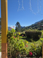
The hike from Col des Bœufs to La Nouvelle offers an accessible route for exploring the Cirque de Mafate. This excursion can be done in one day or over two days if you book a lodge. It allows you to discover the Plaine des Tamarins, the small hamlets of La Nouvelle (considered the capital of Mafate) and Marla.
From Col des Bœufs to Marla
8.25 mi
+2,451 ft
-2,438 ft
5h 55
Difficult
Departure from La Possession (Réunion)
From the Col des Bœufs, a forest track leads you to the edge of the Cirque de Salazie, where you’ll discover the majestic pass and its breathtaking views over the Cirque de Mafate. Your walk begins on a path carved into the mountainside, offering a dizzying view. You’ll then enter the tamarind forest. After crossing a clearing, you’ll descend towards the pebble-strewn river, discovering a hidden pool along the way. Finally, a short climb takes you to the village of Marla, where you can rest.
La Roche Écrite via Dos d'Âne
13.58 mi
+4,436 ft
-4,416 ft
5 hrs
 Very difficult
Departure from La Possession (Réunion)
La Roche Écrite rises to 2,276 metres and is accessible from several points. The route via Dos d'Ane is one of the longest, but also one of the most beautiful, with frequent views of the Cirque de Mafate in the first section. Some sections along the ridge are vertiginous and offer unique views. The detour via the Mare aux Cerfs and the Caverne Soldat adds an extra dimension to this long, challenging route.
From Maïdo to Le Bronchard
 9.44 mi
+4,213 ft
-4,190 ft
6 hrs
Very difficult
Departure from Saint-Paul (La Réunion) (Réunion)
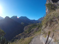
The route to Mafate via Maïdo is one of the most challenging ways to reach Mafate. This fairly strenuous round trip allows you to see the charming village of Roche Plate and go beyond it to Le Bronchard, which offers sweeping views of the surrounding area. The village of Roche Plate is typical of the villages in Mafate with its Creole houses. It is quite spread out and consists of two neighbourhoods. There are numerous lodges in the area.
Mafate via the Rivière des Galets
 10.40 mi
+440 ft
-449 ft
5h 10
Moderate
Departure from La Possession (Réunion)
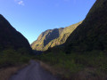
The Cirque de Mafate is accessible from many different points. The flat track is easy to follow and suitable for everyone. Families can come on this walk and turn back at any time. You can even take a dip in the Rivière des Galets. The track runs straight ahead, winding its way between rock faces that grow ever higher as you go.
Caverne de la Glacière via the Tamarin Lodge
 4.82 mi
+2,300 ft
-2,300 ft
4h 15
Difficult
Departure from Les Trois-Bassins (Réunion)
The Grand Bénare area is known for its cool or sub-zero temperatures in winter. During this period, ice forms in the ravines. In the past, ice was stored in wells and in the Caverne de la Glacière. The route via the Maïdo is accessible to everyone and is very easy. However, reaching the cave via the Tamarin Lodge is a more challenging alternative, reserved for those with very strong calves.
Le Grand Bénare via the Tamarin Lodge
 9.30 mi
+3,629 ft
-3,629 ft
7 hrs
Very difficult
Departure from Les Trois-Bassins (Réunion)
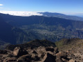
Le Grand Bénare is an iconic peak on the island. The approach via the Tamarin Lodge is much more strenuous than from Le Maïdo. You’ll need calves of steel to tackle the inevitable sharp rocks. The views are spectacular, and this is the case well before you reach the summit. The climb is steady and the elevation gain is quite significant. The route through the Caverne de la Glacière and the various shafts encountered during the ascent add an extra dimension to this hike.
From Pointe au Sel to Stella via the Sentier Sucré Salé
3.42 mi
+449 ft
-449 ft
2h 00
 Easy
Departure from Saint-Leu (La Réunion) (Réunion)
Réunion has a few remarkable museums, such as the Salt Museum and the Stella Matutina Museum. It is possible to visit both by taking a circular route via the Sentier Sucré Salé, which was used by the Stella factory owners to come and help the workers in the salt flats during the Second World War. You can also return via Piton des Roches Tendres, which offers a lovely view of the west of the island.
The Chemin Pavé Lougnon
2.17 mi
+768 ft
-771 ft
1h 40
Easy
Departure from Saint-Paul (La Réunion) (Réunion)
The Saint-Paul region once had three paved roads: the Chemin Charrette Boeuf, the Chemin du Bernica and the Chemin Pavé Lougnon. They were built by Governor Antoine Desforges-Boucher in the18th century. Goods were previously transported from the hills above Saint-Paul to the town via unpaved tracks, which is why Antoine Desforges-Boucher decided to build these paved roads. The route of the Chemin Pavé de Lougnon was rediscovered by Albert Lougnon.
Bassin Long and Ravine Divon
1.08 mi
+85 ft
-85 ft
0h 35
Easy
Departure from Saint-Paul (La Réunion) (Réunion)
The Saint-Paul area comprises three main basins: Bassin Vital, Bassin Long and Bassin Pigeon. The latter is the easiest to access and is situated in Ravine Divon. The ravine has changed its name several times. Its first name was Ravine d’Hibon, in honour of a landowner nearby, then Ravine d’Yvon and finally Ravine Divon. The walk to the pond is suitable for families and never difficult, with a few spots that are ideal for a picnic.
Bottle Rock
 2.08 mi
+1,024 ft
-1,017 ft
1h 50
Moderate
Departure from La Possession (Réunion)
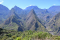
This short hike offers magnificent views of the Mafate cirque on one side and the coast of La Possession on the other, with the Dos-d'Àne islet in the foreground. This is the easiest place to get a spectacular, unobstructed view of Mafate.
From Saint-Paul to Trou d'Eau via the beaches
9.42 mi
+75 ft
-89 ft
4h 25
Moderate
Departure from Saint-Paul (La Réunion) (Réunion)
The west of Réunion is very popular for its white sandy beaches stretching for miles! Starting from Saint-Paul, you’ll come across plenty of sights. Some beaches are particularly beautiful when they’re not crowded. Of course, you can take your time visiting the coastal towns along the way or taking a dip in the water. There are plenty of places to stop for refreshments all along the route! But we strongly recommend bringing a hat!
The Bassin Vital
 1.44 mi
+686 ft
-686 ft
1h 15
Moderate
Departure from Saint-Paul (La Réunion) (Réunion)
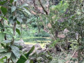
Étang Saint-Paul is designated as a nature reserve. There are several walking routes around it, including the Bassin Vital trail. Perched at an altitude of just over 150 metres, you can reach it via a short, fairly steep climb or by following a circular route. The views over Étang Saint-Paul are absolutely stunning! You can combine this walk with others in the area.
From La Possession to Saint-Denis via the Chemin des Anglais and the Colorado
 12.29 mi
+4,006 ft
-3,770 ft
9h 10
Difficult
Departure from La Possession (Réunion)
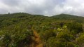
Here’s an original way to get from La Possession to Saint-Denis. This is the final section of the Grand Raid, one of the world’s toughest mountain races. Nearly half of the walk follows the Chemin des Anglais, a cobbled path steeped in history and offering stunning views. This route passes through La Grande-Chaloupe and Le Colorado. This walk requires a certain level of fitness.
From Cayenne to Bras Mouton
2.71 mi
+1,467 ft
-1,467 ft
2h 30
Moderate
Departure from Saint-Leu (La Réunion) (Réunion)
Cayenne is a small village not far from Kélonia. Many people pass through this village on their way to Saint-Gilles (or Saint-Leu) but don’t stop, except to look at the sea. A path runs through the village and leads to Bras Mouton in the hills above Saint-Leu, offering some panoramic views of this part of the island.