Country:
 City:


Access: Take the RF8 towards Maïdo. Stay on this road until you reach the leisure park and summer toboggan run. Continue along this road for several kilometres and take the first right onto the Route Forestière des Tamarins towards Tévélave. Follow it for 6 km to the Gîte des Tamarins, situated after Bras Calebasse. Drive past the lodge and park at the start of the picnic area.
(S/E) From the picnic area, take the path (Sentier Vaudeville) which starts on the left at the edge of the area. It climbs towards the Grand Bénare and the Caverne de la Glacière (signposted). The first few metres are under the tamarind trees of the highlands, but the vegetation changes very quickly and is replaced by acacias. Some sections have been severely affected by fires, the scars of which are still visible, although the vegetation is gradually reclaiming its place. The path is grassy but won’t remain so for long.
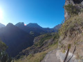
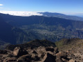
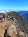
(1) It takes just 10 minutes’ walk to cross a tributary of the Grande Ravine. Iron bars assist with the crossing. After the ravine, the terrain changes completely, with the path leading over scree and across undulating basalt rocks – some smooth, others very sharp – which can be slippery in wet weather. You’ll need calves that can withstand anything on this stretch. The vegetation thins out as you gain altitude, giving way to scree. The climb is never steep, but these rocks slow you down. And they never seem to end. On the other hand, the views of the ocean become increasingly expansive during the exposed ascent. In the distance, a small hill comes into view, which can be used to gauge the distance remaining to La Glacière, situated just behind it.
(2) After an hour of steady climbing over scree, cross a second ravine.
(3) A 1½-hour climb is enough to reach the first well. It is to the right of the path and a sign provides information about its history. Then continue the climb over the pebbles. The Piton de la Glacière comes into view shortly afterwards.
(4) At the junction, ignore the path on the right leading to the Piton Rouge and carry on straight ahead.
(5) Then keep to the right at the next junction towards the Caverne de la Glacière. There is a table above the cave. Information boards are on site, providing further details about the history of the place. As its name suggests, ice can form in the ravine in the depths of winter. From here, it is possible to head off to other locations (see ‘Practical Information’). After enjoying the site, return to the starting point by following the route in reverse (S/E).

 Tourist office
 Very difficult

 Visorando Member
 Extremely difficult
 Moderate
 Easy