Country:
 City:
City:




How to get to the starting point: head towards La Possession. If you’re coming from Saint-Louis, take the exit at the D41 junction, Route de la Montagne (a sign indicates the exit onto the D41 as well as La Montagne, which is crossed by this departmental road). Turn left onto the D41, then take the second exit at the roundabout. The Chemin des Anglais starts on the right-hand side of the road.
If you’re coming from Saint-Denis, drive towards La Possession, then leave the dual carriageway by taking the next exit after leaving the Route du Littoral. At the roundabout, take the fifth exit onto Rue Sarda Garriga, which passes over the dual carriageway. At the next roundabout, take the second exit, then turn left at the end of the road. Stay on the same road until the next roundabout. Take the second exit. The Chemin des Anglais starts on the right-hand side of the road.
Access to the finish point: from La Possession, follow signs for Saint-Denis, then take the second exit towards Le Barachois. Go through a tunnel, then take the first departmental road on the right (D41). Stay on the same road at every junction and continue until you reach the start of the path, situated on the left-hand side of the road just before you reach the Pont Vin-San.
From Sainte-Marie, head towards La Possession via Le Barachois. Stay on the same road until you have crossed the Rivière Saint-Denis. Then take the first departmental road on the left. Stay on the same road at every junction and continue until you reach the start of the trail, situated on the left-hand side of the road, just before you reach the Vin-San Bridge.
I strongly recommend downloading the GPS track!
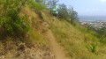
(S/E) A sign marks the start of the Chemin des Anglais, which you’ll need to follow for its entire length! Here we go for 9 kilometres of cobblestones and nearly 700 metres of elevation gain! The tone is set right from the start: the slope is steep, and even more so on the hairpin bends! The path climbs in the shade of tamarind trees and through dry vegetation. You’ll soon be able to see the harbour and La Possession behind you.
After the first hairpin bends, the Chemin des Anglais emerges into the open, winding along fairly long straight stretches. Never stray from the cobbled path! Shortly afterwards, begin a short but steep descent towards the Ravine à Malheur, followed by an equally challenging climb! Take care on the descents as the cobblestones can often be tricky for your ankles!
You’ll then cross the Ravine de la Petite Chaloupe at the end of a steep descent. One more hill to climb, and you’re off on the descent to La Grande-Chaloupe. You’ll reach this little hamlet. Make the most of the panoramic views of the hamlet and the ocean during the descent!
(1) At the end of the first section of the Chemin des Anglais, turn left. The concrete path then descends gently towards the sea and passes in front of the Grande-Chaloupe quarantine stations.
(2) Look out for the old railway line on your right, which you’ll need to follow for a few hundred metres. After crossing the Ravine de la Grande Chaloupe, you’ll pass the old railway station (3) as well as a steam locomotive, a reminder of the island’s railway heritage.
(4) Cross the Ravine Tamarins and take the cobbled path that starts on the right just after it. Here we go for the second part of the Chemin des Anglais, which winds its way between houses for the first few metres. As at the start, the incline is immediate. The winding path climbs quite steeply at times beneath the tamarind trees and offers beautiful panoramic views of Grande-Chaloupe and Pointe des Galets.
After a 1.2-kilometre climb, you’ll reach a cross marking the end of the hairpin bends. The path opens out into the open again. Looking to the left, you can see part of the Bambous neighbourhood, and the surrounding mountains to both the left and right.
Reaching the first short descent of the walk signals that the end of the Chemin des Anglais is near! After one last short climb, you’ll reach the end of the Chemin des Anglais. Continue along the concrete path, which is easy going and presents no difficulties. A few gaps in the vegetation on the left offer glimpses of the Ravine à Jacques valley. Then turn left at the first junction, which is at the bottom of a descent, and head towards the next right-hand bend.
(5) Take the path that continues straight ahead and crosses the Ravine à Jacques via a footbridge. After the footbridge, keep to the left. The paved path, which is a short section of the Chemin des Anglais, climbs steeply towards the concrete road.
(6) At the end of the path, turn left onto the road and follow it to the end.
(7) Continue straight on; the path runs alongside the Bambous neighbourhood on your right, on a gentle slope in contrast to the steeper sections you’ve already covered since setting off. A few more bends and a short descent – offering beautiful panoramic views of the Montagne region – will take you to the end of the road.
(8) Take the path opposite, which continues straight on and descends steeply towards the Grande Ravine. At the next junction, turn left onto the paved path, which is also a remnant of the Chemin des Anglais. Cross the Grande Ravine, then climb steeply back up to the road along a concrete path.
(9) At the end of the path, carry on straight ahead.
(10) After the first bend to the left, take the first alleyway on the right. Look out for an electricity meter on the left marked with the number 808. Take the path that starts on the left just past it. This dirt track climbs steeply at times but offers beautiful panoramic views that become increasingly sweeping as you head towards Colorado, which you can see in the distance thanks to its weather station.
(11) At the junction, keep to the right and, at the next one, continue straight ahead. Turn left at the next junction, then immediately right. Continue straight ahead and then turn left at the next junction.
(12) Keep left again, then carry on straight ahead at the next junction. Then keep left, turn right, and carry on straight ahead at the next junction.
(13) At the junction, turn left. You’ll then be on a wide track that climbs towards some houses and turns into a lane a little further on. You can see the Colorado weather station from the end of the lane. You can also make out the distance you still have to go to reach it.
(14) At the road, turn left. Follow the D41 towards La Montagne. There is a slight descent towards the Ravine Infante. Pass a bus stop on the right, then look out for a large parking area on the left, situated on the hard shoulder of the road.
(15) After this large parking area, take the first path on the right. The start of the path will be a little slippery! The panoramic views will become more and more frequent as you make your way towards the Rivière-Saint-Denis embankment. Continue straight on at the next two junctions.
(16) At the next junction, turn left towards the Colorado. The climb is over! All that remains is the descent, which will be punctuated here and there by short climbs. The wide, flat path descends gently towards the Colorado. Make the most of the gaps in the vegetation, as they offer stunning views of the Rivière Saint-Denis. Carry straight on at the next junction, then turn right at the following one.
(17) At the junction, turn right and then left at the next one. The path crosses the very large grassy area at Colorado, ideal for resting or having a picnic. The only downside is that there is little or no shade. Carry on straight ahead until you reach the road. Follow the road by turning right.
(18) Keep to the right again and, at the bend just after this junction, enjoy the beautiful, well-maintained viewpoint over the Saint-Denis River. Stay on the same road until you reach the start of the path, which begins on the right between a kiosk and a table.
(19) Follow the path to the right. From there, it’s straightforward; if you’re unsure which way to go, simply follow the ONF signs pointing towards La Redoute until you reach the end of the path.
The descent, which is gentle for a few minutes, begins with a few wooden steps in the open. Keep to the right at the next junction. The path then levels out slightly and is completely in the open. Keep to the left at the next two junctions.
(20) Turn right at the third junction. After a bend, the going gets tough! There are plenty of steps and tree roots in this first section. There are few panoramic views and the slope is quite steep at times. There will be a few short climbs during the descent. The first glimpses of Saint-Denis appear after 30 minutes of technical descent. But these first views also signal the arrival of numerous rocky sections. You’ll need to use your hands on certain parts of the descent! Fortunately, the branches are well-placed so you can use them for support, helping you through a few sections.
After just over an hour’s descent, we reach some eucalyptus woods and a drainage channel. The path then runs alongside a hairpin bend on the Route de la Montagne. A sign that the finish is very close! Another five minutes or so and a descent of about a hundred metres, and we’re at the end of the route at the Pont Vin-San (E).

 Visorando Member
 Moderate
  Tourist office
 Very difficult