The Bassin Vital

Étang Saint-Paul is designated as a nature reserve. There are several walking routes around it, including the Bassin Vital trail. Perched at an altitude of just over 150 metres, you can reach it via a short, fairly steep climb or by following a circular route. The views over Étang Saint-Paul are absolutely stunning! You can combine this walk with others in the area.

Details

953349
Creation:
Last update:
Last review:
  • Walking
    Activity: Walking
  • ↔
    Distance: 1.44 mi
  • ◔
    Average duration: 1h 15 
  • ▲
    Difficulty: Moderate

  • ⚐
    Back to start: Yes
  • ↗
    Ascent: + 686 ft
  • ↘
    Descent: - 686 ft

  • ▲
    Highest point: 699 ft
  • ▼
    Lowest point: 13 ft

Photos

Description of the walk

How to get there.

If you’re coming from Saint-Pierre: head towards Saint-Paul and take the Savanna junction exit. Take the second exit at the first two roundabouts, then the first exit at the third roundabout. Follow the road until you reach the car park on the left.
If you’re coming from Saint-Denis: head towards Saint-Paul and exit at the Savanna junction. Take the third exit at the first two roundabouts, then the second at the next one, and finally the first at the fourth. Follow the road to the car park on the left.

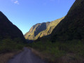
(S/E) Set off along the path that heads straight ahead. From the car park, you can see part of the high cliff overlooking the Bassin Vital. The path is very pleasant and runs alongside the Ravine Bassin. Caves of varying sizes can be found on either side of the path. The beautiful trees are already a sight to behold, and some are very tall! The first few metres are the perfect warm-up for what lies ahead.

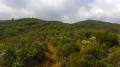
(1) At the first junction, turn left and begin a slightly steep climb, particularly over the first few metres! The Bassin Vital is then signposted to the right on the rocks: this is the correct route. The climb can be gruelling in direct sunlight, but it’s short-lived. Soon, views open up over the hills towards Bellemène and Maison Rouge. The vegetation is dry and typical of lower altitudes. Reaching some very beautiful tamarind trees signals that the pond is near. The slope becomes gentler from this point onwards.

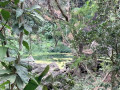
(2) At the next junction, turn right towards the pool, which you’ll reach very quickly. The pool is very beautiful, as is its setting, but the slightly murky water doesn’t really encourage a swim. It’s surrounded by a high cliff inhabited by a few birds. The waterfall feeding the pool is, however, only impressive during periods of heavy rain. Cross the ravine by hopping from pebble to pebble and take the path on the other side. The slope climbs a little steeply again, though not as steeply as on the first few metres of the circular route. Some sections may be a bit muddy. Here too, a few tamarins put on a show.

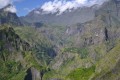
Then take the first path on the right. From here, you can see part of the Étang de Saint-Paul. The descent follows a very stony path, but the views of the Étang de Saint-Paul National Nature Reserve are stunning. In season, flower lovers can come and photograph the pitaya flowers, which only bloom at night. The path becomes more open towards the end of the descent, offering views towards Macabit and the Saint-Paul viaduct. The first section winds down in hairpin bends, whilst the second is more open and straight.

(3) Turn right onto a path that descends steeply towards the ravine. Halfway down, you can see the route you took from the Bassin Vital. Continue to the ravine and then to the junction you passed on the way there.

(1) Turn left to return to the car park (S/E).

Waypoints

  1. S/E : mi 0 - alt. 13 ft - Car park
  2. 1 : mi 0.17 - alt. 30 ft - Turn left at the first junction
  3. 2 : mi 0.56 - alt. 449 ft - Turn right at the junction
  4. 3 : mi 1.19 - alt. 141 ft - Keep to the right
  5. S/E : mi 1.44 - alt. 13 ft - Car park

Notes

Take water and a cap with you!
Watch out for mosquitoes!
Come after a spell of rain to see the waterfall.

(S/E) Drinking water available at the car park.

Worth a visit

Reviews and comments

3.8 / 5
Based on 5 reviews

Reliability of the description
3.4 / 5
Ease of following the route
3.6 / 5
Route interest
4.4 / 5
Maluana47
Maluana47

Overall rating : 4.3 / 5

Date of your route : Jun 08, 2026
Reliability of the description : ★★★★☆ Good
Ease of following the route : ★★★★☆ Good
Route interest : ★★★★★ Very good
Very busy route : No

An easy hike to warm up before tackling the cirques. Once you reach the basin, it’s not easy to find the way back, but if you look carefully, you’ll find it.

Machine-translated

david jean paul
david jean paul

Overall rating : 3.3 / 5

Date of your route : Oct 13, 2025
Reliability of the description : ★★★☆☆ Average
Ease of following the route : ★★★☆☆ Average
Route interest : ★★★★☆ Good
Very busy route : No

Not as easy as that
We got lost at the basin
The signs are very poor, if not non-existent
It's a shame because it's worth seeing

Machine-translated

Beatrice B
Beatrice B

Overall rating : 4 / 5

Date of your route : Feb 24, 2025
Reliability of the description : ★★★★☆ Good
Ease of following the route : ★★★★☆ Good
Route interest : ★★★★☆ Good
Very busy route : No

We extended the walk by taking the footpath to the first houses, making it a 2-hour circular walk. Beautiful views over Saint Paul. Best done in the morning, as the heat in the western lowlands quickly becomes unbearable.

Machine-translated

DoumeLiger
DoumeLiger

Overall rating : 4.3 / 5

Date of your route : Dec 11, 2023
Reliability of the description : ★★★★☆ Good
Ease of following the route : ★★★★★ Very good
Route interest : ★★★★☆ Good
Very busy route : Yes

A hike of moderate difficulty. Allow 2 hours if you’re a bit older. Watch out for car break-ins – the car park isn’t secure!!!

Machine-translated

Seb9
Seb9

Overall rating : 3 / 5

Date of your route : Sep 27, 2023
Reliability of the description : ★★☆☆☆ Disappointing
Ease of following the route : ★★☆☆☆ Disappointing
Route interest : ★★★★★ Very good
Very busy route : Yes

A lovely walk with some lovely views – but be aware that the directions on the website aren’t always accurate. You really do need to pay close attention to the signs and markings on the ground! Yellow and white arrow markings

Machine-translated

Other walks in the area

For more walks, use our search engine .

The GPS track and description are the property of this route's author. Please do not copy them without permission.