The Chemin Pavé Lougnon

The Saint-Paul region once had three paved roads: the Chemin Charrette Boeuf, the Chemin du Bernica and the Chemin Pavé Lougnon. They were built by Governor Antoine Desforges-Boucher in the18th century. Goods were previously transported from the hills above Saint-Paul to the town via unpaved tracks, which is why Antoine Desforges-Boucher decided to build these paved roads. The route of the Chemin Pavé de Lougnon was rediscovered by Albert Lougnon.

Details

2768302
Creation:
Last update:
Last review:
  • Walking
    Activity: Walking
  • ↔
    Distance: 2.17 mi
  • ◔
    Average duration: 1h 40 
  • ▲
    Difficulty: Easy

  • ⚐
    Back to start: Yes
  • ↗
    Ascent: + 768 ft
  • ↘
    Descent: - 771 ft

  • ▲
    Highest point: 784 ft
  • ▼
    Lowest point: 13 ft

Description of the walk

Access:
From Saint-Pierre: follow the Route des Tamarins to Saint-Paul and take the first exit. Pass under the main road and take the first left onto the Chaussée Royale. Then take the first left towards Grande Fontaine, pass under the bridge and take the first left towards Tour des Roches. Follow the road to the first footbridge on the right.

From Saint-Denis: head towards Saint-Paul via the N1. After passing the Étang de Saint-Paul, take the next exit. At the traffic lights, keep left onto the Chaussée Royale and follow this road before taking the second left. Go under the bridge, then take the first left towards the Tour des Roches. Follow the road to the first footbridge on the right, where it is best to park.

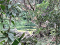
(S/E) At the footbridge, continue along the road. The walk begins beneath the orchards, which are home to trees – mainly mango trees – of enormous size. They are among the oldest on the island and are nearly 300 years old. These trees were planted by the island’s first inhabitants.

(1) At the first junction, turn right onto Chemin des Cèdres in the Bouillon neighbourhood. Turn left at the T-junction and follow the road to its end.

(2) The cobbled path begins at the end of the road. It has been beautifully restored and is one of the finest cobbled paths on the island. The climb is easy along this winding path but may, however, be more challenging for young children.

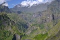
The views become increasingly sweeping as you climb, all overlooking the Étang de Saint-Paul area and, at times, the Ravine Divon. When you reach the oratory, you’ll find that half the route still lies ahead.

The second half consists of basic shaded areas that have been created following a recent exhibition. These are the only shaded spots on the walk: apart from these, the route is completely exposed to the sun! The path winds through dry vegetation where the only trees growing are tamarinds.

(3) The paved path ends after about 30 to 45 minutes’ climb. There is an information board here, as well as a water point. Return to your car via the same route, with the added bonus of having the views facing you this time (S/E).

Waypoints

  1. S/E : mi 0 - alt. 16 ft - Footbridge
  2. 1 : mi 0.09 - alt. 13 ft - Turn right onto the Chemin des Cèdres
  3. 2 : mi 0.35 - alt. 177 ft - Start of the Chemin Pavé de Lougnon - Chemin Pavé de Lougnon
  4. 3 : mi 1.08 - alt. 784 ft - End of the Chemin Pavé de Lougnon - Chemin Pavé de Lougnon
  5. S/E : mi 2.17 - alt. 16 ft - Footbridge

Notes

This walk is best done in winter as it is completely exposed: bring water and sun cream
Water available at (3).
You can have a picnic and go rock climbing by following the path that starts at the footbridge and heads up the Ravine Divon (S/E).

Worth a visit

Reviews and comments

4.8 / 5
Based on 2 reviews

Reliability of the description
5 / 5
Ease of following the route
5 / 5
Route interest
4.5 / 5
User 3241879

Overall rating : 5 / 5

Date of your route : Jun 20, 2026
Reliability of the description : ★★★★★ Very good
Ease of following the route : ★★★★★ Very good
Route interest : ★★★★★ Very good
Very busy route : Yes

A short round-trip walk along a rather unusual cobbled path. Lovely views of St Paul’s Bay throughout the climb. There’s no shade, so make sure you take plenty of water with you as it can get quite hot on the cobbles. We really enjoyed this short walk to round off our stay in Réunion. Thank you for the description of this walk.

Machine-translated

vivi 31
vivi 31

Overall rating : 4.7 / 5

Date of your route : May 28, 2026
Reliability of the description : ★★★★★ Very good
Ease of following the route : ★★★★★ Very good
Route interest : ★★★★☆ Good
Very busy route : No

A lovely little walk with information boards providing historical details. A pleasant path used by locals as well as hikers

Machine-translated

Other walks in the area

For more walks, use our search engine .

The GPS track and description are the property of this route's author. Please do not copy them without permission.