From Cayenne to Aurère

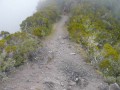
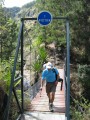
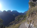
From Cayenne to Deux-Bras, follow the course of the Rivière des Galets, avoiding the path down to the riverbed. Instead, take the path on the right leading to the Bras d’Oussy footbridge. After crossing the bridge, turn right towards Aurère, beginning the ascent to Bord Bazar. The climb begins with a secured section along a cliff face, offering breathtaking views of the Maïdo rampart and Piton Tortue. The Bambou spring signals the imminent end of this adventure, marking a harmonious exploration where humanity and majestic nature come together.

Details

n°42478985
Creation:
Last update:
Last review:
  • Walking
    Activity: Walking
  • ↔
    Distance: 3.66 mi
  • ◔
    Average duration: 3h 55 
  • ▲
    Difficulty: Difficult

  • ⚐
    Back to start: No
  • ↗
    Ascent: + 2,579 ft
  • ↘
    Descent: - 1,322 ft

  • ▲
    Highest point: 3,284 ft
  • ▼
    Lowest point: 1,152 ft

Description of the walk

This hike requires a bit of planning (see the ‘Practical Information’ section).

(S) From Cayenne, head towards Deux-Bras, overlooking the Rivière des Galets. Ignore the path that climbs to the right towards Grand-Place, then take the one that descends to the river.

(1) Continue straight on until you reach the Bras d’Oussy footbridge.

(2) Carry on; after crossing the stream at the next junction, turn right towards Aurère, then stay on the path leading uphill. The final climb to Bord Bazar begins after a secured section along the cliff face, offering a breathtaking view of the Maïdo rampart and Piton Tortue.

(3) Take in the view. Carry on to the spring.

(4) The Source Bambou signals that the climb is almost over. You will then arrive at Bord Bazar.

(5) Take the first path, on the far left, which leads directly to Aurère, keeping to the left at all times. (E)

Waypoints

  1. S : mi 0 - alt. 1,778 ft - Cayenne - Fontaine (ravine) - Affluent de la Rivière des Galets
  2. 1 : mi 0.5 - alt. 1,673 ft - Junction with the path leading to the river - Rivière des Galets (fleuve)
  3. 2 : mi 1.6 - alt. 1,217 ft - Bras d'Oussy
  4. 3 : mi 2.22 - alt. 1,929 ft - View of the Maïdo rampart and Piton Tortue
  5. 4 : mi 2.95 - alt. 2,759 ft - Source Bambou
  6. 5 : mi 3.06 - alt. 3,107 ft - Bord Bazar
  7. E : mi 3.66 - alt. 3,025 ft - Aurère

Notes

Access to the hike’s starting point

From Rivière des Galets, take a 4x4 (booking required) along the track towards Deux Bras for 25 minutes. A walk of around 2 hours is then required to reach the starting point.

At the end of this hike, there are four options for leavingAurère:

- Via the Rivière des Galets, walk to Deux-Bras in around 2 hours 30 minutes and continue on foot to the Rivière des Galets, or alternatively take a 4x4 (booking required) for a 25-minute journey.

- Via the Sentier Augustave, head towards Bord Martin by following the Bras Bemale ravine. Take care as there are slippery sections.

- Via the Sentier Scout between Ilet à Malheur and Ilet à Bourse, reach the Col des Bœufs road, with breathtaking views over vertiginous sections along the cliff face.

- Via Dos d’Âne – the Bras de Sainte-Suzanne trail: leave Mafate via Dos d’Âne. Cross the river, climb a technical path with handrails and ladders, then join the main road near the church at Dos d’Âne.

Worth a visit

- Rivière des Galets
- Bras d’Oussy
- Viewpoint over the Maïdo rampart and Piton Tortue
- Source Bambou
- Bord Bazar

Reviews and comments

4.7 / 5
Based on 1 review

Reliability of the description
5 / 5
Ease of following the route
5 / 5
Route interest
4 / 5
johan33510
johan33510

Overall rating : 4.7 / 5

Date of your route : Jul 07, 2025
Reliability of the description : ★★★★★ Very good
Ease of following the route : ★★★★★ Very good
Route interest : ★★★★☆ Good
Very busy route : No

Take time to stop and rest in the various hamlets. We found mandarins and oranges for sale along the way.
Take time to visit Aurere, one of the nicest villages in Mafate

Machine-translated

Other walks in the area

For more walks, use our search engine .

The GPS track and description are the property of this route's author. Please do not copy them without permission.