


restefond2800

 Visorando Member
 Premium user
Sign up:
Published route(s)
 The Céva Plateau via the Cime de Coss, starting from Fontan

 11.32 mi
 +4,715 ft
 -4,715 ft
 8 hrs
 Very difficult
 Departure from Fontan (Alpes-Maritimes)
A major centre for pastoralism, the Céva plateau remains little known and rarely visited by walkers. This pleasant walk takes you there via a secondary peak of the Mercantour, the Cime de Coss, whilst still offering interesting views, particularly of the Authion massif.
An ideal walk for those seeking tranquillity and a sense of solitude. Spring is probably the best time to explore this plateau perched high above the Roya valley.
The Colombin and Saviglioni circular loop from Airole
 8.12 mi
+3,396 ft
-3,392 ft
6h 40
 Difficult
Departure from Airole (Imperia)
A beautiful and unique hike starting from the village of Airole, in the lower Roya Valley, winding through wild and unspoilt valleys and offering lovely views of the valley as well as some of its hilltop hamlets and villages (Olivetta and Fanghetto on the Italian side, and Piène Haute and Libre on the French side). From the highest point, there is a view of the Ligurian coast and the main peaks of the Menton region (Grammondo and Mulacié) as seen from their Italian slopes.
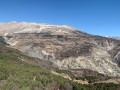
Tour of the Grotte du Chat valley
 8.06 mi
+3,002 ft
-3,005 ft
6h 20
 Moderate
Departure from Daluis (Alpes-Maritimes)
A pleasant circular route through a quiet valley passing by the Grotte du Chat, a geological curiosity comprising a vast network of galleries, though access is restricted and not unrestricted. The circular route also takes us through the countryside of Le Bez, a vast meadow ideal for a rest in the sun before descending via the other side of the valley where the cave is located.
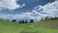
Tête de Méric
 7.66 mi
+2,858 ft
-2,861 ft
6h 00
Moderate
Departure from Péone (Alpes-Maritimes)
A lesser-known and less-frequented secondary summit of the Mercantour, located above the pretty village of Péone, the Tête de Méric nevertheless offers a magnificent panorama stretching from the Tours du Lac d'Allos to the peaks of the Vallée des Merveilles, via the Val d'Entraunes and the Gorges de Daluis. The final ridge allows you to gradually discover this panorama.
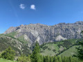
Tour de Roche Grande via Col des Trentes Souches and Vallon de l'Estrop
 15.04 mi
+5,203 ft
-5,187 ft
10 hrs
Very difficult
Departure from Entraunes (Alpes-Maritimes)
This is a long but very beautiful hike starting from Entraunes, taking you through two wild valleys and offering magnificent views of the peaks of the Haut Var and Haut Verdon, as well as the valley leading up to the Col de la Cayolle. This hike is particularly recommended in early summer when the flowers are in full bloom.
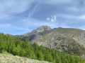
Col des Champs and Cime de Voya starting from Entraunes
 10.33 mi
+3,061 ft
-3,071 ft
7h 25
Difficult
Departure from Entraunes (Alpes-Maritimes)
A very beautiful circular walk starting from the small village of Entraunes, situated very close to the source of the Var. This relatively quiet route offers stunning panoramic views over the upper Var valley and the Val d’Entraunes. In early summer, a dazzling array of flowers accompanies you on your way to the Col des Champs, where you’re likely to spot marmots.
The walk presents no technical difficulties.
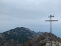
From Castillon-village to Monti via Mont Mulacié
 9.66 mi
+3,589 ft
-4,764 ft
7h 35
Difficult
Departure from Castillon (Alpes-Maritimes)
A cross-country hike through the Menton region along a little-used route, passing through wild and unspoilt areas where traces of human habitation still remain.
The route also provides access to the summit of Mont Mulacié, the second-highest peak in the Menton region, which is very little visited as it lies off the official marked trails. The view from this summit is interesting, although less spectacular than that from its neighbour, the Grammondo.
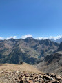
Cime de la Lombarde via Terre Rouge and Pas du Loup
 6.89 mi
+2,946 ft
-2,953 ft
5h 45
Difficult
Departure from Isola (Alpes-Maritimes)
A relatively easy summit above Isola 2000, the Cime de la Lombarde offers superb views of the French and Italian Alps. The route described here is a beautiful circular loop that is relatively uncrowded, except for chamois, and offers beautiful views of the Orgials and Rio Freddo valleys.
Tour du Raton via Les Granges d’Auvare and the Dôme de Barrot
 13.12 mi
+2,946 ft
-2,946 ft
7 hrs
Very difficult
Departure from Beuil (Alpes-Maritimes)
A lovely circular walk above the Gorges du Cians through the red rock formations, relatively uncrowded with walkers and taking in a wide variety of landscapes. This walk offers two options: one involves a straightforward ascent to the Tour du Raton, whilst the other leads to the summit of the Dôme de Barrot, which offers a superb panorama of the Mercantour. An ideal spring hike to appreciate the shades of green and red above the gorges and enjoy the flowers at their peak.
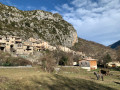
Gars–Amirat–Briançonnet circular loop
 11.59 mi
+2,703 ft
-2,726 ft
7h 40
Difficult
Departure from Gars (Alpes-Maritimes)
Far from the most popular trails in the Alpes-Maritimes, this walk takes you through a few small villages in the upper Estéron valley. The circular route described here also offers some lovely panoramic views of the Mercantour mountains and features a fairly varied landscape, ranging from woodland to farmland.
A long route with significant elevation gain but no technical difficulties.
Please note: there appears to be an issue regarding private property.However, there is an issue between the waymark (7) and (8). The path is now closed by the owner of the farm. You must continue via the Crête des Rochers des Côtes and then rejoin the path at the far end of the Rochers de Notre-Dame.
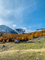
Sestrière Plateau and the Braissa hut, returning via Gianto
 7.93 mi
+2,569 ft
-2,566 ft
5h 55
Moderate
Departure from Saint-Dalmas-le-Selvage (Alpes-Maritimes)
A lovely walk starting from Saint Dalmas le Selvage, this route takes you on foot to the Sestrière plateau via an old path leading to alpine barns and overlooking the Sestrière torrent canyon. The return route follows a pleasant forest track for part of the way and leads to the Pras viewpoint, overlooking the village.
This walk is particularly recommended in autumn when the larch trees are decked out in their crimson finery.
Buse and Marsan descents
 5.67 mi
+2,041 ft
-2,001 ft
4h 25
Moderate
Departure from Coaraze (Alpes-Maritimes)
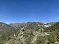
Forming a pleasant circular route starting from the village of Coaraze, this walk is ideal for a half-day outing or for a hike in autumn, winter or even early spring.
In early autumn, you can pick (and taste) a few wild arbutus berries between the La Croix and Buse valleys.
The route offers some lovely views of certain peaks along the Alpes-Maritimes coastline, such as the Cime de Baudon or Mont Agel.
Lake Scluos and Mollières via the Salèse valley
 13.23 mi
+3,455 ft
-3,442 ft
9h 05
Difficult
Departure from Saint-Martin-Vésubie (Alpes-Maritimes)
A pleasant walk in the Col de Salèse area along a relatively quiet route, offering the chance to discover a very picturesque and unspoilt forest lake in the heart of the Mercantour National Park. The route also allows you to reach the hamlet of Mollières without having to walk the entire way back along the Col de Salèse track.
Most of the walk takes place in the forest, making it pleasant even in hot weather.
Lake Malinvern and Lake Paur
 13.47 mi
+5,817 ft
-5,801 ft
11h 15
Difficult
Departure from Isola (Alpes-Maritimes)
A beautiful, long hike starting from Isola 2000, offering the chance to explore several lakes, beginning with the classic Terre Rouge and Valscura Lakes on the Italian side, then continuing on to the lesser-known Malinvern and della Paur Lakes, still in Italy.
This is a challenging hike requiring good physical stamina, as it involves a succession of five ascents and descents. The views at the Lacs della Paur and du Malinvern are, however, well worth the effort.
From the Lacs de Terre Rouge to Lac de Tavels circular
 9.87 mi
+3,652 ft
-3,645 ft
6 hrs
Very difficult
Departure from Isola (Alpes-Maritimes)
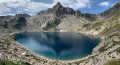
A very beautiful hike starting from Isola 2000, allowing you to discover six lakes, some of which are in Italian territory.
The hike is varied in that it follows a fairly busy route offering magnificent views, as well as a much wilder and less frequented section.
The numerous lakes and water sources along the way are an invitation to cool off.
Please note: there are some difficulties on the terrain => see § Practical information.
A circular route to the Cimes de Rogué and Pagari de Salèse via the Vallon des Naucettes
 9.39 mi
+3,976 ft
-3,953 ft
7h 45
Difficult
Departure from Saint-Martin-Vésubie (Alpes-Maritimes)
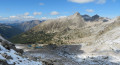
A lovely hike offering the chance to climb two peaks in the Salèse area of the Boréon, following a wild and little-used route. From the summit of the Cime de Pagari de Salèse, the view over the Argentera massif is breathtaking.
The return journey takes you partly off the beaten track to explore the French Fremamorte lakes. A detour via Lac de Graveirette rounds off the route before heading back via the classic Salèse valley.
Lac Long de la Gordolasque
 6.71 mi
+2,959 ft
-2,933 ft
5h 40
Difficult
Departure from Belvédère (Alpes-Maritimes)
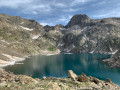
The destination of a hike starting from Pont du Countet, the traditional entry point to the Vallée des Merveilles, Lac Long is relatively uncrowded and exudes an atmosphere of serenity in its rocky setting dominated by the elegant Cime de la Malédie.
Reaching this lake allows you to enter a wild and mineral valley located near the very popular Refuge de Nice. Ibex and chamois will probably be your only companions.
Lacs d'Orgials, Martel and Aver
 10.50 mi
+5,003 ft
-4,993 ft
7 hrs
Very difficult
Departure from Vinadio (Cuneo)
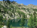
A superb circular hike, allowing you to discover no fewer than five lakes through magnificent landscapes at the foot of Mount Malinvern. It is located entirely in Italian territory, close to Isola 2000, starting from the Col de la Lombarde road on the Vinadio side.In addition to the lakes, the hike offers superb views of the peaks overlooking the Rio Freddo valley at the foot of Malinvern, which is omnipresent during the first part of the circuit.
Barns and the summit of Chabanals in the Demandols valley
 8.49 mi
+3,553 ft
-3,524 ft
7h 00
Difficult
Departure from Saint-Étienne-de-Tinée (Alpes-Maritimes)
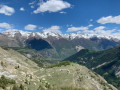
Following a somewhat hidden route away from the very busy areas of the upper Tinée Valley, this hike offers stunning panoramic views of the magnificent and wild upper Demandols valley, as well as the ‘3,000s’ of the Tinée, such as Mont Ténibre and the Cime de Corborant.
If you undertake this hike in spring or very early summer, you might be lucky enough to spot some ibex that haven’t yet returned to the higher altitudes...
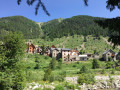
The hamlet of Mollières and the Col du Barn, seen from the Millefonts car park
 11.86 mi
+4,436 ft
-4,429 ft
7 hrs
Very difficult
Departure from Valdeblore (Alpes-Maritimes)
This hike allows you to explore the beautiful hamlet of Mollières via an unusual, little-used route through a wild valley.
The traditional routes to Mollières involve round-trip walks; taking this route, however, allows you to complete a lovely circular route passing by the pretty Millefonts Lakes in Valdeblore.
Brec l'Ilonse from Lieuche via Thiéry
 12.21 mi
+4,039 ft
-4,009 ft
9h 10
Difficult
Departure from Lieuche (Alpes-Maritimes)
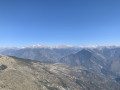
A beautiful circular hike starting from the village of Lieuche, taking you to the summit of Brec d'Ilonse, which offers a beautiful view of the Mercantour massif and the village of the same name. The hike passes through the beautiful village of Thiéry, which is well worth a visit. The route is long and requires a good level of fitness, although it does not present any technical difficulties.
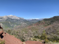
Tête de Pibossan at the start of the Croix-sur-Roudoule
 11.79 mi
+4,265 ft
-4,265 ft
9h 10
Difficult
Departure from La Croix-sur-Roudoule (Alpes-Maritimes)
A beautiful and original hike on a little-used route offering a lovely view of the Mercantour (some peaks can be seen from unusual angles) from the summit of Pibossan.
Spring is the ideal time to walk this route, with the broom in bloom.
The route follows what is probably an ancient Roman road (paved path) through the red earth rising from the Daluis Gorges.