Sestrière Plateau and the Braissa hut, returning via Gianto

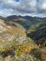
A lovely walk starting from Saint Dalmas le Selvage, this route takes you on foot to the Sestrière plateau via an old path leading to alpine barns and overlooking the Sestrière torrent canyon. The return route follows a pleasant forest track for part of the way and leads to the Pras viewpoint, overlooking the village.
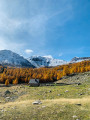
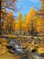
This walk is particularly recommended in autumn when the larch trees are decked out in their crimson finery.

Details

2691199
Creation:
Last update:
Last review:
  • Walking
    Activity: Walking
  • ↔
    Distance: 7.93 mi
  • ◔
    Average duration: 5h 55 
  • ▲
    Difficulty: Moderate

  • ⚐
    Back to start: Yes
  • ↗
    Ascent: + 2,569 ft
  • ↘
    Descent: - 2,566 ft

  • ▲
    Highest point: 7,136 ft
  • ▼
    Lowest point: 4,902 ft

Photos

Description of the walk

The walk starts at the car park at Saint-Dalmas-le-Selvage, just before the bridge crossing the Sestrière torrent. If you can’t find a space in this small car park, head down to the second one.

(S/E) Follow the signs for the Sestrière Plateau and the Par Gazé circular loop, as indicated by marker 50.
You’ll cross the Sestriere torrent straight away before beginning the ascent along a path lined with stone walls.

(1) Join the Col de la Moutière road at marker 51 and follow it for 200m (continuing towards the Sestriere Plateau to the north-north-east), until you reach marker 52 where you join a footpath.

(2) Reach marker 53 and continue towards the Sestriere plateau; the path descends slightly towards the stream, which you cross via a footbridge to join the path on the orographic left bank.
From the footbridge, the path climbs steadily. Pass marker 49, continuing towards the Sestriere plateau; the path is well-marked and dotted with yellow markers.

(3) Reach the Sestriere mountain hut, then cross the stream via the footbridge to join the road to the Col de la Moutière and the Sestriere plateau, which you cross to reach the path climbing towards the Col de la Braissa.

(4) Join the Col de la Braissa path, which winds through the larch forest; follow it to the hut of the same name. The walk is relatively easy and very pleasant, but the path is not always very well marked, so you must keep an eye out for the yellow markers at intervals, as well as a few cairns.

(5) Braissa mountain hut. Head back down towards Sestriere via the same route.

(4) Continue to the right until you reach the Col de la Moutière road at marker 57.

(6) Walk down the Col de la Moutière road to marker 56.

(7) Leave the road and take the path that descends through the forest, rejoining the road at marker 55.

(8) Return to the road and follow it for 250 metres until you reach a hairpin bend.

(9) Take the Gianto forest track, at the start of which there is a barrier. It climbs gently through the forest until it reaches the Gianto shelter, from where it descends again.

(10) At the end of the track, take a quick round trip to the Pras viewpoint.

(11) From the viewpoint, turn back.

(10) Turn right and head for marker 63, where you follow the signs for Saint Dalmas le Selvage. A path takes you back to marker 51, which you passed on the way up.

(1) Return along the path you took on the way up and you’ll easily reach the starting point (S/E).


Waypoints

  1. S/E : mi 0 - alt. 4,902 ft - Saint-Dalmas-le-Selvage car park
  2. 1 : mi 0.33 - alt. 5,312 ft - Marker 51
  3. 2 : mi 0.57 - alt. 5,456 ft - Marker 53
  4. 3 : mi 2.5 - alt. 6,562 ft - Sestrière Mountain Hut
  5. 4 : mi 2.69 - alt. 6,568 ft - Braissa Trail
  6. 5 : mi 3.52 - alt. 7,136 ft - Braissa Hut
  7. 6 : mi 4.7 - alt. 6,463 ft - Marker 57
  8. 7 : mi 4.97 - alt. 6,302 ft - Marker 56
  9. 8 : mi 5.38 - alt. 6,014 ft - Marker 55
  10. 9 : mi 5.53 - alt. 6,050 ft - Start of the Gianto trail
  11. 10 : mi 7.07 - alt. 5,791 ft - End of the Gianto trail
  12. 11 : mi 7.18 - alt. 5,715 ft - Pras Viewpoint
  13. S/E : mi 7.93 - alt. 4,902 ft - Saint-Dalmas-le-Selvage car park

Notes

Crossing the Sestrière plateau between points (3) and (4) involves crossing a stream.
This is no problem at all in summer, but it can be trickier in autumn, especially after a spell of heavy rain. If you don’t feel up to crossing it, head for the road and follow it downhill to marker 57 (point (6)), then simply follow the path back up to the Braissa hut.

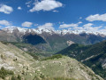
You don’t have to make the round trip to the Braissa hut, but it would be a shame not to enjoy the lovely view over the Sestrière valley, especially in autumn when the sight of the glowing larch trees is spectacular.

This route passes through multiple protected areas, which may be subject to special regulations:

Reviews and comments

4.6 / 5
Based on 3 reviews

Reliability of the description
4.7 / 5
Ease of following the route
4.3 / 5
Route interest
4.7 / 5
User 23390829

Overall rating : 4 / 5

Date of your route : Jun 22, 2026
Reliability of the description : ★★★★☆ Good
Ease of following the route : ★★★☆☆ Average
Route interest : ★★★★★ Very good
Very busy route : No

We couldn’t find the start of the climb up to the Col de Braissa when we reached the Sestrieres plateau, as it wasn’t signposted once we’d crossed the footbridge over the Tinee! There should be a sign indicating to turn left onto the road; the signpost for the hut is further on to the right (don’t cross the meadow – a post has been cut down!).

Machine-translated

Laurence du Béal
Laurence du Béal

Overall rating : 4.7 / 5

Date of your route : Jul 15, 2023
Reliability of the description : ★★★★★ Very good
Ease of following the route : ★★★★★ Very good
Route interest : ★★★★☆ Good
Very busy route : No

A lovely walk through the larch woods and mountain pastures. It’s a bit of a let-down when you arrive at the hut (the view’s nothing special). You’d have to carry on to the pass, but that would mean an extra 400 metres of climbing!

Machine-translated

migar
migar

Overall rating : 5 / 5

Date of your route : Jun 05, 2023
Reliability of the description : ★★★★★ Very good
Ease of following the route : ★★★★★ Very good
Route interest : ★★★★★ Very good
Very busy route : No

We’d planned to follow the route in the suggested direction. But with the weather looking threatening, the lady at the tourist information centre suggested we go to the viewpoint first. So we did it the other way round. In the end, it didn’t rain.
We didn’t go all the way to La Baïsa; we turned off at the mountain refuge. There we came across a roe deer and a chamois.
We’d been hoping to see some mouflons, but no such luck.

Machine-translated

Other walks in the area

For more walks, use our search engine .

The GPS track and description are the property of this route's author. Please do not copy them without permission.