From Castillon-village to Monti via Mont Mulacié

A cross-country hike through the Menton region along a little-used route, passing through wild and unspoilt areas where traces of human habitation still remain.
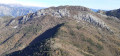
The route also provides access to the summit of Mont Mulacié, the second-highest peak in the Menton region, which is very little visited as it lies off the official marked trails. The view from this summit is interesting, although less spectacular than that from its neighbour, the Grammondo.

Details

n°7859078
Creation:
Last update:
Last review:
  • Walking
    Activity: Walking
  • ↔
    Distance: 9.66 mi
  • ◔
    Average duration: 7h 35 
  • ▲
    Difficulty: Difficult

  • ⚐
    Back to start: No
  • ↗
    Ascent: + 3,589 ft
  • ↘
    Descent: - 4,764 ft

  • ▲
    Highest point: 4,327 ft
  • ▼
    Lowest point: 492 ft

Photos

Description of the walk

The walk starts from the Castillon-village bus stop or from the lowest car park in the village.

(S) From the bus stop, follow the road up towards the village, then head towards the first car park and walk past marker 130 (located opposite the restaurant ‘La Bergerie’). From the marker, follow the signs for the Col de Castillon. The route follows a road.

(1) At marker 131, the road turns into a footpath. Take the path which leads up through the woodland, still heading towards the Col de Castillon. Ignore the sign stating that the path is impassable; it is perfectly passable and well-maintained.

(2) Join the road that runs through the Remégon neighbourhood and follow it. It is marked by a few yellow signposts. Continue until you reach signpost 133.

(3) At marker 133, you’ll reach the road leading up to the Col de Castillon; cross it to join a path on the opposite side that descends slightly through the woodland. Follow it, keeping an eye out for the yellow markings, until you rejoin the pass road a little further up.

(4) When the path rejoins the road, cross it and then head slightly uphill along the concrete track. Head straight ahead towards house number 5824 and, just before the property gate, turn left at marker 134. Then follow the path and the yellow markers to the Col de Castillon, which you’ll reach quickly and without difficulty.

(5) At the Col de Castillon, follow the signs for the Baisse de Scuvion, indicated by marker 135. You will then walk along a road and then, shortly afterwards, along a well-marked path (from marker 136); follow the yellow markings.

(6) At marker 137, continue towards the Baisse de Scuvion. The slope becomes steeper but the going is easy right up to the pass.

(7) Reach marker 92, situated just below the Baisse de Scuvion, which you’ll reach very quickly; from there, follow the signs for the Col de Roulabre along a gently descending path through the forest.

(8) At the Col de Roulabre, continue downwards, heading towards the Col du Razet.

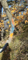
(9) At the Col du Razet, carry on straight ahead towards the east, heading for the summit of Mont Mulacié. An unofficial signpost indicates the direction to follow. The route is easy at first, following a relatively well-marked track, but becomes more challenging once you leave the forest. As for finding your way, simply follow the numerous red and blue markings, which indicate the path to take.

(10) At this point, the blue and red markings split; you must now follow the red ones to reach the summit. This is the most technical part of the climb; you need sure-footedness, as there is no longer really a defined path.

(11) Summit of Mont Mulacié. Retrace your steps back to the Col du Razet.

(9) Once back at the pass, take the path leading down towards the Col Saint-Bernard. Follow the yellow markers.

(12) At this point, near Villaron, take a small path on the left, the start of which is marked by a cairn on a rock. This path cuts across the hairpin bends of the track, which you’ll rejoin a little further up.

(13) Col Saint-Bernard. Head towards Monti and follow a very steep path marked with yellow markers. At the start of the descent, watch out for the numerous goat tracks which can be misleading; therefore, make sure you spot the yellow markers clearly, as they are sometimes hard to see because they have been worn away over time.

(14) At marker 418, cross the road and take the track opposite. Turn right; as you come out of the bend, turn onto a path marked at the start by a yellow marker on a post. The path joins a track at marker 417.

(15) Marker 417: ignore the path opposite which leads up towards Castellar. Head down along the concrete track; a sign reading ‘Itinéraire pédestre’ (Walking route) points in this direction. Follow the red and white markers ofthe GR® 51.

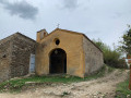
(16) At marker 434, head towards Monti and continue to follow the red and white markings until you reach the car park in front of the church (E).

Waypoints

  1. S : mi 0 - alt. 1,772 ft - Castillon-village (bus stop)
  2. 1 : mi 0.37 - alt. 1,824 ft - Marker 131
  3. 2 : mi 0.69 - alt. 2,146 ft - End of the first path (marker 132)
  4. 3 : mi 1.33 - alt. 2,096 ft - Marker 133
  5. 4 : mi 1.74 - alt. 2,257 ft - Number 5824 (path/road junction)
  6. 5 : mi 1.97 - alt. 2,392 ft - Col de Castillon
  7. 6 : mi 2.38 - alt. 2,546 ft - Marker 137
  8. 7 : mi 3.42 - alt. 3,793 ft - Marker 92 - Baisse de Scuvion (1154m)
  9. 8 : mi 3.97 - alt. 3,576 ft - Col de Roulabre (1094m)
  10. 9 : mi 4.18 - alt. 3,389 ft - Le col du Razet
  11. 10 : mi 4.67 - alt. 4,147 ft - Continue to follow the red markings
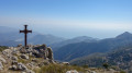
  12. 11 : mi 4.75 - alt. 4,275 ft - Summit of the - Mont Mulacié (1328m)
  13. 12 : mi 6.34 - alt. 2,657 ft - Cairn on a rock
  14. 13 : mi 7.21 - alt. 2,526 ft - Col St Bernard
  15. 14 : mi 8.48 - alt. 1,001 ft - Marker 418
  16. 15 : mi 9.02 - alt. 673 ft - Marker 417. Towards the - Careï (fleuve)
  17. 16 : mi 9.31 - alt. 568 ft - Marker 434
  18. E : mi 9.66 - alt. 597 ft - Monti (church car park)

Notes

The walk requires two cars: one to be left at Monti, and the other to take you to the start point at Castillon.
You can also complete the route with just one car, which you leave in Monti; in this case, you’ll need to take the bus to the start point in Castillon (check the timetables for the Menton–Sospel route).

If you choose the two-car option, the walk starts from the lower car park in the village of Castillon; if you choose to take the bus up to Castillon, the walk begins at the bus stop, situated slightly below the village (this is the option described here).

Please take care on the round trip to the summit of Mont Mulacié: the second part of the ascent is very steep, following a barely marked path over terrain that can become very slippery after a day’s rain or when there are fallen leaves on the ground . Be particularly careful on the descent.

Always be cautious and plan ahead when you're outdoors. Visorando and the author of this route cannot be held responsible for any accidents occurring on this route.

The GR® and PR® markings are the intellectual property of the Fédération Française de Randonnée Pédestre.

Reviews and comments

4.2 / 5
Based on 2 reviews

Reliability of the description
3 / 5
Ease of following the route
5 / 5
Route interest
4.5 / 5
jacques06380
jacques06380

Overall rating : 5 / 5

Date of your route : May 09, 2021
Reliability of the description : Not used / Not applicable
Ease of following the route : Not used / Not applicable
Route interest : ★★★★★ Very good
Very busy route : No

I did the route, setting off from Sospel and returning the same way
At the Col de Razet, there is an unofficial sign for Mont Mulacié on the FFR sign
The route is clearly marked through the woods and across the meadow; there are red and blue paint marks. Before the summit, at an altitude of around 1,200 metres, the blue markings for the path leading down through ‘overgrown’ terrain split from the red markings; follow the red markings to the summit, and the wine-red markings on the descent
The path is clear, with branches cut back
On that day, two couples plus us – four people in total – made the ascent

A very steep and slippery climb

Machine-translated

Other walks in the area

For more walks, use our search engine .

The GPS track and description are the property of this route's author. Please do not copy them without permission.