Country:

 City:


The walk starts at the Éguilles car park, at the foot of the chairlift of the same name. This car park is reached via a small road branching off to the left from the main road leading to Valberg, after passing through Les Launes.
(S/E) Head due south and turn left, following the signs for Margioulins/L’Illion indicated by marker 17, situated at the end of the car park and at the foot of the Éguilles chairlift. The route follows a track.
(1) Carry on straight ahead, heading due south, along the track which climbs slightly through the forest, still heading towards Margioulins.
(2) Ignore the path climbing up to the right and carry on straight ahead along the track, which descends very slightly, following the direction of L’Illion. You will very soon come to the few houses of the hamlet of Margioulins. Continue along the track. You will reach the hamlet of L’Illion at marker 26 and should continue straight ahead along the track at this point.
(3) Please note: at marker 26a, stay on the track by continuing straight ahead and do not follow the cairns on the left which lead to the bottom of the Clue du Raton (well known to canyoning enthusiasts). Continue towards Les Granges d’Auvare.
(4) Ignore the path climbing up to the right and stay on the track, still heading towards Les Granges d’Auvare.
(5) At Les Granges d’Auvare, turn right (west) and pass markers 214 and 214a in turn. At marker 214, follow the signs for the Col de Raton, then when you reach marker 214a.
(6) There are two options available:
- Option 1: a simple loop around the summit of the Raton (for the less fit).
Continue to the right, along the track towards the Col de Raton to reach the Col de Raton directly.
- Option 2: detour via the summit of the Dôme de Barrot (for the more fit).
Leave the track and head towards the Baisse de Barrot. Continue along a poorly marked path, which is easy to lose sight of due to the numerous animal tracks. Try to spot the very rare and old yellow markers. The slope is relatively steep up to marker 219.
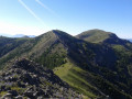
(7) Turn left towards Auvare. Head due south along a very good path offering magnificent views of the route you have already covered and of the Mercantour.
(8) Reach a pass and turn right, heading towards the Dôme de Barrot. There isn’t really a path from here, but the going is easy: simply follow the cairns, which show you the best route.
(9) From the Dôme de Barrot, continue straight on towards the north-west. There isn’t really a path, but the going is fairly easy: simply follow the ridge. The Baisse de Barrot soon comes into view.
(10) At marker 130, carry on straight ahead along an old, signposted path heading east, which is no longer marked as such on the new IGN maps. Follow it to the Col de Raton. There are a few yellow markers along the way.
Junction of routes 1 and 2
(11) Head north-north-east from Valberg. The path climbs up a gentle slope, crosses a ski run and then passes under the Barzès chairlift. Shortly afterwards, you’ll come across markers 25 and then 24 at the Col des Anguillers.
(12) Continue towards Valberg.
(13) You’ll reach a junction between two slopes where marker 20 is located. Follow the signs for the Col des Atres. The path curves through the forest and crosses several ski and mountain bike trails.
If in doubt, follow the signposted arrows marked ‘Retour pédestre parking Éguilles’.
Please note: the new IGN maps show marker 22, which does not actually exist on the ground, so you must continue all the way to the junction of the trails and marker 20!
(14) From the Col des Atres, turn right onto the yellow-marked path towards Les Launes to reach the starting point without any difficulty (S/E).

 Visorando Member
 Moderate

 Difficult
 Easy
 Local authority