Col des Champs and Cime de Voya starting from Entraunes

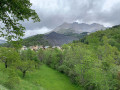
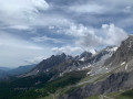
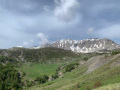
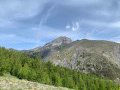
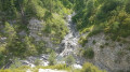
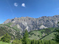
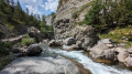
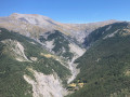
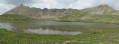
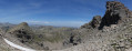
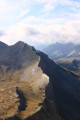
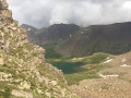
A very beautiful circular walk starting from the small village of Entraunes, situated very close to the source of the Var. This relatively quiet route offers stunning panoramic views over the upper Var valley and the Val d’Entraunes. In early summer, a dazzling array of flowers accompanies you on your way to the Col des Champs, where you’re likely to spot marmots.
The walk presents no technical difficulties.

Details

9892864
Creation:
Last update:
Last review:
  • Walking
    Activity: Walking
  • ↔
    Distance: 10.33 mi
  • ◔
    Average duration: 7h 25 
  • ▲
    Difficulty: Difficult

  • ⚐
    Back to start: Yes
  • ↗
    Ascent: + 3,061 ft
  • ↘
    Descent: - 3,071 ft

  • ▲
    Highest point: 6,864 ft
  • ▼
    Lowest point: 3,953 ft

Photos

Description of the walk

The route starts at the first car park at the entrance to Entraunes.

(S/E) At marker 256, follow the signs for Col des Champs, Clue du Chaudan and Colmars. The route begins on a track; follow the red and white markings ofthe GR® 52A. Continue to marker 258.

(1) Continue following the signs for Col des Champs and Clue du Chaudan; the track then turns into a very well-maintained path. The going is easy; you must continue to follow the red and white markings. You will reach the crossroads at marker 259.

(2) Carry on straight ahead along the path as it climbs, still heading towards the Col des Champs.

(3) At marker 262, carry on straight ahead (towards Col des Champs/Cime de Voya), still following the red and white markings. Shortly after this marker, the slope becomes steeper but the going remains easy and pleasant through a larch forest. The path reaches a junction at
marker 264.

(4) Head towards Col des Champs and continue to follow the red and white markings, which head north and lead to the pass and marker 265.

(5) At the historic Col des Champs, turn left onto the track towards the road pass.

(6) Once you reach the Col des Champs road pass, continue south-east, off the trail, heading for the Cime de Voya, until you reach marker 249a (IGN map).

(7) Head towards the Cime de Voya and follow the narrow path to the summit.

(8) Cime de Voya. Return to marker 249a via the same route.

(7) Turn left towards Val Pelens; you should now follow the yellow markings. You will reach the Route du Col des Champs and marker 248.

(9) Cross the D78 road to reach the path on the other side, still following the yellow markings. Cross the road once more; the path runs alongside it before veering eastwards to reach marker 246.

(10) Turn left towards Serre d’Au/Entraunes, continuing to follow the yellow markings. You will now be walking along a track heading north-west, leading to the Ravin des Rinières. Look out for a yellow marker on a tree.

(11) Leave the track and take the path that turns left; continue to follow the yellow markings; the path becomes faint in places but finding your way is straightforward.

(12) At marker 254, continue following the direction of Entraunes; further on, you’ll come to marker 253, which marks the Serre d’Au, and from there the slope becomes noticeably steeper. However, the route remains easy and eventually joins the Col de la Cayolle road at marker 252.

(13) Follow this road for about one kilometre due north to return to the starting point in Entraunes (S/E).

Waypoints

  1. S/E : mi 0 - alt. 4,085 ft - Entraunes car park, marker 256
  2. 1 : mi 0.16 - alt. 4,213 ft - Marker 258
  3. 2 : mi 0.67 - alt. 4,613 ft - Marker 259
  4. 3 : mi 2.01 - alt. 5,692 ft - Marker 262
  5. 4 : mi 3.68 - alt. 6,654 ft - Marker 264
  6. 5 : mi 3.92 - alt. 6,719 ft - Col des Champs (marker 265)
  7. 6 : mi 4.18 - alt. 6,841 ft - Col des Champs (road)
  8. 7 : mi 4.62 - alt. 6,742 ft - Marker 264a
  9. 8 : mi 4.78 - alt. 6,864 ft - Cime de Voya
  10. 9 : mi 5.47 - alt. 6,286 ft - Marker 248 – D78 road
  11. 10 : mi 6.81 - alt. 5,364 ft - Marker 246
  12. 11 : mi 7.05 - alt. 5,338 ft - Yellow marker on a tree
  13. 12 : mi 7.64 - alt. 5,098 ft - Marker 254
  14. 13 : mi 9.59 - alt. 3,953 ft - Marker 252
  15. S/E : mi 10.33 - alt. 4,098 ft - Entraunes car park, marker 256

This route passes through a protected area, which may be subject to special regulations:

Always be cautious and plan ahead when you're outdoors. Visorando and the author of this route cannot be held responsible for any accidents occurring on this route.

The GR® and PR® markings are the intellectual property of the Fédération Française de Randonnée Pédestre.

Reviews and comments

4.2 / 5
Based on 3 reviews

Reliability of the description
4 / 5
Ease of following the route
3.7 / 5
Route interest
5 / 5
Nousky38
Nousky38

Overall rating : 4.3 / 5

Date of your route : Jun 02, 2025
Reliability of the description : ★★★★☆ Good
Ease of following the route : ★★★★☆ Good
Route interest : ★★★★★ Very good
Very busy route : No

Beautiful hike, completed in April 2025 (Col des Champs still covered in snow). Lots of marmots. Magnificent views. No hikers encountered at this time of year. We recommend it.

Machine-translated

Piolit
Piolit

Overall rating : 3.7 / 5

Date of your route : Jun 11, 2024
Reliability of the description : ★★★☆☆ Average
Ease of following the route : ★★★☆☆ Average
Route interest : ★★★★★ Very good
Very busy route : No

Confusion regarding the signposting, which is very poorly done. No consistency between the different signs (yellow, untreated wood, etc.)
No information on time, altitude or, in some cases, even direction; signs were incorrectly positioned
Sheep have passed through here and worn the path away
An IGN map and mobile phone are essential

Machine-translated

Floren
Floren

Overall rating : 4.7 / 5

Date of your route : Aug 05, 2022
Reliability of the description : ★★★★★ Very good
Ease of following the route : ★★★★☆ Good
Route interest : ★★★★★ Very good
Very busy route : No

A lovely walk with magnificent views

Machine-translated

barbarainess
barbarainess

Hello everyone. I’d like to know if there’s any water along the route. I think it’s important to mention this in the description. Thank you very much, and have a lovely summer.

Machine-translated

Other walks in the area

For more walks, use our search engine .

The GPS track and description are the property of this route's author. Please do not copy them without permission.