Country:

 City:
City:


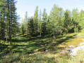
The route starts at the entrance to the Mercantour National Park, in the Salèse car park.
(S/E) From the Salèse car park, take the track leading to the pass of the same name and the hamlet of Mollières; follow it for about 300 metres until you reach the first hairpin bend. Do not take the GR®.
(1) Shortly after the bend, take a path that climbs into the forest on your right; a small cairn marks its start. A fairly steep climb then begins on a path that is relatively well-marked but not signposted; only a few scattered cairns mark the way. You will reach a scree slope.
Go round it at the top, continuing to follow the path, which is now a little less clearly marked.
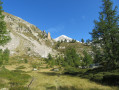
(2) Once at the top of the scree slope, continue north-north-west on almost level ground before descending slightly (cairns will guide you after the descent). You’ll reach a clearing in the Naucettes valley.
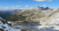
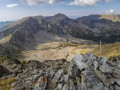
(3) From the clearing, you can see the Baisse de Rogué and the two peaks that are the destinations of this hike. Continue north-north-west. The path climbs again to reach the Baisse de Rogué.
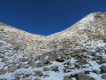
(4) Turn left onto the ridge heading south-west towards the summit of Rogué. The climb to the summit is relatively easy.
(5) From the summit of Cime de Rogué, descend back towards the pass of the same name via the same route.
(4) Back at the Baisse de Rogué, head north-east to climb the ridge leading to the summit of Pagari de Salèse. Please note that the climb is quite steep, although relatively short; some rocks are loose, so it is best to stick to the grassy areas; a few cairns mark the ideal route.
(6) Descend via the same route.
(4) Back at the Baisse de Rogué, take the north-westerly path down towards the Lacs de Fremamorte; follow the cairns, which become more numerous here.
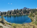
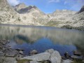
(7) At the first small Fremamorte Lake, continue westwards off the path to reach the second Fremamorte Lake.
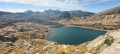
(8) Walk round it, keeping it on your right. A few cairns guide you to the lakes. Reach the third and largest of the Fremamorte Lakes.
(9) Leave it on your left as you head towards the fourth and final lake.
(10) You can walk round it, keeping it on your right, or go round it on your left. Whichever option you choose, you must then head north for a few hundred metres from its westernmost shore, then north-west, towards Camp Soubran. There are no further cairns from this point, and you will largely have to navigate by sight.
(11) At Camp Soubran, head towards Lac Nègre and, after a gentle climb, you’ll reach a hairpin bend on a track. When you reach the hairpin, take the track that descends to the left and do not continue the climb towards Lac Nègre. You’ll come to a fork in the track.
(12) Take the track that climbs slightly to the right towards Lac de Graveirette.
(13) At Lac de Graveirette, return to the previous fork via the same route.
(12) Back at the junction, turn right onto the track.
(14) At marker 269, head towards the Col de Salèse.
(15) At the Col de Salèse, follow the signs for the Salèse car park and easily return to the starting point by following the red and white markings ofthe GR®52(S/E).


 Visorando Member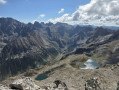

 Moderate
 Very difficult