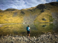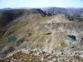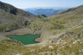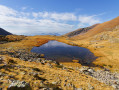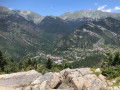
The hamlet of Mollières and the Col du Barn, seen from the Millefonts car park

This hike allows you to explore the beautiful hamlet of Mollières via an unusual, little-used route through a wild valley.
The traditional routes to Mollières involve round-trip walks; taking this route, however, allows you to complete a lovely circular route passing by the pretty Millefonts Lakes in Valdeblore.

Details

n°2122855
Creation:
Last update:
Last review:
  • Walking
    Activity: Walking
  • ↔
    Distance: 11.86 mi
  • ◔
    Duration according to the author: 7 hrs 
  • ▲
    Difficulty: Very difficult

  • ⚐
    Back to start: Yes
  • ↗
    Ascent: + 4,436 ft
  • ↘
    Descent: - 4,429 ft

  • ▲
    Highest point: 8,140 ft
  • ▼
    Lowest point: 5,085 ft

Photos

Description of the walk

The walk starts at the Millefonts car park, at marker 82, which is reached via a narrow, winding road starting just above Saint-Dalmas Valdeblore, to the left of a hairpin bend on the road leading to La Colmiane.

(S/E) Head due north towards the Col de Veillos, as indicated by marker 82. Follow a well-marked path that follows theGR® 52.

(1) From the Col de Veillos, turn left towards the Lacs de Millefonts along a gently descending path. Do not continue to follow theGR® 52, which climbs back up towards the Col du Barn.

(2) Head north-west after crossing the small bridge over the Lac Petit spillway, heading towards the Col Ferrière. The path is poorly marked here as it is rarely used, but a few yellow markers serve as a guide towards the pass. The slope is relatively steep.

(3) Once you reach the Col Ferrière, follow the signs for Mollières, indicated by marker 262.
Please note that in early summer there may be a snowfield at the top of the pass, making the start of the descent perilous. Exercise caution, as the slope is relatively steep.
The path is well-marked at the start of the descent but steep through scree.
Please note: at the end of the path through the scree, you’ll reach a small plateau on the edge of a coniferous forest; this is where you’ll need to pay close attention to your direction, as the path disappears completely and you’ll no longer find any yellow markings to guide you.

(4) Continue slightly north-eastwards as you enter the forest, then turn north-west. You will soon come across a stream flowing down the Margès valley; you must then follow it all the way, mostly on the right bank, although at times it is easier to proceed on the left bank. You must always continue in a north-westerly direction.

(5) You’ll reach a small clearing, where you’ll come across a better-defined path that continues on to Mollières. It ends with a series of hairpin bends through the forest, followed by a footbridge.

(6) Turn right towards the Col de Salèse at marker 261, situated at the entrance to Mollières.

(7) Continue to the right over the bridge, heading towards the Col de Salèse at marker 263, then follow the Col de Salèse track as far as La Vacherie du Collet.

(8) Turn right towards the Col du Barn (marker 266). Stay on theGR® 52; this path is well-marked in red and white. The climb is long but pleasant. The gradient is reasonable, although it becomes steeper over the final few hundred metres.

(9) Carry on to the right, towards Lac Gros.

(10) Carry on past Lac Long.

(11) Stay on theGR® 52 until you reach the Col de Veillos.

(1) Turn left onto the path taken on the way out, which takes you back to the Millefonts car park (S/E).

Waypoints

  1. S/E : mi 0 - alt. 6,699 ft - Millefonts car park
  2. 1 : mi 0.5 - alt. 7,195 ft - Col de Veillos
  3. 2 : mi 1.13 - alt. 7,313 ft - Lac Petit
  4. 3 : mi 1.94 - alt. 8,133 ft - Col Ferrière
  5. 4 : mi 2.47 - alt. 7,270 ft - The start of the path through the scree
  6. 5 : mi 3.63 - alt. 6,119 ft - Clearing in the Margès valley
  7. 6 : mi 4.87 - alt. 5,121 ft - Mollières (marker 261)
  8. 7 : mi 5.26 - alt. 5,213 ft - Marker 263
  9. 8 : mi 7.48 - alt. 6,024 ft - Vacherie of the Small Pass (marker 266)
  10. 9 : mi 9.86 - alt. 8,035 ft - Marker 84 - Col du Barn
  11. 10 : mi 10.07 - alt. 7,900 ft - Lac Gros (Lacs des Millefonts)
  12. 11 : mi 10.31 - alt. 7,720 ft - Lac Long (Lacs des Millefonts)
  13. S/E : mi 11.85 - alt. 6,699 ft - Millefonts car park

Notes

The walk is long and requires stamina, although it presents no technical difficulties.

The main difficulty lies in the fact that the path leading down from the Col Ferrière quickly becomes hard to follow and can present some navigation challenges, but by paying close attention and always following the stream, you’ll get through it without too much trouble.

Throughout the walk, you follow a stream almost constantly, which can be useful for filling your water bottle or cooling your feet.

I have chosen to classify this hike as ‘Very Difficult’, mainly because of its length and the fact that it crosses two passes, the ascent of the second of which is long, although it presents no technical difficulties. A minor navigation challenge after Col Ferrière also influenced this difficulty rating.

Worth a visit

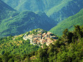
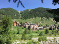
The arrival in Mollières from the Margès valley, as you descend from the Col Ferrière, is simply enchanting. The hamlet comes into view at the very last moment, and it is a real pleasure to discover this secluded spot that seems to be frozen in time.
A track leads to the hamlet from Le Boréon via the Col de Slaèse, but only residents are permitted to use it by car (the hamlet is situated in the central zone of the Mercantour National Park).
It is only on 15 August, the day of the banquet in Mollières, that the track is open to everyone. The hamlet is part of the municipality of Valdeblore.

Whilst hiking up the Barn valley, you can take a short detour to admire Lake Barn by veering slightly off the path at an altitude of 2,100 metres.

Whilst passing through La Vacherie du Collet, you can buy cheese, which is also sold at the Salèse car park in Le Boréon.

Always be cautious and plan ahead when you're outdoors. Visorando and the author of this route cannot be held responsible for any accidents occurring on this route.

The GR® and PR® markings are the intellectual property of the Fédération Française de Randonnée Pédestre.

Reviews and comments

5 / 5
Based on 1 review

Reliability of the description
5 / 5
Ease of following the route
5 / 5
Route interest
5 / 5
bernardino
bernardino ★

That’s right, and this was confirmed by FR3’s regional television news yesterday, which reported that around 2,000 people were present in the hamlet.
The very engaging report focused particularly on the organisations working to revitalise this hamlet, which was described as a gem.

Machine-translated

Jubulbe
Jubulbe

Overall rating : 5 / 5

Date of your route : Aug 15, 2019
Reliability of the description : ★★★★★ Very good
Ease of following the route : ★★★★★ Very good
Route interest : ★★★★★ Very good

A lovely walk today. I’d just advise against going on 15 August (unless you want to join in the festivities), as the hamlet gets a bit too busy – and there are too many cars!

Machine-translated

Other walks in the area

For more walks, use our search engine .

The GPS track and description are the property of this route's author. Please do not copy them without permission.