Lake Scluos and Mollières via the Salèse valley

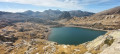
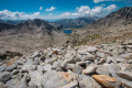
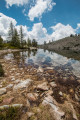
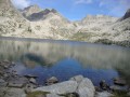
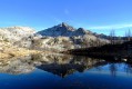
A pleasant walk in the Col de Salèse area along a relatively quiet route, offering the chance to discover a very picturesque and unspoilt forest lake in the heart of the Mercantour National Park. The route also allows you to reach the hamlet of Mollières without having to walk the entire way back along the Col de Salèse track.
Most of the walk takes place in the forest, making it pleasant even in hot weather.

Details

n°2614075
Creation:
Last update:
Last review:
  • Walking
    Activity: Walking
  • ↔
    Distance: 13.23 mi
  • ◔
    Average duration: 9h 05 
  • ▲
    Difficulty: Difficult

  • ⚐
    Back to start: Yes
  • ↗
    Ascent: + 3,455 ft
  • ↘
    Descent: - 3,442 ft

  • ▲
    Highest point: 6,985 ft
  • ▼
    Lowest point: 5,118 ft

Photos

Description of the walk

The walk starts from the Salèse car park, at the entrance to the Mercantour National Park.

(S/E) Head towards the Col de Salèse, following the red and white markings ofthe GR® 52.

(1) From this pass, descend on the other side, heading towards Mollières and the Col Mercière until you reach marker 267.

(2) Leave theGR® and head towards Col Mercière on the right, as indicated by marker 267. The route follows a wide but very pleasant forest track.

(3) Take the path which climbs slightly to the right through the forest towards the north-east (a cairn on the track marks the start). Then follow a relatively well-marked trail, dotted with a few cairns, which leads to Lac Scluos.

(4) At the lake, return along the path you took on the way there.

(3) Back on the track, turn right and follow it until you reach marker 265.

(5) Head down to the left towards Mollières on an unmarked but well-trodden path.

(6) At marker 263, join the Col de Salèse road and continue down towards Mollières (which you’ll reach in ten minutes).

(7) Once you reach the hamlet, do take the time to walk around it before returning to marker 263.

(6) Follow the signs for the Col de Salèse along the Col de Salèse road, as far as the small pass cattle shed. You can easily cut across some of the hairpin bends on the track.

(8) At the Collet cattle shed, you’ll join theGR® 52, which descends from the Col du Barn. Then follow the red and white markings to return to marker 267, which you passed on the way out.

(2) Back at marker 267, follow the route taken on the way there via the Col de Salèse in the opposite direction to reach the Salèse car park (S/E).

Waypoints

  1. S/E : mi 0 - alt. 5,456 ft - Salèse car park
  2. 1 : mi 1.81 - alt. 6,640 ft - Col de Salèse
  3. 2 : mi 2.19 - alt. 6,398 ft - Marker 267
  4. 3 : mi 4.08 - alt. 6,722 ft - Junction towards Lake Scluos (north-east)
  5. 4 : mi 4.54 - alt. 6,985 ft - Lac Scluos
  6. 5 : mi 6.28 - alt. 6,555 ft - Marker 265
  7. 6 : mi 7.37 - alt. 5,220 ft - Marker 263
  8. 7 : mi 7.71 - alt. 5,121 ft - Mollières
  9. 8 : mi 10.11 - alt. 6,017 ft - Small Pass cattle farm
  10. S/E : mi 13.23 - alt. 5,469 ft - Salèse car park

Notes

There are no technical difficulties on this walk, the vast majority of which is along tracks.

This route passes through a protected area, which may be subject to special regulations:

Always be cautious and plan ahead when you're outdoors. Visorando and the author of this route cannot be held responsible for any accidents occurring on this route.

The GR® and PR® markings are the intellectual property of the Fédération Française de Randonnée Pédestre.

Reviews and comments

5 / 5
Based on 1 review

Reliability of the description
Not used
Ease of following the route
Non utilisé
Route interest
5 / 5
JEAN MARIE MAGAL
JEAN MARIE MAGAL

Overall rating : 5 / 5

Date of your route : Aug 22, 2020
Reliability of the description : Not used / Not applicable
Ease of following the route : Not used / Not applicable
Route interest : ★★★★★ Very good
Very busy route : No

Thanks to the author for this route. Walk completed using the GPS track. No particular difficulties. The little lake is very pretty. A quiet route. The village of Mollieres is well worth a visit. Picnic stop by the water’s edge. A mostly shaded route. Only the final climb is a bit long along a wide track
We were able to rejoin the main route from the lake without having to do the recommended return leg. This path is located near the campsite and leads back down to the original track

Machine-translated

Other walks in the area

For more walks, use our search engine .

The GPS track and description are the property of this route's author. Please do not copy them without permission.