


Office de Tourisme Centre Tarn

 Tourist office
PRO  Premium user
Premium user - 8, Place de la République
81 120 Réalmont - Tel:05 63 79 05 45
- Website: http://www.tourisme-centretarn.fr/
Sign up:
Published route(s)
 Puech du Caylou trail
 3.42 mi
 +377 ft
 -377 ft
 1h 55
1h 55
 Easy
Easy
 Departure from Réalmont (Tarn)
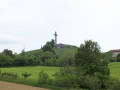
The Puech du Caylou trail will take you to the historic bastide town of Réalmont, founded in 1272 by Guillaume de Cohardon, before climbing to the summit of Puech or Pic du Caylou, which rises to 329 metres.
Trail of community interest created by the Centre Tarn Tourist Office. See § Practical information.
The secret path of Autan
 3.95 mi
+335 ft
-315 ft
2h 05
Easy
Departure from Lombers (Tarn)
3.95 mi
+335 ft
-315 ft
2h 05
Easy
Departure from Lombers (Tarn)
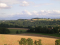
The secret path of Autan will take you on a journey of discovery through the village of Lombers and its surroundings. Starting from the village, you will join the greenway, the "human rights path" running from Albi to Castres, before heading back up towards Réalmont. You will then take a path lined with mulberry trees offering panoramic views of the Montagne Noire.
Trail of community interest created by the Centre Tarn Tourist Office. See § Practical information.
Chemin d'Agros
 3.94 mi
+184 ft
-210 ft
2h 00
Easy
Departure from Poulan-Pouzols (Tarn)
3.94 mi
+184 ft
-210 ft
2h 00
Easy
Departure from Poulan-Pouzols (Tarn)
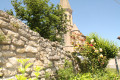
The Agros trail will take you through the village of Pouzols and its surrounding countryside. It passes near the Agros stream, which marks the boundary between Poulan-Pouzols and Lombers. Thanks to its reservoirs, this small stream used to power the mills that were once used to grind grain. Remains of these old mills can still be seen, such as the Raco mill and the Vitrac mill.
Trail of community interest created by the Centre Tarn Tourist Office. See § Practical information.
Chemin Dels Galloromans
 5.17 mi
+443 ft
-443 ft
2h 45
Easy
Departure from Lamillarié (Tarn)
5.17 mi
+443 ft
-443 ft
2h 45
Easy
Departure from Lamillarié (Tarn)
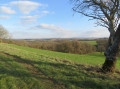
The Dels Galloromans trail begins in the village of Lamillarié. The name of this hike comes from its rich Gallo-Roman past. The Roman road that came from Albi and followed the ridges to Castres gives us an insight into the wealth of yesterday. Several sites have been discovered in this countryside, from where you can see the Pic du Caylou and the Montagne Noire in the distance.
Trail of community interest created by the Centre Tarn Tourist Office. See § Practical information.
Circular for Archaeologists
 5.64 mi
+305 ft
-308 ft
2h 50
Easy
Departure from Lombers (Tarn)
5.64 mi
+305 ft
-308 ft
2h 50
Easy
Departure from Lombers (Tarn)
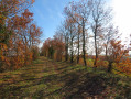
This circular starts at the Church of Saint-Sernin. It was built in the 13th century, marking the end of the Albigensian Crusade and Catharism. The circular route continues to the banks of the Agros stream and the old mills of Racco and Vitrac. Along the way, you will have the opportunity to see the dovecote of Saint-Sernin, a pyramid-shaped building. You can choose between a short 5.5 km (1.5 hour) route or a longer 9 km route.
Path between valleys and hills in Terre-Clapier
 5.87 mi
+863 ft
-843 ft
3h 25
Easy
Departure from Terre-Clapier (Tarn)
5.87 mi
+863 ft
-843 ft
3h 25
Easy
Departure from Terre-Clapier (Tarn)
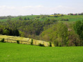
The "between valleys and hills" hiking trail starts near the wash house in Saint-Salvy de Fourestes, in the heart of the commune of Terre-Clapier. Further on, the trail joins the Lézert, a stream that rises in Roudayrou, where the Dadou flows into it. It meanders (hence its name) through a narrow valley covered in meadows. Its waters used to turn four mills.
Trail of community interest created by the Centre Tarn Tourist Office. See § Practical information.
The Miners' Trail starting from Lafenasse
 6.47 mi
+810 ft
-794 ft
3h 40
6.47 mi
+810 ft
-794 ft
3h 40
 Moderate
Departure from Saint-Lieux-Lafenasse (Tarn)
Moderate
Departure from Saint-Lieux-Lafenasse (Tarn)
The Miners' Trail begins in the village of Lafenasse. It passes through valleys carved out by the Siez river and climbs up to the Saint-Lieux plateau, where the landscape opens up onto the surrounding hills. This path, which links the villages of Saint-Lieux and Lafenasse, is part of the collective memory of the inhabitants, as it was once used by miners to reach the Peyrebrune mine.
Path of community interest created by the Centre Tarn Tourist Office. See § Practical information.
Chemin des Puechs en Assou, starting from Fauch
 7.81 mi
+797 ft
-797 ft
4h 15
Moderate
Departure from Fauch (Tarn)
7.81 mi
+797 ft
-797 ft
4h 15
Moderate
Departure from Fauch (Tarn)
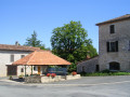
The Chemin des Puechs en Assou will take you through the village of Fauch before heading out into the countryside. Legend has it that Fauch owes its origins to a secondary Roman road that linked the Albi lowlands to the mountains. It has a turbulent past due to its former status as a stronghold. It was the scene of civil wars in the late 16th century and sieges between 1621 and 1653.
A trail of community interest created by the Centre Tarn Tourist Office. See § Practical information.
Travanet Path
 7.82 mi
+981 ft
-981 ft
4h 25
Moderate
Departure from Saint-Antonin-de-Lacalm (Tarn)
7.82 mi
+981 ft
-981 ft
4h 25
Moderate
Departure from Saint-Antonin-de-Lacalm (Tarn)
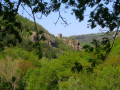
The Travanet trail offers exceptional diversity in terms of landscape and heritage. It is situated in the southernmost part of the Réalmontais, a mountainous area close to the Montredonnais and the Arifat waterfalls. The start is in the hamlet of Travanet. It continues uphill to the highest point in the area (483m), offering a panoramic view of the Réalmontais before descending to the banks of the Dadou.
A trail of community interest created by the Centre Tarn Tourist Office. See § Practical information.
Houlette Trail
 10.87 mi
+1,270 ft
-1,299 ft
6h 05
Moderate
Departure from Montredon-Labessonnié (Tarn)
10.87 mi
+1,270 ft
-1,299 ft
6h 05
Moderate
Departure from Montredon-Labessonnié (Tarn)
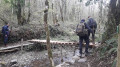
The Houlette trail starts in the village of Montredon-Labessonnié. After crossing the plateau, the route passes by the highest viewpoint in the commune (641m). You will overlook the Agout valley before descending towards the Houlette, a wild site.
Please note: crossing the stream may be difficult during periods of high water.
Trail of community interest created by the Centre Tarn Tourist Office. See § Practical information.
Lac de la Bancalié trail
 6.12 mi
+112 ft
-131 ft
2h 55
Easy
Departure from Saint-Antonin-de-Lacalm (Tarn)
6.12 mi
+112 ft
-131 ft
2h 55
Easy
Departure from Saint-Antonin-de-Lacalm (Tarn)
The Lac de la Bancalié trail is a hike through woods, hills and meadows, following the contours of the lake in a unique and wild setting. Built in the 1980s, it covers 86 hectares on the bed of the Lézert river, with pine-covered hills reminiscent of Mediterranean landscapes on the left bank and large, peaceful, rolling pastures on the right bank.
Trail of community interest created by the Centre Tarn Tourist Office. See § Practical information.
Roman Trail
 5.27 mi
+312 ft
-282 ft
2h 40
Easy
Departure from Lombers (Tarn)
5.27 mi
+312 ft
-282 ft
2h 40
Easy
Departure from Lombers (Tarn)
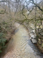
The trail starts in the village of Lombers. The history of this village dates back to between 1165 and 1633. Its origins can be traced back to Celtic or Gallo-Roman times. There was a fortified castle at the peak, which allowed enemies to be spotted approaching. The path passes behind this peak, circling Combe Maussou along wide paths through fields. It then joins the Albi-Castres greenway.
Trail of community interest created by the Centre Tarn Tourist Office. See § Practical information.
The Old Oak Route in Lombers
 6.98 mi
+443 ft
-413 ft
3h 35
Moderate
Departure from Lombers (Tarn)
6.98 mi
+443 ft
-413 ft
3h 35
Moderate
Departure from Lombers (Tarn)
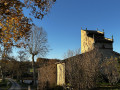
The trail starts in the village of Lombers. It begins by crossing the agricultural plateaus of Albi until it reaches the hamlet of Belsoleil, home to the private museum of Michel Lucien, the pigeon loft specialist. The route then continues along narrower paths through woodland before joining the Albi-Castres Greenway, which runs alongside the Ruisseau de l’Assou, which you will need to cross.
Trail of Community Interest created by the Centre Tarn Tourist Office. See § Practical Information
Tour of Montredon-Labessonnié
 4.16 mi
+358 ft
-354 ft
2h 15
Easy
Departure from Montredon-Labessonnié (Tarn)
4.16 mi
+358 ft
-354 ft
2h 15
Easy
Departure from Montredon-Labessonnié (Tarn)
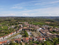
The Village Circular Walk will take you on a journey through the heart of Montredon-Labessonnié and the surrounding countryside. The bell tower of Saint-Jean Church will serve as your central landmark throughout the walk. Its rich historical past, shaped by religion, astronomy and mining, unfolds as you make your way round the village.
A trail of community interest created by the Centre Tarn Tourist Office. See the ‘Practical Information’ section.
Lombers Dovecote Interpretation Trail
 8.55 mi
+440 ft
-443 ft
4h 20
Moderate
Departure from Lombers (Tarn)
8.55 mi
+440 ft
-443 ft
4h 20
Moderate
Departure from Lombers (Tarn)
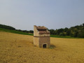
The village of Lombers has an important shared history with dovecotes. In addition to around fifteen of these historic structures of all shapes (cylindrical, mule-foot, on pillars, etc.), Lombers also boasts a museum, "Le Chaî aux pigeonniers", and a breeding farm for purebred and meat pigeons, "Les Pigeons du Mont Royal".
This heritage is highlighted throughout this hike with nine information panels that will help you discover their history.
The dovecotes you will encounter along the route are private property. You can admire them from the trail. Please respect the premises and the privacy of the owners.
Please note that most of this trail follows tarmac roads. Take care with the traffic.