Tour of Montredon-Labessonnié

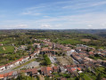
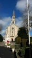
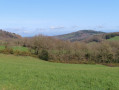
The Village Circular Walk will take you on a journey through the heart of Montredon-Labessonnié and the surrounding countryside. The bell tower of Saint-Jean Church will serve as your central landmark throughout the walk. Its rich historical past, shaped by religion, astronomy and mining, unfolds as you make your way round the village.
A trail of community interest created by the Centre Tarn Tourist Office. See the ‘Practical Information’ section.

Details

n°29865368
Creation:
Last update:
Last review:
  • Walking
    Activity: Walking
  • ↔
    Distance: 4.16 mi
  • ◔
    Average duration: 2h 15 
  • ▲
    Difficulty: Easy

  • ⚐
    Back to start: Yes
  • ↗
    Ascent: + 358 ft
  • ↘
    Descent: - 354 ft

  • ▲
    Highest point: 1,716 ft
  • ▼
    Lowest point: 1,499 ft

Photos

Description of the walk

Park on the Place du Foirail. The trail is marked in yellow.

(S/E) Head towards the central crossroads, then turn left onto the Grand’Rue (D89) and walk past the town hall.

(1) Turn right onto Rue du Globe and, 40 metres further on, take the path on the left, heading due south.

(2) At the junction, turn right onto the path which climbs towards the hamlet of Brescou. Once past the farm, carry on straight ahead for 200 m, then turn right, walking alongside the houses. At the fork in the road, turn left and continue along the path as it runs on.

(3) Leave the path that climbs and take the hairpin bend to the right. Continue for 300 m until you reach a road. Follow it to the right until you reach the junction with the D89.

(4) Follow the D89 to the left for 130 m, then turn right onto the Chemin de Lagrange.

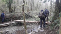
(5) Turn right for 20 m, then left onto the small path leading down into the woods. Take care on the descent. Continue until you reach a crossroad.

(6) Turn right until you reach the junction with the D63 and, taking care, follow the road to the left for 250 m. At the junction at the hamlet of Lavaur (cross), take the path on the right under the trees. Continue due east, alternating between footpaths and small roads.

(7) At the end of a road (cross), turn right and carry on straight ahead for 550 m towards the village. Turn right onto Rue de la Halle, then take the fourth street on the left after the church to reach Place du Foirail (S/E).

Waypoints

  1. S/E : mi 0 - alt. 1,706 ft - Place du Foirail - Église Saint Jean-Baptiste de Labessonnié
  2. 1 : mi 0.12 - alt. 1,703 ft - Rue du Globe
  3. 2 : mi 0.33 - alt. 1,631 ft - Chemin de Brescou
  4. 3 : mi 1.12 - alt. 1,594 ft - Hairpin bend
  5. 4 : mi 1.72 - alt. 1,640 ft - D89 junction
  6. 5 : mi 1.96 - alt. 1,634 ft - Canto-Coucut
  7. 6 : mi 2.58 - alt. 1,611 ft - Route de Réalmont
  8. 7 : mi 3.71 - alt. 1,703 ft - Junction
  9. S/E : mi 4.16 - alt. 1,706 ft - Place du Foirail

Notes

There are toilets and a drinking water point at the starting point.

Worth a visit

Reviews and comments

4.4 / 5
Based on 3 reviews

Reliability of the description
4.7 / 5
Ease of following the route
4.7 / 5
Route interest
4 / 5
Caelia
Caelia

Overall rating : 4.7 / 5

Date of your route : Sep 21, 2026
Reliability of the description : ★★★★★ Very good
Ease of following the route : ★★★★★ Very good
Route interest : ★★★★☆ Good
Very busy route : No

This route is very varied and enjoyable

Machine-translated

lizola
lizola

Overall rating : 5 / 5

Date of your route : Nov 11, 2025
Reliability of the description : ★★★★★ Very good
Ease of following the route : ★★★★★ Very good
Route interest : ★★★★★ Very good
Very busy route : No

Beautiful, easy hike

Machine-translated

GiPhi
GiPhi

Overall rating : 3.7 / 5

Date of your route : Nov 10, 2025
Reliability of the description : ★★★★☆ Good
Ease of following the route : ★★★★☆ Good
Route interest : ★★★☆☆ Average
Very busy route : No

No problem at all, it's fine for a walk. It's really a tour of the village.

Machine-translated

Other walks in the area

For more walks, use our search engine .

The GPS track and description are the property of this route's author. Please do not copy them without permission.