Refine your search for walks in Vernajoul
Vernajoul walks


 Sarda Trail around Vernajoul
 Visorando Member

 6.75 mi
 +1,214 ft
 -1,234 ft
 4h 10
 Moderate
 Departure from Vernajoul (Ariège)
A signposted route of around twelve kilometres through the woods and meadows around Vernajoul. The path includes a few short uphill sections but allows you to enjoy the coolness of the woods in summer. Some sections can be slippery and muddy in wet weather.
The Croix de Saint-Sauveur as seen from Foix station
 5.65 mi
+1,129 ft
-1,122 ft
3h 35
Moderate
Departure from Foix (Ariège)
A walk through the land of Gaston Fébus, former Count of Foix, along the Ariège. After an enjoyable climb “in the land of the elves” amongst the moss-covered rocks, you reach two rural hamlets, where time seems to have stood still, then the ridge and its viewpoints over the Pyrenees.
(!) There appear to be restrictions on access. Message from a user on 28 February 2025. Hike not recommended.
From Saint-Pierre-de-Rivière to Saint-Martin-de-Caralp
 7.57 mi
+951 ft
-922 ft
4h 20
Moderate
Departure from Saint-Pierre-de-Rivière (Ariège)
An easy hike with beautiful views of the Pyrenees. No difficulty apart from some old markings or sections overlapping local routes, and a section requiring GPS guidance at the point (8).
Section of the Tour de la Barguillère via the Rocher de Batail and Brassac
 18.72 mi
+4,777 ft
-4,783 ft
12h 45
 Extremely difficult
Departure from Brassac (Ariège)
From Saint-Pierre-de-Rivière, head for the Rocher de Batail via the Col Blanc. The first section follows the GRP® Tour de la Barguillère trail, through a fairly wild, mid-mountain landscape, whilst the second section leads back to Saint-Pierre via Brassac, along quiet tarmac roads towards the end of the route.
Les Côtes and Saint-Genès from Montgailhard
 4.66 mi
+1,421 ft
-1,414 ft
3h 25
Moderate
Departure from Montgaillard (Ariège)
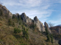
Circular starting from the village of Montgailhard, near Foix, climbing up the Côtes, then to Saint-Genès. Hike through the woods during the ascent and descent. May be a little slippery if it is very wet. The passage along the ridge offers a beautiful view to the south over the Pyrenees, from Soularac in the east to Pique d'Endron, then to Roc de Batail in the west.
In the footsteps of Montgrenier Castle to the Pic de Montgailhard
 2.03 mi
+656 ft
-636 ft
1h 30
 Easy
Departure from Montgaillard (Ariège)
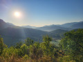
It’s impossible to spend a few days in Montgailhard without climbing the local ‘peak’, the ‘Pain de Sucre’ of Montgailhard (in Occitan) or Montgaillard (in French), also grandly known as the ‘Pic de Montgailhard’ or Costebelle on the land registry.
From the summit rock at an altitude of 627 metres, there are beautiful views of the surrounding countryside, set in completely unspoilt natural surroundings.
In the Middle Ages, each hilltop was crowned by a castle or a watchtower.
At the summit of the peak, you can play at being an archaeologist by searching for the remains of a stronghold of the County of Foix, the Château de Montgrenier (built in the 12th century and demolished on the orders of Louis XIII), of which at least one square tower still stood in 1673.
But the circular walk first takes us to ‘Le Château’ in the village centre, then up a small hill known as ‘Le Castel’ (the castle)...
All that’s missing are the men-at-arms to transport us straight into the heart of feudal warfare.
Montagnon of Carsabel and Lios riverbanks circular walk
 3.53 mi
+928 ft
-912 ft
2h 25
Moderate
Departure from Montgaillard (Ariège)
The village of Montgailhard is dominated by the famous Pic de Montgailhard, or ‘Pain de Sucre’, rising proudly to an altitude of 627 m. But there is another, lesser-known peak called Carsabel, which is well worth a visit, as, at 615 m, it has nothing to be ashamed of when compared to its big brother. Less imposing, far less easily accessible, yet without any major technical difficulties, you must nevertheless brave the challenges of its winding and hard-to-follow paths to reach its summit deep in the forest. This is the domain of wild boars, roe deer and other mammals and birds of this region in the Pyrenean foothills, but also of the foresters who (moderately) manage its slopes.Part of the route follows the paths across the plain, through the local park or along the old paths on the banks of the River Lios.An unusual route, reserved for hikers seeking a challenge or runners looking to add variety to their routes.
Circular of Cascades de la Piche from Prayols
 4.48 mi
+1,621 ft
-1,604 ft
3h 30
Moderate
Departure from Prayols (Ariège)
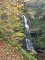
Circular starting from the hamlet of Prayols through the woods. Provides access to the three beautiful Cascades de la Piche waterfalls, as well as an orientation table describing the valley to the east that leads to Lavelanet. Beautiful view of Roquefixade and Mont Fourcat.
Grésale Loop
 Association / Club / Walk leader8.85 mi
+2,087 ft
-2,087 ft
5h 55
Moderate
Departure from Serres-sur-Arget (Ariège)
This hike is located in the hills above Serres-sur-Arget. It leads to the Fautils pastures and Cap de la Grésale, the highest point of this loop, at 1,112 metres. Most of the route is through forest with wide views of the Séronais, the Pays de Foix, the Massif de Tabe and the Massif de l'Arize. Marked in yellow and very well signposted.
Circular family walk in Brassac
 2.25 mi
+367 ft
-377 ft
1h 20
Easy
Departure from Brassac (Ariège)
Most of the route is shaded, which can be pleasant in summer. There are few viewpoints, but the route is nonetheless varied. You cross the Ruisseau de Faurat via a ford and a few bridges.
La Cabane des Gardes, Le Bout de Touron and Le Pla des Peyres
 6.36 mi
+1,234 ft
-1,204 ft
4h 00
Moderate
Departure from Prayols (Ariège)
This is an easy hike, although the last part is not marked. The first part is shaded. There is a pretty cabin and beautiful views of the region.
At (5): you can extend the hike with a return trip along the ridges after Bout de Touron.
Soum de Bazillac from Prat d'Albis
 10.34 mi
+1,762 ft
-1,755 ft
6h 15
Easy
Departure from Prayols (Ariège)
A pleasant hike above Foix (in Ariège), alternating between forest paths and ridge trails, with beautiful views of the plain to the north and the Pyrenees to the south.
Pech de Limouzy from Loubens
 3.80 mi
+863 ft
-846 ft
2h 30
Easy
Departure from Loubens (Ariège)
A family circular offering exceptional views of the Pyrenees and the plains of Ariège. This hike takes you through meadows, undergrowth and then forest, on very pleasant paths and tracks. It is also a livestock farming area, so please keep an eye on your dog.
Around Cadarcet
 2.73 mi
+276 ft
-279 ft
1h 30
Easy
Departure from Cadarcet (Ariège)
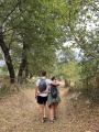
A peaceful walk through a small village, between fields, woods and village paths, easily accessible from the greenway. A circular route with easy parking in front of the village school/town hall.
From Pla des Peyres to Rocher de Batail
 7.80 mi
+1,211 ft
-1,211 ft
4h 40
Moderate
Departure from Ganac (Ariège)
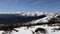
An easy walk along the ridge between the Toulouse plain and the Pyrenees mountain range from Mont Valier to Saint-Barthélémy.
Bout de Touron and Sommet de Bazillac from Pla des Peyres
 4.17 mi
+449 ft
-449 ft
2h 20
Easy
Departure from Montoulieu (Ariège)
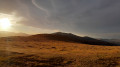
This is a short, easy, accessible and aerial hike offering views of the entire Ariège Pyrenees, from Mont Valier to the Orlu Reserve, as well as the plain.
From Prat d’Albis to the Pic de Razels via the Rocher de Batail
 14.04 mi
+2,969 ft
-2,956 ft
9h 00
 Very difficult
Departure from Ganac (Ariège)
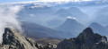
A very beautiful ridge walk, without any difficulty, suitable for both summer and winter, with quick access from Foix.
Belvèze Pass from the village of Seignaux
 5.99 mi
+1,470 ft
-1,552 ft
4h 00
Moderate
Departure from Montoulieu (Ariège)
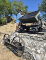
Starting from the village of Seignaux, which was once an old kaolin (white clay) mine used to make porcelain, you will reach the Col de Belvèze to discover a superb view of the Pyrenees mountain range. Back in the village, you can take a few minutes to learn a little more about kaolin, see the wagon used in the mine, and admire the view from the orientation table.
Bout de Touron and Cabane des Gardes from Seignaux
 11.26 mi
+2,802 ft
-2,792 ft
7h 35
 Difficult
Departure from Montoulieu (Ariège)
A very pleasant hike in the hills of Ariège, between forest and ridges.
Le Picou via the Cabane de la Devèze
 10.36 mi
+2,772 ft
-2,769 ft
7h 10
Difficult
Departure from Brassac (Ariège)
After a steady climb through the forest, the Cabane de la Devèze offers a welcome rest stop before tackling the last demanding section leading to the ridge. The path along this vast ridge offers exceptional views of the Haute Ariège as well as the sites of Foix and Tarascon-sur-Ariège. After the Picou, the return journey is via the Route Forestière du Calmil, where you can rest from the efforts of the climb while admiring the magnificent trees that populate it.
 Bout de Touron from Cabus, Ramon locality
 7.49 mi
+1,401 ft
-1,401 ft
5 hrs
Moderate
Departure from Saurat (Ariège)
Snowshoe hike starting from Ramon, depending on snow conditions. Be careful of road conditions; make sure you have good winter tyres (keep chains in the boot of your vehicle as a precaution). It is sometimes possible to drive to the small car park just next to the cattle grid. Fairly gentle slopes, mainly on tracks and trails, except before the summit of Bout du Touron. South-facing with a beautiful view, short section through the forest to see the Cabane des Gardes on the trail.