Sarda Trail around Vernajoul

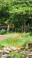
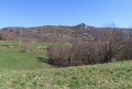
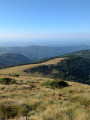
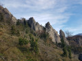
A signposted route of around twelve kilometres through the woods and meadows around Vernajoul. The path includes a few short uphill sections but allows you to enjoy the coolness of the woods in summer. Some sections can be slippery and muddy in wet weather.

Details

n°74588609
Creation:
Last update:
Last review:
  • Walking
    Activity: Walking
  • ↔
    Distance: 6.75 mi
  • ◔
    Average duration: 4h 10 
  • ▲
    Difficulty: Moderate

  • ⚐
    Back to start: Yes
  • ↗
    Ascent: + 1,214 ft
  • ↘
    Descent: - 1,234 ft

  • ▲
    Highest point: 1,811 ft
  • ▼
    Lowest point: 1,220 ft

Photos

Description of the walk

Park in the car park at the town hall in Vernajoul.

(S/E) Take Rue de Latière alongside the cemetery, following the blue and yellow markings. Continue to the end of the street, ignoring the dead-end streets on either side. 

(1) Head up to the right towards the woods. Ignore a path on the left and continue to a junction at the edge of a clearing. 

(2) Turn right, pass Clot des Pièles and reach the junction with a wider path.

(3) Follow this path, turning left. Then head down to the entrance of a clearing, which you’ll leave on your left, and continue for a few dozen metres along the main path.

(4) Look out for the cairn marking the start of the path which climbs to the left, then descends towards Sarda le Fort after passing through a fence. 

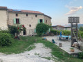
(5) Turn right onto the road leading to the hamlet, join the D1 and follow it to the right as far as the Planté junction. 

(6) Take the road on the left towards the hamlet and continue to follow the yellow and blue signposts. You’ll reach a T-junction.

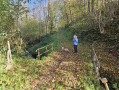
(7) Take the path on the left, which winds round a series of bends before reaching the Pont Fagé bridge over the Ruisseau de Vernajoul.

(8) Cross the bridge and head up towards the Voie Verte.

(9) Turn left onto the Voie Verte and follow it towards Saint-Girons for about 600 metres.

(10) Head up a wide path on the right and reach the ridge path through the woods; follow this to the right to rejoin the Voie Verte just before the viaduct.

(11) Turn right onto the Voie Verte, cross the viaduct and join the D231.

(12) Cross the D231 with care and continue straight ahead on the Greenway, signposted in blue and yellow. 

(13) Leave the Voie Verte and follow the small road that runs above it; continue in the same direction past the school, then turn right onto the Chemin du Cap des Ors to return to the town hall (S/E).

Waypoints

  1. S/E : mi 0 - alt. 1,355 ft - Car park at the town hall in Vernajoul - Parking de la mairie de Vernajoul
  2. 1 : mi 0.26 - alt. 1,358 ft - End of the road, climb to the right
  3. 2 : mi 0.61 - alt. 1,634 ft - Clearing, main path on the right
  4. 3 : mi 0.94 - alt. 1,585 ft - Junction, turn left
  5. 4 : mi 1.56 - alt. 1,624 ft - Cairn, on the left
  6. 5 : mi 2.09 - alt. 1,578 ft - Sarda le Fort
  7. 6 : mi 2.55 - alt. 1,437 ft - Leave the road, take the path on the left
  8. 7 : mi 2.94 - alt. 1,365 ft - T-junction, turn left
  9. 8 : mi 3.6 - alt. 1,220 ft - Fagé Bridge
  10. 9 : mi 3.94 - alt. 1,358 ft - Greenway
  11. 10 : mi 4.4 - alt. 1,398 ft - Leave the Greenway, turn right
  12. 11 : mi 5.61 - alt. 1,339 ft - Return to the Greenway, turning left
  13. 12 : mi 5.99 - alt. 1,322 ft - Crossing the D231
  14. 13 : mi 6.44 - alt. 1,286 ft - Leave the Greenway, iron bridge
  15. S/E : mi 6.75 - alt. 1,355 ft - Car park at the town hall in Vernajoul - Parking de la mairie de Vernajoul

Notes

The path between markers (4) and (5) is sometimes overgrown but offers good opportunities to spot roe deer. 

Reviews and comments

3.2 / 5
Based on 3 reviews

Reliability of the description
3.3 / 5
Ease of following the route
3 / 5
Route interest
3.3 / 5
Galsan
Galsan

Overall rating : 3.3 / 5

Date of your route : Nov 16, 2025
Reliability of the description : ★★★★☆ Good
Ease of following the route : ★★★☆☆ Average
Route interest : ★★★☆☆ Average
Very busy route : No

Same comment as above: between 4 and 5, the trail has quite a few brambles and gets lost, but luckily I had GPS. What's more, you arrive at Sarda le Fort, which is private property. A recent sign has been put up, and I had to cross the mule pastures, which I found intrusive for the owner of the farmhouse. Between 7 and 8, you cross cow pastures, going from one fence to another. The route is not bad, but it gets lost, which is a shame.

Machine-translated

User 11565019

Overall rating : 3.3 / 5

Date of your route : Aug 04, 2025
Reliability of the description : ★★★☆☆ Average
Ease of following the route : ★★★☆☆ Average
Route interest : ★★★★☆ Good
Very busy route : No

the trail is overgrown with brambles in places, making it difficult to follow, particularly in section (4) towards Sarda le Fort

Machine-translated

anizette
anizette

Overall rating : 3 / 5

Date of your route : Jun 19, 2025
Reliability of the description : ★★★☆☆ Average
Ease of following the route : ★★★☆☆ Average
Route interest : ★★★☆☆ Average
Very busy route : No

Ideal walk in hot weather. Trails sometimes invisible. GPS required.

Machine-translated

Other walks in the area

For more walks, use our search engine .

The GPS track and description are the property of this route's author. Please do not copy them without permission.