Country:

 City:
City:


Start from the car park between the neighbouring villages of Las Prados and Saint-Pierre-de-Rivière, at the junction of the D47 andD11A.
(S/E) Take the D47 towards Ganac, and at the three-way junction opposite the church of Saint-Pierre-de-Rivière, keep left. Follow the road to house no. 18.
(1) Turn onto the fairly flat path on the right and follow the GRP® Tour de la Barguillère. At the small road, turn right, then, at the 90° right-hand bend, take the path on the left.
(2) At the hamlet of Lacassagne, carry straight on, then quickly take the Cami de Dijous on the left. At the end, keep to the left and head downhill to the junction at the corner of No. 12. Turn right, head uphill towards houses Nos. 6–8–10 (signposted), then quickly follow the path that climbs to the left. At the next fork, turn left, then, at the cemetery, turn right. At the end of the Chemin de Fount Blanquo, continue to the left and head downhill to the hairpin bend, to the left of the departmental road.
(3) Turn right onto Route de Micou, pass through the bottom of the valley and reach a path on the right, which winds upwards. Follow it, climbing through the woodland, cross a track and arrive at a farm on a flat area.
(4) Turn right and follow the path along the upper part of the ridge until you reach the summit of Cap Blanc.
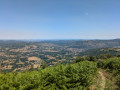
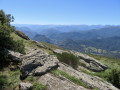
(5) Lovely view down towards Foix. Join the GR® and continue uphill along it to the Cabane de Bladas.
(6) From the hut, continue climbing to the road and follow it to the right until the end. Carry on along the track until you reach a pass at Prat d’Albis.
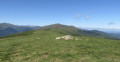
(7) Turn right and follow the wide ridge path to the Rocher de Batail, the highest point on this route.
(8) Continue along the ridge path to reach the summit of the Sarrat de la Pelade, which is almost as high as the Rocher de Batail.
(9) Take the path leading down to the right and follow the ridge to the Cabane de la Devèze.
(10) Take the path leading to the hut and descend to a four-way junction.
(11) Follow the forest track opposite, heading downhill. Pass a gully and continue until you reach the start of a path, just after the bend on the right.
(12) Follow this path down to the Col de Legrillou.
(13) Continue down the tarmac road and, at the hairpin bend that follows, take the path opposite.
(14) Cross the D111 diagonally and carry on straight ahead. Then continue along the tarmac and, at the end, go round the building on the right. Follow the path into the woods and, at the small road, turn right, enter Burges and reach the bottom of the slope, at the corner of No. 834.
(15) Turn onto the path on the right, just in front of a small wash house. Walk uphill to a crossroads and take the path on the right. When you reach the track, turn onto the path on the left; you’ll soon reach a road. Follow it to the left, enter Cazals and reach No. 1424.
(16) Turn into the lane on the right, then continue along the footpath. At the road, carry on to the right, pass through Razent and stay on the D111 until you reach the four-way junction at Brassac.
(17) Turn right onto the D21 towards Ganac, and at Lample, head down to the left to reach No. 171.
(18) Take the footpath on the right and, when you reach the road, follow it to the left until you reach No. 15, at the first houses in Ganac.
(19) Turn left onto the small street, Rue de la Hière, and continue along Rue de la Coumette. At the end, turn left and, at the three-way junction, keep left onto Chemin du Cap de Ra. At the top of the hill, continue along the path opposite, head down through the woods and reach the end of Chemin du Roc Blanc.
(20) Turn left and follow the road to the car park at the junction of the D47 andD11A ( S/E).

 Visorando Member
 Moderate
 Easy
Easy  Association / Club / Walk leader
 Difficult