Circular family walk in Brassac

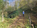
Most of the route is shaded, which can be pleasant in summer. There are few viewpoints, but the route is nonetheless varied. You cross the Ruisseau de Faurat via a ford and a few bridges.

Details

n°66735476
Creation:
Last update:
Last review:
  • Walking
    Activity: Walking
  • ↔
    Distance: 2.25 mi
  • ◔
    Average duration: 1h 20 
  • ▲
    Difficulty: Easy

  • ⚐
    Back to start: Yes
  • ↗
    Ascent: + 367 ft
  • ↘
    Descent: - 377 ft

  • ▲
    Highest point: 2,260 ft
  • ▼
    Lowest point: 1,857 ft

Photos

Description of the walk

You can park at the school in Brassac.

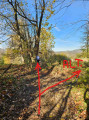
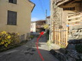
(S/E) Cross the D111 and head up the narrow lane; after about 30 m, turn right to begin a long climb along a lovely path.
After about 15 minutes’ walk, go straight on at the junction, as indicated by the yellow signs. Cross the Faurat Stream at the ford and continue towards Lacout.

(1) After the house, turn right down the slope to follow the path, which turns sharply left about 200 m further on, and you will reach Cazals.

(2) Please note: after house number 145, follow the road to the right and pass under a canopy, in front of the wash houses. Immediately afterwards, turn right again, heading down the path which joins the D111.

(3) Turn right and, after 100 m, head diagonally left to pass in front of a white house with red shutters. The road turns into a path leading to a tarmac road.
The final section is a bit steep and can be slippery. You can choose to follow the flat path on the right if you think it’s better.

(4) Turn right and a long bend follows.

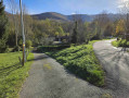
(5) Leave the main road and follow a lovely path on the left. At the end, you’ll reach a tarmac road. Turn right and you’ll arrive at the school car park after 200 m (S/E).


Waypoints

  1. S/E : mi 0 - alt. 1,939 ft - School car park
  2. 1 : mi 0.86 - alt. 2,208 ft - Lacout
  3. 2 : mi 1.18 - alt. 2,149 ft - Cazals
  4. 3 : mi 1.35 - alt. 2,041 ft - Junction with the D111
  5. 4 : mi 1.71 - alt. 1,886 ft - Junction with the D21
  6. 5 : mi 1.88 - alt. 1,877 ft - Fork
  7. S/E : mi 2.25 - alt. 1,939 ft - School car park

Notes

Water point at Cazals.
Fording the Ruisseau du Faurat.

Worth a visit

Col de Légrillou

Reviews and comments

4.8 / 5
Based on 2 reviews

Reliability of the description
5 / 5
Ease of following the route
5 / 5
Route interest
4.5 / 5
pit31
pit31

Overall rating : 5 / 5

Date of your route : Sep 28, 2026
Reliability of the description : ★★★★★ Very good
Ease of following the route : ★★★★★ Very good
Route interest : ★★★★★ Very good
Very busy route : Yes

Partly because of the circular ‘L’eau’ walk – this is a walk well worth doing.
Best avoided in wet weather.
Very shady and very few tarmac roads

Machine-translated

User 16003437
• Edited:

Overall rating : 4.7 / 5

Date of your route : May 19, 2025
Reliability of the description : ★★★★★ Very good
Ease of following the route : ★★★★★ Very good
Route interest : ★★★★☆ Good
Very busy route : No

A pleasant, easy and varied walk – just the thing for a lovely time. The route seems to be well known to the locals, so it’s quite popular, but I didn’t come across anyone. I’d recommend it.

Machine-translated

Other walks in the area

For more walks, use our search engine .

The GPS track and description are the property of this route's author. Please do not copy them without permission.