


Refine your search for walks in Valdeblore
Valdeblore walks


 The Belvédère de Séréna via Mont Viroulet
 Visorando Member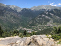
 7.59 mi
 +2,385 ft
 -2,375 ft
 5h 35
5h 35
 Difficult
 Departure from Valdeblore (Alpes-Maritimes)
A beautiful hike in a very shady forest environment, best done in spring or during the warmer months, where you can enjoy this area rich in fir and spruce trees. Finally, enter the fortified village through the old ogival gate to discover what is certainly the oldest of the three villages of Valdeblore.
Saint-Dalmas de Valdeblore – Le Boréon
 12.91 mi
+4,491 ft
-3,720 ft
10 hrs
12.91 mi
+4,491 ft
-3,720 ft
10 hrs
 Very difficult
Departure from Valdeblore (Alpes-Maritimes)
Very difficult
Departure from Valdeblore (Alpes-Maritimes)
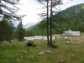
Second stage of the route and first stage on theGR®52. A long 21km stage taking in the Col de Veillos, numerous lakes, the Col du Barn, the Vacherie du Collet and the Col de Salèse, ending at a place called Le Boréon.
A spectacular stage thanks to its landscapes and views, but very difficult.
From Saint-Dalmas to Utelle
 15.80 mi
+4,124 ft
-5,745 ft
10h 50
Difficult
Departure from Valdeblore (Alpes-Maritimes)
15.80 mi
+4,124 ft
-5,745 ft
10h 50
Difficult
Departure from Valdeblore (Alpes-Maritimes)
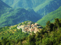
This twentieth stage marks the end of the crossing of the Mercantour Massif. From Saint-Dalmas, the GR®5 heads south to climb the steep slope towards the Cime de Colmiane, which it bypasses by heading for the Col du Varaire. It crosses the Bois Noir and reaches the Col des Deux Caïres, then the Caïre Gros. The route follows its ridge and, hugging the hillside, passes beneath Mont Chalancha, La Partissuola and the Cime de la Combe before descending to the small pass of Trous. Before the Col du Fort, the path descends to the Granges de la Brasque, crosses the upper part of the Riou du Figaret valley and arrives at the Col d’Andrion. Cutting across the hairpin bends of the M33, the GR®5 reaches the Col des Fournès and the Col de Gratteloup. Through rocky gaps, it runs alongside the Petit Brec d’Utelle and then the Brec d’Utelle. From there, the path descends towards the Crête de l’Albaréa and reaches the Col du Castel Ginesté. It crosses the slope below the ridges of the Têtes du Sac de Bécasse, Parabosquet and Les Pennes to reach the Utelle community lodge.
Saint-Dalmas de Valdeblore - Utelle
15.74 mi
+4,354 ft
-5,919 ft
11h 00
Difficult
Departure from Valdeblore (Alpes-Maritimes)
Étape de la traversée des Alpes de Saint-Dalmas de Valdeblore jusqu'à Utelle. Randonnée sur une ligne de crête offrant des panoramas extraordinaires sur l'arrière pays niçois.
Caïre Gros
 6.51 mi
+2,270 ft
-2,254 ft
5h 00
6.51 mi
+2,270 ft
-2,254 ft
5h 00
 Moderate
Departure from Valdeblore (Alpes-Maritimes)
Moderate
Departure from Valdeblore (Alpes-Maritimes)
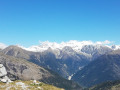
A magnificent viewpoint, the summit of Caïre Gros, between the Tinée and Vésubie valleys, offers superb views of the Franco-Italian mountain range and the main peaks of the Mercantour.
Mont Pepoiri, Petoumier and Lacs de Millefonts
 12.11 mi
+5,696 ft
-5,669 ft
10 hrs
Very difficult
Departure from Valdeblore (Alpes-Maritimes)
12.11 mi
+5,696 ft
-5,669 ft
10 hrs
Very difficult
Departure from Valdeblore (Alpes-Maritimes)
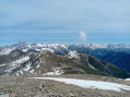
This is a beautiful circuit that allows you to discover the Baus de la Frema and Mont Pétoumier with incredible views of the Argentera and Gélas massifs, then the Lacs de Millefonts with the final climb to Mont Pépoiri, which offers an extraordinary panorama of the entire Mercantour and the middle country.
Ascent of Baus de la Frema
 4.46 mi
+1,982 ft
-1,988 ft
3h 45
Moderate
Departure from Valdeblore (Alpes-Maritimes)
4.46 mi
+1,982 ft
-1,988 ft
3h 45
Moderate
Departure from Valdeblore (Alpes-Maritimes)
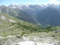
An easy hike offering beautiful views of the Mercantour Massif and, opposite, the Madone de Fenestre valley. You can extend the hike on the mountain pasture towards the Tête du Brec (2566m).
Alpine pastures and woodland above the Vésubie Valley and Valdeblore
6.28 mi
+2,398 ft
-2,398 ft
5h 00
Moderate
Departure from Venanson (Alpes-Maritimes)
A hike starting from the village of Venanson in the Vésubie Valley; relatively short but with a significant elevation gain. It offers a variety of views over different parts of the region: the Tinée and Vésubie valleys, and the villages in the Valdeblore area. A good mix of wooded and open sections. There are no difficulties with navigation. The paths are clearly visible and the signposts are very helpful.
Around the village of La Bolline in Valdeblore
4.23 mi
+663 ft
-640 ft
2h 30
 Easy
Departure from Valdeblore (Alpes-Maritimes)
Easy
Departure from Valdeblore (Alpes-Maritimes)
This walk around La Bolline, a village in Valdeblore, takes you along pretty paths through wooded valleys. It takes you to the village of La Bolline, the Chapel of Sainte-Croix des Pénitents Blancs, the fountain in Place de Casetto (1857) and the Church of Saint-Jacques-le-Majeur (17th century), as well as the village of La Roche and the Chapel of the Pénitents Noirs de l'Annonciation.
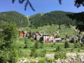
The hamlet of Mollières and the Col du Barn, seen from the Millefonts car park
 11.86 mi
+4,436 ft
-4,429 ft
7 hrs
Very difficult
Departure from Valdeblore (Alpes-Maritimes)
11.86 mi
+4,436 ft
-4,429 ft
7 hrs
Very difficult
Departure from Valdeblore (Alpes-Maritimes)
This hike allows you to explore the beautiful hamlet of Mollières via an unusual, little-used route through a wild valley.
The traditional routes to Mollières involve round-trip walks; taking this route, however, allows you to complete a lovely circular route passing by the pretty Millefonts Lakes in Valdeblore.
Crossing Mont Pépoiri
 Association / Club / Walk leader
 4.59 mi
+2,192 ft
-2,195 ft
4h 00
Moderate
Departure from Valdeblore (Alpes-Maritimes)
4.59 mi
+2,192 ft
-2,195 ft
4h 00
Moderate
Departure from Valdeblore (Alpes-Maritimes)
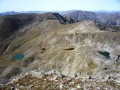
We offer a hike through the Valdeblore mountain pastures, including the ascent of one of the area’s major peaks, Mont Pépoiri, offering exceptional views across the entire border ridge of the Mercantour massif.Views of Corsica on a clear day.
Cime des Lauses and tour of the Lacs des Millefonts
 5.81 mi
+2,569 ft
-2,549 ft
4h 55
Difficult
Departure from Valdeblore (Alpes-Maritimes)
5.81 mi
+2,569 ft
-2,549 ft
4h 55
Difficult
Departure from Valdeblore (Alpes-Maritimes)
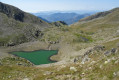
Starting from the Millefonts car park, this hike will take you via Lac Petit to Cime des Lauses, a peak offering exceptional views of the Mercantour.
After a section off the marked trail along the Têtes des Margès and Barn ridges, you will reach Col du Barn and descend to the other beautiful lakes of Millefonts: Lac Gros (slightly heart-shaped) and Lac Long (entirely colonised by aquatic plants).
Lacs des Millefonts via the Cols de Ferrière and Barn
5.26 mi
+1,975 ft
-1,972 ft
4h 10
Moderate
Departure from Valdeblore (Alpes-Maritimes)
A very beautiful hike in the Colmiane area. No difficulty on this route.
Lacs des Millefonts - Col du Barn
 4.66 mi
+1,365 ft
-1,362 ft
3h 20
Easy
Departure from Valdeblore (Alpes-Maritimes)
4.66 mi
+1,365 ft
-1,362 ft
3h 20
Easy
Departure from Valdeblore (Alpes-Maritimes)
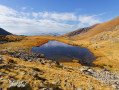
The Millefonts lakes hike will take you to no fewer than five lakes at the foot of the Mercantour. The Col de Barn offers breathtaking views of the Molières valley and the lakes.
Mercantour route via the GR®52
 65.54 mi
+21,585 ft
-24,639 ft
7 days
Very difficult
Departure from Saint-Martin-Vésubie (Alpes-Maritimes)
65.54 mi
+21,585 ft
-24,639 ft
7 days
Very difficult
Departure from Saint-Martin-Vésubie (Alpes-Maritimes)
TheGR® 52 is a route that crosses the Mercantour National Park, through the Alpes-Maritimes from Saint-Dalmas-de-Valdeblore to Menton.
ThisGR® route is very challenging due to the varied terrain and significant elevation changes.
You’ll reach altitudes of up to 2,700m, where you can admire the high-mountain landscapes, flora and fauna. Then, in the second half of the route, you’ll encounter panoramas that are more southern in character but just as extraordinary.
Saint-Martin-de-Vésubie - Saint-Dalmas de Valdeblore
 4.01 mi
+1,821 ft
-732 ft
3h 25
Moderate
Departure from Saint-Martin-Vésubie (Alpes-Maritimes)
4.01 mi
+1,821 ft
-732 ft
3h 25
Moderate
Departure from Saint-Martin-Vésubie (Alpes-Maritimes)
The GR®52 starts in Saint-Dalmas de Valdeblore. This first stage is a transition to reach the starting point of the GR®.This is a lovely hike that passes through the small resort of La Colmiane and offers a relatively easy climb, following the GR®52 A through the woods for just over 6km.
Cime de Piagu
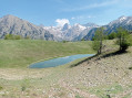 11.88 mi
+5,249 ft
-5,233 ft
10h 00
Difficult
Departure from Saint-Martin-Vésubie (Alpes-Maritimes)
11.88 mi
+5,249 ft
-5,233 ft
10h 00
Difficult
Departure from Saint-Martin-Vésubie (Alpes-Maritimes)
A magnificent mid-mountain hike offering a variety of landscapes: the village of Saint-Martin-Vésubie, the Boréon forest and, finally, a rocky landscape with a 360° view of the surrounding peaks.
More walks in Valdeblore
Select a point of interest below:
- Col des Deux Caïres (1921m)
- Col du Barn
- Col du Suc (1580m)
- Col du Varaire (1700m)
- Col Ferrière
- Collet du Puei (1330m)
- Eglise de Saint-Dalmas
- Gite les Marmottes
- Gros Vallon (cours d'eau) - Affluent du Vallon de Bramafam
- La vacherie du Collet
- Lac d'en Veillos
- Lac de Tavels (2290m)
- Lac Graveirette
- Lac Gros (Lacs des Millefonts)