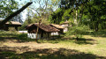
Adour trail from Hinx to Préchacq-les-Bains

This section of the Adour Trail runs between Hinx and Préchacq-les-Bains. It can be walked in either direction as a round trip or as a one-way trip, in which case you will need two vehicles.

Details

n°1582985
Creation:
Last update:
Last review:
  • Walking
    Activity: Walking
  • ↔
    Distance: 6.36 mi
  • ◔
    Average duration: 3h 00 
  • ▲
    Difficulty: Easy

  • ⚐
    Back to start: No
  • ↗
    Ascent: + 75 ft
  • ↘
    Descent: - 69 ft

  • ▲
    Highest point: 102 ft
  • ▼
    Lowest point: 23 ft
  • ⚐ Country: France
  • ⚐ City: Hinx (40180)
  • ⚑
    Start: N 43.721989° / W 0.940312°
  • ⚑
    End: N 43.766701° / W 0.929682°
  • Hour-by-hour weather

Photos

Description of the walk

(S) From Hinx harbour, take the D368.

(1) Cross the Pont Neuf stream and continue along the same road.

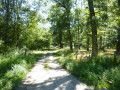
(2) Take the first left onto Route de Soubolle and follow the forest track, which forms a circular route.

(3) At the junction with the Route des Carasses, turn left and then take the first left, leaving the mountain bike trail on your right.

(4) Before the pumping station, turn onto the track on your right and follow the banks of the Adour for a few hundred metres.

(5) Turn right to cut across a bend in the Adour, then head away from the river to rejoin the D368.

(6) Follow this departmental road to the left and cross the Louts, spying the ruins of Divielle Abbey on your right.

(7) Take the first path on the left to get closer to the Adour, then turn right, moving away from the river.

(8) Turn left, then follow the river for about 2 km through the Préchacq-les-Bains communal forest.

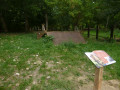
(9) Then head right towards the Trou de Madame; to visit this unmissable spot, you’ll need to leave the path for a few metres, but this unique spot is well worth the detour!

(10) Return to the fork and continue to the right along the path that goes round the spa complex.

You’ll reach the information board opposite the restaurant Le Clos Pité at the entrance to the spa complex (E).

Waypoints

  1. S : mi 0 - alt. 26 ft - Hinx Harbour - Adour (fleuve)
  2. 1 : mi 0.24 - alt. 30 ft - Ruisseau du Pont-Neuf (cours d'eau) - Affluent de l'Adour
  3. 2 : mi 0.39 - alt. 102 ft - Route de Soubolle
  4. 3 : mi 0.98 - alt. 33 ft - Route des Carasses
  5. 4 : mi 1.26 - alt. 26 ft - Pumping station
  6. 5 : mi 1.61 - alt. 30 ft - Side road
  7. 6 : mi 2.51 - alt. 49 ft - D368 junction
  8. 7 : mi 2.88 - alt. 30 ft - Take the path on the left after the - Louts (rivière) - Affluent de l'Adour
  9. 8 : mi 3.72 - alt. 30 ft - Path on the left
  10. 9 : mi 5.43 - alt. 30 ft - Turn right at the junction towards the Trou de Madame
  11. 10 : mi 5.56 - alt. 26 ft - Le Trou de Madame (Préchacq-les-Bains)
  12. E : mi 6.36 - alt. 33 ft - Spa

Notes

From Hinx, park at the port.
From Préchacq-les-Bains, park at the Clos Pité restaurant at the entrance to the thermal spa.

Worth a visit

Reviews and comments

4.3 / 5
Based on 1 review

Reliability of the description
4 / 5
Ease of following the route
5 / 5
Route interest
4 / 5
mitch85
mitch85

Overall rating : 4.3 / 5

Date of your route : Jun 17, 2024
Reliability of the description : ★★★★☆ Good
Ease of following the route : ★★★★★ Very good
Route interest : ★★★★☆ Good
Very busy route : No

done on a mountain bike, so more difficult because it was littered with puddles due to the ruts dug by tractors
very pleasant route, lovely

Machine-translated

Other walks in the area

For more walks, use our search engine .

The GPS track and description are the property of this route's author. Please do not copy them without permission.