The Adour Trail from Saint-Vincent-de-Paul to Candresse

This section of the Sentier de l’Adour runs between Saint-Vincent-de-Paul and Candresse.

Details

1582783
Creation:
Last update:
Last review:
  • Walking
    Activity: Walking
  • ↔
    Distance: 2.81 mi
  • ◔
    Average duration: 1h 20 
  • ▲
    Difficulty: Easy

  • ⚐
    Back to start: No
  • ↗
    Ascent: + 16 ft
  • ↘
    Descent: - 10 ft

  • ▲
    Highest point: 39 ft
  • ▼
    Lowest point: 20 ft

Photos

Description of the walk

The walk starts at the information sign on the forest track leading off the D322, on the left just after the bridge over the Adour when coming from Saint-Vincent-de-Paul.

See the practical information section for parking options and details on whether to do a one-way or return walk.

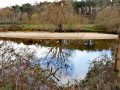
(S) Head east and follow the Adour for about 800 metres.

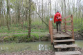
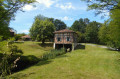
(1) Turn right and cross the Saint-Vincent-de-Paul communal forest (path not shown on the IGN map). Cross the tarmac road and continue along the forest track. Cross the Adouret via a wooden footbridge.

(2) As you come off the footbridge, turn left and follow the stream.

(3) Cross the stream again and immediately cross a second one. Then follow the second stream on your right.

(4) Ignore a path coming from the left and cross the stream once more. Continue straight on (south) and follow a track (enjoy the scenery of the Candresse alluvial plains).

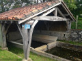
(5) At the junction of the track and the road (wash house), turn left. At the next crossroads (cross), veer left towards the church and you’ll reach the information board at its foot (E).

Waypoints

  1. S : mi 0 - alt. 23 ft - Information board - Adour (fleuve)
  2. 1 : mi 0.49 - alt. 23 ft - Start of the trail
  3. 2 : mi 0.87 - alt. 20 ft - Footbridge over the Arroudet
  4. 3 : mi 1.39 - alt. 20 ft - Footbridge
  5. 4 : mi 1.75 - alt. 20 ft - Junction
  6. 5 : mi 2.6 - alt. 26 ft - Candresse wash house
  7. E : mi 2.81 - alt. 30 ft - Candresse Church

Notes

The walk can be done as a one-way trip, either in the direction described or in the opposite direction. In this case, you’ll need to organise at least two vehicles:
- On the Saint-Vincent-de-Paul side (S), park on the forest track on your left after the bridge when coming from the village.
- On the Candresse side (E), park in the small car park opposite the church and the cemetery.

The walk can, of course, be done as a round trip: in that case, allow for a distance of 9 km and around 2½ hours’ walking (not including breaks).

Worth a visit

Candresse wash house
Candresse Church
Candresse Stork Reserve

Reviews and comments

4.6 / 5
Based on 3 reviews

Reliability of the description
5 / 5
Ease of following the route
5 / 5
Route interest
3.7 / 5
GRISARD
GRISARD

Overall rating : 4.3 / 5

Date of your route : Jul 15, 2024
Reliability of the description : ★★★★★ Very good
Ease of following the route : ★★★★★ Very good
Route interest : ★★★☆☆ Average
Very busy route : No

A RURAL, flat, short route; I walked it as a round trip starting from Candresse, where it’s easier to park and set off; not to be attempted if the Adour is in flood, as the alluvial plains are then flooded.

Machine-translated

jocelynebernard
jocelynebernard

Overall rating : 5 / 5

Date of your route : Mar 19, 2021
Reliability of the description : ★★★★★ Very good
Ease of following the route : ★★★★★ Very good
Route interest : ★★★★★ Very good
Very busy route : No

Hello – We did the route in the opposite direction, starting from Candresse –
To start, take Rue Eugénie – at the wayside shrine, carry straight on – then head towards the wash house and enter the Candresse forest.
The path is very pleasant to start with for about 2 km – things get trickier after that, as there are loads of ruts caused by forestry machinery and lots and lots of mud – we turned back
In my opinion, not one to do very early in the spring – after the floods – We didn’t see the storks’ nesting site –
We’ll do the route again this summer as it’s still very pleasant despite everything – Thank you

Machine-translated

SENTIERADOUR
SENTIERADOUR

Hello Moise5433,

It seems you were there just as the access to the footbridge was being modified in mid-September 2020 (conversion of the steps into ramps).

Both access points to the footbridge are now operational!

Thank you for your feedback!

Machine-translated

moise5433
moise5433

Overall rating : 4.3 / 5

Date of your route : Aug 27, 2020
Reliability of the description : ★★★★★ Very good
Ease of following the route : ★★★★★ Very good
Route interest : ★★★☆☆ Average
Very busy route : No

The car park at the start isn’t all that easy to find and is a bit out of the way.
The footbridge crossing the Adouret has a wooden walkway for the ascent on the start side, which isn’t fully constructed but still provides a way to climb up.

Machine-translated

Other walks in the area

For more walks, use our search engine .

The GPS track and description are the property of this route's author. Please do not copy them without permission.