Country:
 City:
City:


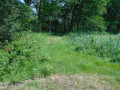
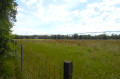
From Saint-Paul-lès-Dax, take the D947 Castets-Bordeaux road. At the racecourse roundabout, take the first exit on the right, signposted Centaure. Continue straight on; the road becomes a wide track after a few industrial buildings. Keep going straight on this track for 2 km until you reach a small road. Continue straight ahead and, a little further on, turn left onto Chemin de Bordessoule, a small road which you must follow straight on for 1.3 km until you reach the ‘No Through Road’ sign. Park here at the side of the road; this is the start of the walk.
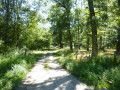
(S/E) Set off along the wide, sandy path heading north-north-west, running parallel to the road. After 360 m, at the three-way junction, take the track on the left until you reach a small road (Chemin de Bouhette), where the Way of St James passes, marked with St James’s symbols and the red and white GR® trail markers.
(1) Take this tarmac Chemin de Bouhette to the left and, 50 m further on, at the Ruisseau de Cabanes and on the right as you look from the road, you can admire the magnificent Moulin de Pouymartet, which is situated on private property. Continue along this small road for 350 m, following the red and white markings.
(2) Leave the road by taking a path on the left, still following the red and white markings, which leads towards some houses (a place called Charlemagne), which you will go round on the right.
(3) Turn left at the junction, still on the path marked in red and white.
(4) Turn left again at the next junction, still following the red and white markings (IGN map incorrect). After a sharp bend to the right, the path soon follows a field fence until the end of the field.
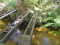
(5) Here, at the corner of the field fence, leave the Way of St James and the GR® to take a grassy path on the left leading towards the Ruisseau de Cabanes. Once at the stream, continue to the shelter with a large motorised pump used to water the field. Pass the shelter and carefully cross the stream using the concrete post on the right (25 to 30 cm wide). Once on the other bank, continue straight on along a small path which quickly widens into a broad track; continue straight on.
(6) At the junction with a cross-path, follow it by turning left. Continue along this path until you reach Chemin de Bordessoule and the car park (S/E).
 Visorando Member