Country:
 City:
City:


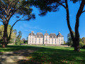
Park in the car park by the town hall and the village hall.
(S/E) Head towards the village hall, then turn right down the stairs leading to Route de Gouarde and turn left until you reach the junction.
(1) Carry on straight ahead towards Pouy de Boussut. Pass through the hamlet, then cross the D339 and continue for about 200 m.
(2) Take the dirt track on the left and follow it straight on until you reach the Laurède cemetery on the D10.
(3) Cross the road, then pass the Henri Emmanuelli memorial, before taking the road on the left. At the junction, turn right and continue to the Leplace three-way junction.
(4) Turn right. Follow the road downhill until you reach a red dirt track.
(5) Take the path opposite which leads to the Adour.
(6) Continue along the track that branches off to your left
(7) At the junction with the Route d’Onard, go straight on, then 40 metres further on, turn left onto the Route de la Côte Rouge.
(8) Just at the top of the hill, before the power line, take the path on the right after the house, which leads downhill. This joins a road which you follow for about 200 metres.
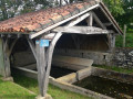
(9) Turn right and walk 50 m towards Gnicq. After the first house, turn right, cross the meadow and, 100 m further down, you’ll find the dirt track on your left which leads to the wash house and then to the church.
(10) Turn left to walk alongside it, heading towards the long, narrow house, then turn right towards the town hall and head for the car park.
(S/E) Opposite the town hall, turn left this time, then turn right onto the Route du Moulin d’Arthoux. Turn right at the junction to follow the Route de Bertranne to the junction you passed on the way out.
(1) After a right-left turn, head straight on along the tarmac road, then take the dirt track on the right before reaching the buildings. Walk for about 200 m and, at the bend.
(11) Take the small path on the left which leads onto a road. Turn left onto this road and follow it for about 300 m.
(12) Take the first track on the right (Pédamous) and head downhill.
(13) Then follow the first road on the right towards Guillemet. Pass through the hamlet and continue to the T-junction.
(14) Viewpoint. Turn right. Carry on straight ahead. Join the D420 (Route de la Toudeille).
(15) Turn right and follow this road straight on until you reach the junction with Rue des Écoliers.
(16) Turn right to follow this street. After the triangular junction, turn left towards the town hall and the car park (S/E).

 Visorando Member
 Easy
Easy 
 Tourist office