


Refine your search for walks in Scrignac
Scrignac walks


 Trinivel to Scrignac route
 Local authority
 5.61 mi
 +367 ft
 -351 ft
 2h 55
2h 55
 Easy
Easy
 Departure from Scrignac (Finistère)
This route allows you to explore the Lestrézec Wood, the Saint-Corentin Chapel and to cycle along Greenway No. 7, ‘La Vélodyssée’, a former railway line that runs alongside the River Squiriou.
The Beurc’hoat route in Scrignac
 4.63 mi
+387 ft
-390 ft
2h 30
Easy
Departure from Scrignac (Finistère)
4.63 mi
+387 ft
-390 ft
2h 30
Easy
Departure from Scrignac (Finistère)
On this walk, you’ll follow a short section of the Voie Verte No. 7 (La Vélodyssée ) before heading into the northern part of the Huelgoat Forest and passing through several hamlets in the Monts d’Arrée.
Route from Lestrézec to Berrien
 7.67 mi
+574 ft
-591 ft
4h 00
7.67 mi
+574 ft
-591 ft
4h 00
 Moderate
Departure from Berrien (Finistère)
Moderate
Departure from Berrien (Finistère)
A picturesque heritage route that passes through the Huelgoat State Forest and the Lestrézec woods.
The Roe Deer Route in the Huelgoat Forest
 7.67 mi
+699 ft
-686 ft
4h 10
Moderate
Departure from Huelgoat (Finistère)
7.67 mi
+699 ft
-686 ft
4h 10
Moderate
Departure from Huelgoat (Finistère)
A walk through the Huelgoat State Forest, following in the footsteps of roe deer, which you may frequently spot if you remain quiet and keep a look-out. A roe deer’s footprint can be recognised by its inverted heart shape.
The two banks of the Aulne as it winds through the hills
 Visorando Member
 8.78 mi
+505 ft
-492 ft
4h 30
Moderate
Departure from Locmaria-Berrien (Finistère)
8.78 mi
+505 ft
-492 ft
4h 30
Moderate
Departure from Locmaria-Berrien (Finistère)
This walk will first take you along a quiet road through the surrounding hills with beautiful views, then along forest paths on the banks of the Aulne, in the shade of the trees and with lovely opportunities to dip your feet in the water.
From the Huelgoat State Forest to the banks of the Aulne
 9.05 mi
+1,007 ft
-994 ft
5h 00
Moderate
Departure from Locmaria-Berrien (Finistère)
9.05 mi
+1,007 ft
-994 ft
5h 00
Moderate
Departure from Locmaria-Berrien (Finistère)
A hike in the heart of the Huelgoat forest, rich in legends but away from the tourist trails. A typical Central Brittany landscape awaits you with forests, hills, valleys, rivers, houses, calvaries and Breton churches.
Discovery tour of the Huelgoat Forest
 5.86 mi
+538 ft
-512 ft
3h 10
Easy
Departure from Huelgoat (Finistère)
5.86 mi
+538 ft
-512 ft
3h 10
Easy
Departure from Huelgoat (Finistère)
In the heart of the Huelgoat Forest, this woodland setting hides a wealth of heritage treasures. The Mine Canal will take you to the old silver-lead mine and then on to the most iconic sites in this legendary forest.
Mine canal and Rivière d'Argent in Huelgoat
 5.92 mi
+377 ft
-394 ft
3h 05
Easy
Departure from Huelgoat (Finistère)
5.92 mi
+377 ft
-394 ft
3h 05
Easy
Departure from Huelgoat (Finistère)
Does the Rivière d'Argent (Silver River), which glitters beneath the canopy of trees, owe its name to its bright sparkle in the twilight, or is it the nuggets that have escaped from the old mine that give it such a luminous appearance? The walk, which follows the mine's supply channel and then the turbulent course of the river, may provide the answer.
It appears that the route is no longer passable between points 4 and 6. If you venture there, please confirm this on the comments page.
Route from Goashalec to Huelgoat
 7.12 mi
+351 ft
-358 ft
3h 35
Moderate
Departure from Huelgoat (Finistère)
7.12 mi
+351 ft
-358 ft
3h 35
Moderate
Departure from Huelgoat (Finistère)
Starting from the village of Huelgoat, skirting the lake and following the winding banks of the River Fao, this walk will take you on a journey of discovery through hamlets and heritage sites steeped in history and ancient traditions.
Walk in the Forest of Huelgoat
 3.56 mi
+423 ft
-427 ft
2h 00
Easy
Departure from Huelgoat (Finistère)
3.56 mi
+423 ft
-427 ft
2h 00
Easy
Departure from Huelgoat (Finistère)
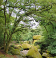
The walk is mainly in the Forest of Huelgoat, starting from Lake Huelgoat with little elevation gain. Points of interest: the Devil's Cave, the Virgin's Household, the Trembling Rock, the Red Bridge, Artus' Cave, the Menhir of the Boar Pond, the Boar Pond, the viewpoint, Artus' Camp.
From Plougonven to the two menhirs via the Bois de Gaspern
9.48 mi
+732 ft
-735 ft
5h 00
Moderate
Departure from Plougonven (Finistère)
A gateway into Finistère via the Monts d’Arrée: the small medieval town of Plougonven, with its parish enclosure, lies close to the Gaspern forest. At the southern end of this route, two menhirs stand alone in a field.
Around Guerlesquin
 10.74 mi
+781 ft
-774 ft
5h 35
Moderate
Departure from Guerlesquin (Finistère)
10.74 mi
+781 ft
-774 ft
5h 35
Moderate
Departure from Guerlesquin (Finistère)
Guerlesquin, a small town full of character, was known in the 11th century for its fairs. From the 17th century, beautiful buildings remain in the town centre: the Présidial, the Market Halls and the Church. The town is close to the Étang du Guic, where two fine sandy beaches await walkers.After walking around the lake, we explore the nearby forest, moving in turn from Finistère into Côtes-d’Armor before returning to Finistère. Indeed, it is the river ‘Le Guic’ that forms the departmental boundary.
The Three Chapels Route in Plouyé
 7.30 mi
+584 ft
-584 ft
3h 50
Moderate
Departure from Plouyé (Finistère)
7.30 mi
+584 ft
-584 ft
3h 50
Moderate
Departure from Plouyé (Finistère)
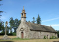
Here is a walk that takes you on a journey of discovery through the Plouyé countryside, with several chapels dotted along the route.
The Roc’h ar Bic route in La Feuillée
 11.25 mi
+476 ft
-446 ft
5h 35
11.25 mi
+476 ft
-446 ft
5h 35
 Difficult
Departure from La Feuillée (Finistère)
Difficult
Departure from La Feuillée (Finistère)
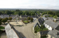
This walk takes you through the valleys and over the peaks of La Feuillée, once the seat of a very important commandery of the Order of the Hospitallers of St John of Jerusalem.
Roc'h an Teuz route in La Feuillée
 8.75 mi
+472 ft
-472 ft
4h 25
Moderate
Departure from La Feuillée (Finistère)
8.75 mi
+472 ft
-472 ft
4h 25
Moderate
Departure from La Feuillée (Finistère)
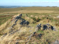
On the border between Léon and Cornouaille, at the foot of the Roc'h mountain range (Roc'h Trédudon, Roc'h Trévézel), the iconic backbone of the Monts d'Arrée, La Feuillée, Brittany's highest village, is well worth a visit.
Brennilis Route
 3.49 mi
+164 ft
-144 ft
1h 45
Easy
Departure from Brennilis (Finistère)
3.49 mi
+164 ft
-144 ft
1h 45
Easy
Departure from Brennilis (Finistère)
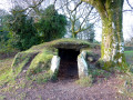
Near Lake Saint-Michel, a short walk around Brennilis to explore the village and a Neolithic site.
Walk around the Moulin Neuf Pond (Vilin Nevez)
 1.88 mi
+10 ft
-7 ft
0h 50
Easy
Departure from Plounérin (Côtes-d'Armor)
1.88 mi
+10 ft
-7 ft
0h 50
Easy
Departure from Plounérin (Côtes-d'Armor)
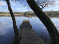
A short walk along the Étang du Moulin Neuf, with opportunities to spot birds and, if you’re lucky, otters.
Route to discover Morlaix
7.13 mi
+699 ft
-682 ft
3h 55
Moderate
Departure from Plougonven (Finistère)
A walk to discover Morlaix. Along this route, you’ll find a few churches and chapels, including the beautiful Saint-Mélaine Church, some stunning murals, the viaduct, a lovely wash house and a few fountains, numerous medieval half-timbered houses, picturesque narrow streets, alleyways and stairways (which involve quite a bit of climbing), the former tobacco factory, the former monastic quarters on the town’s hillside, but also plenty of car parks and traffic – even right in the town centre – and the regrettable absence of the River Morlaix, which has been covered over by a car park upstream of the harbour.
The Jarlot and Tromorgan valleys
9.14 mi
+833 ft
-840 ft
4h 55
Moderate
Departure from Plourin-lès-Morlaix (Finistère)
Explore the narrow streets and traditional houses of Morlaix, then follow the Morlaix-Carhaix greenway and the Jarlot and Tromorgant valleys.
The Pennélé Valley and the River Morlaix
7.08 mi
+686 ft
-715 ft
3h 50
Moderate
Departure from Saint-Martin-des-Champs (Finistère) (Finistère)
After crossing a residential area via shaded paths, don’t be put off by a short stretch of tarmac running parallel to the main road. After Bot-Balan, the route consists solely of forest paths along the river. After the Chapel of La Salette, a magnificent covered walkway will take you back to the start.