Brennilis Route

Near Lake Saint-Michel, a short walk around Brennilis to explore the village and a Neolithic site.

Details

21370881
Creation:
Last update:
Last review:
  • Walking
    Activity: Walking
  • ↔
    Distance: 3.49 mi
  • ◔
    Average duration: 1h 45 
  • ▲
    Difficulty: Easy

  • ⚐
    Back to start: Yes
  • ↗
    Ascent: + 164 ft
  • ↘
    Descent: - 144 ft

  • ▲
    Highest point: 899 ft
  • ▼
    Lowest point: 725 ft

Photos

Description of the walk

Park on Rue du Bourg, near the town hall.

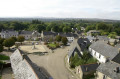
(S/E) In front of the town hall, head to the right towards the 15th-century Notre-Dame Parish Church. Turn left at the war memorial, going round the cemetery.
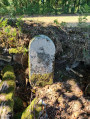
As you head downhill, you’ll see a cross on your left. Continue until you reach the old Plouescat–Rosporden railway line and follow the track to the right until you come to a tarmac road.

(1) Turn left, follow the road, then turn left again towards the hamlet of Kermorvan.

(2) Walk through the village, keeping to the right, and continue straight on until you reach a crossroad.

(3) Turn left at the junction, then immediately right onto a small path that climbs uphill.

(4) When you reach a wider path markedGR®37GR®380, follow it to the left until you join the D36.

(5) Turn left and follow this departmental road with care. At the picnic area, turn left to reach the village, passing in front of the water tower.

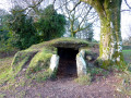
(6) At the junction at the entrance to the village (off the route: 150 m to the left, Dolmen Ti ar Boudiged – Maison des Fées), carry on straight ahead through the village, passing the bar-grocery shop, and return to the starting point (S/E).

Waypoints

  1. S/E : mi 0 - alt. 833 ft - Rue du Bourg, near the town hall
  2. 1 : mi 0.58 - alt. 738 ft - Road junction
  3. 2 : mi 1.08 - alt. 771 ft - The hamlet of Kermorvan
  4. 3 : mi 1.52 - alt. 817 ft - Crossing the road
  5. 4 : mi 1.81 - alt. 814 ft - GR junction
  6. 5 : mi 2.54 - alt. 804 ft - D36
  7. 6 : mi 3.11 - alt. 837 ft - Crossroads - Dolmen Ti Ar Boudiged (Brennilis)
  8. S/E : mi 3.49 - alt. 833 ft - Rue du Bourg, near the town hall

Notes

Departmental roads: take care when crossing and walking along these roads!

Worth a visit

Always be cautious and plan ahead when you're outdoors. Visorando and the author of this route cannot be held responsible for any accidents occurring on this route.

The GR® and PR® markings are the intellectual property of the Fédération Française de Randonnée Pédestre.

Reviews and comments

4.2 / 5
Based on 3 reviews

Reliability of the description
4.7 / 5
Ease of following the route
4.3 / 5
Route interest
3.7 / 5
Les pommiers
Les pommiers

Overall rating : 4.7 / 5

Date of your route : Aug 11, 2025
Reliability of the description : ★★★★★ Very good
Ease of following the route : ★★★★★ Very good
Route interest : ★★★★☆ Good
Very busy route : No

Beautiful tour around Brennilis

Machine-translated

les2g
les2g

Overall rating : 3.3 / 5

Date of your route : May 21, 2023
Reliability of the description : ★★★★☆ Good
Ease of following the route : ★★★☆☆ Average
Route interest : ★★★☆☆ Average
Very busy route : No

Hello, we were a bit disappointed with the route because, although it started off well, we lost our way near Kermovan. We couldn’t find the path leading uphill. The grass was too tall to cut through, so we followed the local council’s yellow markings instead. As a result, there was a lot of tarmac. The section of the old railway line through the woods was very pleasant. The Neolithic site is superb.

Machine-translated

FredoS
FredoS

Overall rating : 4.7 / 5

Date of your route : Oct 09, 2022
Reliability of the description : ★★★★★ Very good
Ease of following the route : ★★★★★ Very good
Route interest : ★★★★☆ Good
Very busy route : No

A lovely walk alternating between roads and tree-lined paths. Best done in dry weather.
Very refreshing.

Machine-translated

Other walks in the area

For more walks, use our search engine .

The GPS track and description are the property of this route's author. Please do not copy them without permission.