


Refine your search for walks in Schwanau
Schwanau walks


 The "Schnakenpfad" starting from Ottenheim-Schwanau
 Visorando Member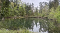
 9.21 mi
 +26 ft
 -26 ft
 4h 15
4h 15
 Moderate
 Departure from Schwanau (Regierungsbezirk Freiburg)
A circular route with virtually no elevation gain, through the shaded forest on the German side of the Rhine. Part of the route follows a signposted path known as the “Schnakenpfad” (the snail trail), which is approximately 7.5 km long. It is located near Lac de Gravier to the west, between the villages of Ottenheim-Schwanau and Meißenheim. This path is aptly named, as the locals also call it “Schnoogepfad” (the Mosquito Trail), because in summer it is teeming with them. The route alternates between small lakes, streams, charming little wooden bridges, footpaths, tracks of varying widths, tarmac roads and a few pavements at the start and finish in the streets of the village of Ottenheim-Schwanau. The whole route is easily accessible. There are several shelters with tables and benches along the way. Suitable walking shoes are nevertheless recommended. Dogs must be kept on a lead! The area is rich in wildlife and you’ll also come across beautiful wild geese.
Spring trail in Rhinau
 6.83 mi
+20 ft
-20 ft
3h 10
Moderate
Departure from Rhinau (Bas-Rhin)
6.83 mi
+20 ft
-20 ft
3h 10
Moderate
Departure from Rhinau (Bas-Rhin)
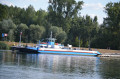
A beautiful, easy walk in the Grand Ried in Rhinau, between fields and forest near the Rhine, surrounded by springs and streams with exceptionally clear water and blockhouses.
Suitable for children.
Route de la Réserve Naturelle Nationale du Taubergiessen
 9.95 mi
+39 ft
-39 ft
4h 35
Moderate
Departure from Rheinau/Rhinau (Regierungsbezirk Freiburg)
9.95 mi
+39 ft
-39 ft
4h 35
Moderate
Departure from Rheinau/Rhinau (Regierungsbezirk Freiburg)
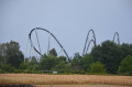
A route through the Taubergiessen National Nature Reserve, in the German part of Rhinau, along the Old Rhine with views of Rhinau Island and a short detour to Europa-Park (Rust).
This is a thousand-hectare nature reserve owned by the French commune of Rhinau on German territory (650 ha of forest and 350 ha of meadows or fields).
I was lucky enough to spot roe deer, swans and herons.
Osthouse and its surroundings
 6.72 mi
+20 ft
-20 ft
3h 05
Moderate
Departure from Osthouse (Bas-Rhin)
6.72 mi
+20 ft
-20 ft
3h 05
Moderate
Departure from Osthouse (Bas-Rhin)
A short tour of the village of Osthouse and its surroundings. Numerous waterways, meadows and shady forests will enhance your journey. The castle and church are also worth a visit.
Circular Feldwasser loop and return between the Ill and Petite Ill rivers
2.72 mi
+16 ft
-16 ft
1h 15
 Easy
Departure from Nordhouse (Bas-Rhin)
Easy
Departure from Nordhouse (Bas-Rhin)
A short walk along the water's edge, pleasant in all seasons and appealing to adults, children and pets (on a lead) alike. With a bit of luck, you may see many animals, including kingfishers, as well as traces of beavers. In fine weather, this route is ideal for a picnic by the water's edge.
The Ill and lock 81 through fields and forest
5.92 mi
+20 ft
-20 ft
2h 45
Easy
Departure from Nordhouse (Bas-Rhin)
Hike between fields and forest near Nordhouse. Pass through the village of Hipsheim and return via the Rhône-Rhine canal. Pass by the Borne 2000 monument in Nordhouse.
Route of the Lutter and Route of the Ill
 9.93 mi
+13 ft
-13 ft
4h 35
Moderate
Departure from Benfeld (Bas-Rhin)
9.93 mi
+13 ft
-13 ft
4h 35
Moderate
Departure from Benfeld (Bas-Rhin)
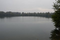
This is a hike in the Ried region, consisting of two circular routes in one. The Lutter Route (Green Ring) and the Ill Route (Blue Ring). You can do both circular routes or just one of them.
It is fairly easy as there are no steep slopes.
The route starts at the Benfeld lake and then crosses forests and fields, following the Lutter, Muhlbach and Ill rivers along forest paths and trails (very little tarmac).
Tour of the Witternheim bench
 4.90 mi
+13 ft
-13 ft
2h 15
Easy
Departure from Witternheim (Bas-Rhin)
4.90 mi
+13 ft
-13 ft
2h 15
Easy
Departure from Witternheim (Bas-Rhin)
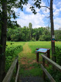
Hike around the Witternheim bench with fun signs created in collaboration with the municipality and the Maison de la Nature de Muttersholtz. Long tour marked by the Club Vosgien with a red ring.
Eschau - Fegersheim - Saint-Ulrich - Eschau
6.66 mi
+13 ft
-13 ft
3h 05
Easy
Departure from Bas-Rhin
A country circuit through forests, villages, fields and rivers.
Walk in the Eschau forest - Route -2-
 4.12 mi
+7 ft
-7 ft
1h 55
Easy
Departure from Bas-Rhin
4.12 mi
+7 ft
-7 ft
1h 55
Easy
Departure from Bas-Rhin
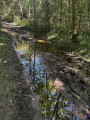
This is a variation on route -1-, slightly longer and slightly less shaded.
Walk in the Eschau Forest - Route -1-
 3.65 mi
+7 ft
-3 ft
1h 40
Easy
Departure from Bas-Rhin
3.65 mi
+7 ft
-3 ft
1h 40
Easy
Departure from Bas-Rhin
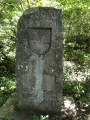
A bucolic walk in the cool shade of the forest, along the water; ideal in hot weather.
Discover Seelbach in the Black Forest and its St Conrad’s Chapel
2.22 mi
+282 ft
-279 ft
1h 15
Easy
Departure from Seelbach (Regierungsbezirk Freiburg)
A visit to my maternal grandparents’ village will take you deep into the Black Forest; as you climb a little higher, you’ll discover the village of Seelbach in the Schutter Valley.
The ruins of Geroldseck Castle (Schonberg)
 6.90 mi
+1,201 ft
-1,184 ft
4h 15
Moderate
Departure from Seelbach (Regierungsbezirk Freiburg)
6.90 mi
+1,201 ft
-1,184 ft
4h 15
Moderate
Departure from Seelbach (Regierungsbezirk Freiburg)
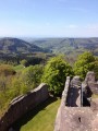
An hour from Strasbourg, in the heart of the Black Forest (Germany), discover the ruins of Géroldseck Castle. A route along small country lanes, which can be completed on foot or by bike (between 4 and 5 hours on foot). After an initial uphill section, you’ll discover a superb 360-degree panoramic view of the Black Forest at the top of the ruins.
Herbert’s Refuge at the start of the route in Seelbach
 7.66 mi
+1,293 ft
-1,286 ft
4h 40
Moderate
Departure from Seelbach (Regierungsbezirk Freiburg)
7.66 mi
+1,293 ft
-1,286 ft
4h 40
Moderate
Departure from Seelbach (Regierungsbezirk Freiburg)
A lovely walk above Seelbach, alternating between woodland and meadows with beautiful scenery and the chance to discover lovely wooden sculptures. Please note that the start of the descent is sometimes quite steep.
Short fishermen's route in Eschau
 Association / Club / Walk leader
 4.96 mi
+7 ft
-7 ft
2h 15
Easy
Departure from Bas-Rhin
4.96 mi
+7 ft
-7 ft
2h 15
Easy
Departure from Bas-Rhin
An 8 km hike on flat terrain. The route passes through parts of villages (Eschau, Ohnheim, Fegersheim), follows streams through fields, crosses a grove and runs alongside a pond.
Among orchards and history in Hattisheim
8.67 mi
+157 ft
-157 ft
4h 05
Moderate
Departure from Blaesheim (Bas-Rhin)
The Hattisheim route is a circular route that connects the villages of Blaesheim and Geispolsheim, both accessible by public transport from Strasbourg. Marked by a Red Ring, the route offers a varied walk. Historical heritage, including the Gloeckelsberg tower (former bell tower) in Blaesheim and the Chapel of Our Lady of the Seven Sorrows in Hattisheim. Natural landscapes, with a route through vineyards, orchards and the Bruch de l’Andlau. Finally, local points of interest, such as fishing ponds once used for hemp processing.