


Refine your search for walks in Sayat
Sayat walks


 Plateau de la Bade from Sayat
 Visorando Member
 6.21 mi
 +538 ft
 -535 ft
 3h 20
3h 20
 Easy
Easy
 Departure from Sayat (Puy-de-Dôme)
Walk on one of the plateaus north of Clermont-Ferrand, where cultivated fields, orchards, vineyards and wild bushy groves alternate. On the way back, discover T. Courtadon's series of sculptures "Ondoyer" on the banks of the Bédat.
Cellars and hillsides of Châteaugay
10.92 mi
+928 ft
-945 ft
5h 50
 Moderate
Departure from Sayat (Puy-de-Dôme)
Moderate
Departure from Sayat (Puy-de-Dôme)
Leaving Sayat, discover the wine-growing village of Châteaugay on the way out through the orchards of the Plateau de Lachaud and on the way back through the Plateau de Bade. Along the way, you'll discover the market towns of Malauzat and Blanzat.
Champ Griaud plateau from Châteaugay
4.27 mi
+299 ft
-299 ft
2h 15
Easy
Departure from Châteaugay (Puy-de-Dôme)
Walk on the Champ Griaud plateau, on beautiful paths that once served pastoral plots now colonised by oak trees and wild vegetation, then through vineyards that have been restored to their former glory, before ending with a visit to the cellar district and the medieval centre of Châteaugay.
From the Jardin de Saint-Alyre to the Amazon via Montjuzet
3.28 mi
+525 ft
-525 ft
2h 00
Easy
Departure from Clermont-Ferrand (Puy-de-Dôme)
An urban walk in Clermont-Ferrand to discover two beautiful murals from 2022 around Montjuzet Park.
From the Crater to the foot of the Puy de Jume
 6.13 mi
+774 ft
-768 ft
3h 30
Moderate
Departure from Volvic (Puy-de-Dôme)
6.13 mi
+774 ft
-768 ft
3h 30
Moderate
Departure from Volvic (Puy-de-Dôme)
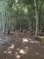
A pleasant walk with woodland cover along much of the route. Ideal in hot weather. Don’t hesitate to venture a little way into the forest to admire the beautiful trees, some of which are truly majestic.
Puy des Goules from the Fontaine du Berger
7.81 mi
+1,106 ft
-1,096 ft
4h 35
Moderate
Departure from Orcines (Puy-de-Dôme)
A circular route passing through a must-see of the Chaîne des Puys, the crater of Puy des Goules, which offers a superb panorama, passing by a few curiosities: an old military barracks, an old pozzolan quarry, and a relay antenna cross!
Between Limagne and Puys for "Contemplation"
9.37 mi
+1,270 ft
-1,247 ft
5h 25
Moderate
Departure from Orcines (Puy-de-Dôme)
The discovery of Thierry Courtadon's sculpture "Contempler" is the pretext for this hike starting from the Fontaine du Berger. The route, along the edge of the Limagne fault, takes you through varied landscapes, cultivated fields, wetlands, pastures, summer meadows, woods and forests, as well as villages and hamlets still rich in traditional buildings.
Short circular loop around the Croix de Ternant
1.30 mi
+190 ft
-190 ft
0h 45
Easy
Departure from Orcines (Puy-de-Dôme)
A walk offering beautiful views of the Puy de Dôme and some of its neighbours, as well as a panorama of the Limagne and the Monts du Forez.Please note! This off-trail route through the mountain pastures is only accessible from early December to late April.
On the heights of Volvic
9.41 mi
+1,568 ft
-1,568 ft
5h 40
Moderate
Departure from Volvic (Puy-de-Dôme)
Starting from the "city of stone and water", this route takes you through cool valleys to the moors of the heights, where you will have the Chaîne des Puys and the Monts du Livradois-Forez as your horizon, then takes you back down to the village through an ancient lava flow, a refuge for Auvergne bats.
Solidified lava flow of Bruvaleix and the Volvic hills
6.64 mi
+797 ft
-807 ft
3h 45
Moderate
Departure from Volvic (Puy-de-Dôme)
Starting from Volvic, this walk first takes you through the Cheire de Bruvaleix forest before climbing to the heights, which offer unobstructed views of the Chaîne des Puys. You’ll pass by Tournoël Castle and the foot of Notre-Dame de la Garde.
Croix de Ternant from Orcines village
7.87 mi
+1,037 ft
-1,010 ft
4h 30
Moderate
Departure from Orcines (Puy-de-Dôme)
Starting from the village of Orcines, this circular route first passes by the Pariou solidified lava flow before climbing up to the plateau for a view of the Croix de Ternant site. The return trip is via the Chemins des Gouris, once used by shepherds to travel from the farms of Fontaine du Berger to the summer pastures at the foot of the Dôme.
Montjuzet Park
2.34 mi
+361 ft
-358 ft
1h 25
Easy
Departure from Clermont-Ferrand (Puy-de-Dôme)
From Clermont city centre to Montjuzet Park, located on the small hill of the same name, preserved from urbanisation, offering beautiful views of the Clermont metropolitan area and the surrounding mountains in a Mediterranean atmosphere.
Circular loop on the solidified lava flow of Puy Pariou
6.14 mi
+1,158 ft
-1,161 ft
3h 50
Moderate
Departure from Orcines (Puy-de-Dôme)
Between Orcines and Durtol, there is a circular path in the shade of the forest that covers the solidified lava flow of Puy Pariou, on trails that wind through rugged, wild terrain. However, this land was once used for farming, with small plots enclosed by stone walls for crops and chestnut trees, of which some beautiful specimens remain, as well as for grazing sheep.
Orcines - Royat via the Chemin des Crêtes
5.96 mi
+404 ft
-1,332 ft
3h 05
Easy
Departure from Orcines (Puy-de-Dôme)
This sixth stage takes you gently closer to the city of Clermont-Ferrand, passing through the hamlet of Villars, which has preserved its beautiful old buildings, before following the stunning Chemin des Crêtes, overlooking the Tiretaine valley, to reach the old village of Royat.
Organs and the music of water at the foot of the Puy de Dôme
8.17 mi
+942 ft
-925 ft
4h 35
Moderate
Departure from Orcines (Puy-de-Dôme)
From village to village, at the foot of the Puy de Dôme, this hike is punctuated by the sound of water flowing from numerous fountains, passing by the basalt columns of Puy de Montrodeix.
Green and other colours in the Carmes district of Clermont
1.87 mi
+39 ft
-39 ft
0h 55
Easy
Departure from Clermont-Ferrand (Puy-de-Dôme)
After visiting the new Place des Carmes, take a stroll through the tree-lined cemetery of the same name, then through the streets to discover some beautiful examples of street art.
Vercingétorix's responsible shopping route
2.44 mi
+141 ft
-138 ft
1h 15
Easy
Departure from Clermont-Ferrand (Puy-de-Dôme)
A city route taking in second-hand clothing shops of various standards, as well as a few dressmakers' workshops, fair trade shops, a luxury accessories shop, an antique and regional jewellery workshop, and second-hand bookshops. It's also a good excuse to explore some of the neighbourhoods on the central plateau of Clermont-Ferrand and take a gourmet break in one of the city's iconic cafés.
The Blaise Pascal ascent via the Chemin des Muletiers
10.84 mi
+3,570 ft
-207 ft
8h 05
 Difficult
Departure from Clermont-Ferrand (Puy-de-Dôme)
Difficult
Departure from Clermont-Ferrand (Puy-de-Dôme)
On 19 September 1648, Blaise Pascal stood before his Torricelli tube in the Jardin des Minimes – now Place de Jaude – in Clairmont (Clermont). His brother-in-law, Florin Périer, had set off earlier with his own Torricelli tube for the summit of the Puy de Dôme. Over the course of the day, 17 experiments were carried out to measure the mercury level in the tubes, which had been placed at different altitudes; these experiments would go on to confirm the hypothesis of the “weight of the air”, which would later become known as atmospheric pressure. At both locations, once filled to the brim, the tube was turned upside down so that its open base was in contact with the mercury contained in a vessel. Due to its weight, the liquid inside the tube dropped under the effect of gravity. In Clermont, the mercury remains at a height of 71.2 cm. At the summit of the Puy de Dôme, it drops to 62.70 cm. This difference of a few centimetres is the result of a height difference of 1,078 metres, which I invite you to appreciate for what it is.
The Blaise Pascal ascent via the Montée des Chèvres
10.46 mi
+3,694 ft
-331 ft
8h 00
Difficult
Departure from Clermont-Ferrand (Puy-de-Dôme)
On 19 September 1648, Blaise Pascal stood before his Torricelli tube in the Jardin des Minimes – now Place de Jaude – in Clairmont (Clermont). His brother-in-law, Florin Périer, had set off earlier with his own Torricelli tube for the summit of the Puy de Dôme. Over the course of the day, 17 experiments were carried out to measure the level of mercury in the tubes, which had been placed at different altitudes; these experiments would go on to confirm the hypothesis of the ‘weight of the mass of air’, which would later become known as atmospheric pressure. At both locations, once filled to the brim, the tube was turned upside down so that its open base was in contact with the mercury contained in a vessel. Due to its weight, the liquid inside the tube sank under the force of gravity. In Clermont, the mercury remained at a height of 71.2 cm. At the summit of the Puy de Dôme, it dropped to 62.70 cm. This difference of a few centimetres is the result of a height difference of 1,078 metres, which I invite you to appreciate for what it is.
From Place de Jaude to the summit of Puy de Dôme, in a circular route and at a leisurely pace
48.66 mi
+8,196 ft
-8,202 ft
7 days
Moderate
Departure from Clermont-Ferrand (Puy-de-Dôme)
In the Clermont-Ferrand metropolitan area, the Transport à la Demande (TAD) service, in addition to regular bus and tram lines, allows you to travel quite far around the city. This seven-stage itinerary takes advantage of this. Each stage begins and ends at a bus or TAD stop. In between, the routes allow you to discover the villages of the metropolitan area's green belt and the foot of the Puy de Dôme: the built heritage of their old wine-growing or mountain villages, their spa resorts, their natural environments and a few geological curiosities. The first stages follow the course of the Artière, and the last ones follow the course of the Tiretaine, two pretty little rivers, tributaries of the Allier, which originate at the foot of the puys.See "Practical information" for a 4-stage variant with accommodation.
Place de Jaude - Beaumont via Puy de Montaudoux
6.64 mi
+768 ft
-492 ft
3h 45
Easy
Departure from Clermont-Ferrand (Puy-de-Dôme)
This first stage is mainly urban, with a few green interludes at Parc Bargoin in Chamalières, on the slopes of Puy de Montaudoux, in the chestnut grove of Beaumont and in the small parks along the Artière.
Clermont Bestiary
5.02 mi
+207 ft
-180 ft
2h 30
Easy
Departure from Clermont-Ferrand (Puy-de-Dôme)
Real and fantastical animals, fauna, legendary creatures, mythological delusions and other hybrid monsters swarm the streets of the city. With a bestiary as its guiding thread, this urban hike will introduce you to many other beautiful things in the centre of Clermont-Ferrand.
Four monumental murals in Clermont
2.79 mi
+39 ft
-108 ft
1h 20
Easy
Departure from Clermont-Ferrand (Puy-de-Dôme)
Exploratory walk through the neighbourhoods north of Clermont's central plateau, discovering recent street art (2022).
Saint-Pierre, district of Clermont
1.01 mi
+72 ft
-72 ft
0h 30
Easy
Departure from Clermont-Ferrand (Puy-de-Dôme)
One of three short walks (Saint-Genès, Saint-Pierre, Le Port) offered by Clermont Auvergne Tourisme to discover Clermont's historic center.
Port district of Clermont
1.32 mi
+98 ft
-98 ft
0h 40
Easy
Departure from Clermont-Ferrand (Puy-de-Dôme)
One of three short walks (Saint-Genès, Saint-Pierre, Le Port) offered by Clermont Auvergne Tourisme to discover Clermont's historic center.