From the Crater to the foot of the Puy de Jume

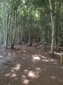
A pleasant walk with woodland cover along much of the route. Ideal in hot weather. Don’t hesitate to venture a little way into the forest to admire the beautiful trees, some of which are truly majestic.

Details

52045021
Creation:
Last update:
Last review:
  • Walking
    Activity: Walking
  • ↔
    Distance: 6.13 mi
  • ◔
    Average duration: 3h 30 
  • ▲
    Difficulty: Moderate

  • ⚐
    Back to start: Yes
  • ↗
    Ascent: + 774 ft
  • ↘
    Descent: - 768 ft

  • ▲
    Highest point: 3,219 ft
  • ▼
    Lowest point: 2,510 ft

Photos

Description of the walk

Park in the car park beside the D943: there is a signpost for walks on site.

(S/E) Take the track heading south-west.

(1) Turn right onto the path between two rows of trees. Follow it, keeping the road on your right.

(2) At the junction, carry on straight ahead along the track, ignoring the turn-off to the road on the right.

(3) A few dozen metres before the large crossroads of tracks, turn right and continue to the Col de la Nugère.

(4) Keep to the left-hand side of the road and take theGR®441, on the left, to the foot of the Puy de Jume.

(5) Follow the path which descends to the left and carry on, keeping the Puy de Jume and the Puy de Coquille on your right.

(6) Ignore the path branching off to the left and carry on to the next junction with a boundary stone. Then take the path on the right and continue to a further junction.

(7) Follow the path to the right. Along the way, you’ll notice a boundary stone with a small cross carved into it, followed by a striking tree. You’ll reach a four-way junction.

(8) Take the path on the left to quickly rejoin a lovely track. Follow it straight on and stay on it.

(9) Turn left and keep to the right about fifty metres further on. Then ignore the first path branching off to the right and continue along the main track heading north-east.

(10) Carry straight on at the crossroads, maintaining the same direction; do the same at the following crossroads to rejoin the original route.

(1) Carry on straight ahead until you reach the car park (S/E).

Waypoints

  1. S/E : mi 0 - alt. 2,510 ft - Car park
  2. 1 : mi 0.22 - alt. 2,530 ft - Crossroads, turn right
  3. 2 : mi 0.84 - alt. 2,671 ft - Crossroads between path and track
  4. 3 : mi 1.18 - alt. 2,746 ft - Crossroads, turn right
  5. 4 : mi 1.54 - alt. 2,871 ft - Col de la Nugère
  6. 5 : mi 2.14 - alt. 3,219 ft - Foot of the Puy de Jume
  7. 6 : mi 2.78 - alt. 2,897 ft - Crossroads, straight ahead
  8. 7 : mi 3.01 - alt. 2,907 ft - Turn right at the fork
  9. 8 : mi 3.43 - alt. 2,989 ft - Crossroads, turn left
  10. 9 : mi 4.4 - alt. 2,779 ft - Turn left
  11. 10 : mi 5.24 - alt. 2,667 ft - Crossroads, straight ahead
  12. S/E : mi 6.14 - alt. 2,516 ft - Car park

Notes

In spring, wild garlic and lily of the valley. Best done in summer, in the afternoon when it’s hot, and finish with the open section of the route.
There are no water points on the route, and no shelter.

Always be cautious and plan ahead when you're outdoors. Visorando and the author of this route cannot be held responsible for any accidents occurring on this route.

The GR® and PR® markings are the intellectual property of the Fédération Française de Randonnée Pédestre.

Reviews and comments

3.9 / 5
Based on 3 reviews

Reliability of the description
3.7 / 5
Ease of following the route
3.7 / 5
Route interest
4.3 / 5
Dorothée Bdx
Dorothée Bdx

Overall rating : 4.3 / 5

Date of your route : Jul 06, 2026
Reliability of the description : ★★★★☆ Good
Ease of following the route : ★★★★☆ Good
Route interest : ★★★★★ Very good
Very busy route : No

A lovely walk through the trees.
We couldn’t find Trail 1, so we took the next little path through the trees; a second, wider path was also an option (point 800 on the map).
The section near the road is quite noisy, which is a shame.
At point 5, we climbed up to the Puy de Jume – quite a steep climb. A lovely view from the top.
We descended back down to point 8 and continued the walk.

Machine-translated

ChrisFlo
ChrisFlo

Overall rating : 3.3 / 5

Date of your route : Oct 11, 2025
Reliability of the description : ★★★☆☆ Average
Ease of following the route : ★★★☆☆ Average
Route interest : ★★★★☆ Good
Very busy route : No

Minimum markings

Machine-translated

claude cussat
claude cussat

Overall rating : 4 / 5

Date of your route : Dec 17, 2024
Reliability of the description : ★★★★☆ Good
Ease of following the route : ★★★★☆ Good
Route interest : ★★★★☆ Good
Very busy route : No

Perfect in the snow!!!

Machine-translated

Other walks in the area

For more walks, use our search engine .

The GPS track and description are the property of this route's author. Please do not copy them without permission.