


Refine your search for walks in Saint-Brice
Saint-Brice walks


 Saint-Brice - Sentier de l'Abbaye
 Local authority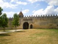
 6.63 mi
 +243 ft
 -240 ft
 3h 15
3h 15
 Moderate
 Departure from Saint-Brice (Charente)
Thanks to the natural beauty of its location and the richness of its heritage, Saint-Brice is one of the most picturesque areas of Cognac region. At the heart of the Charente and Soloire rivers valley, man has erected many symbolic buildings: dolmens, churches, abbeys, castles and manors, all expertly crafted.
From the Château de Bourg-Charente to the banks of the Charente
 Visorando Member
 6.62 mi
+174 ft
-174 ft
3h 10
Moderate
Departure from Bourg-Charente (Charente)
6.62 mi
+174 ft
-174 ft
3h 10
Moderate
Departure from Bourg-Charente (Charente)
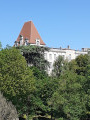
Beautiful views of Château de Bourg and the Cognac vineyards. A very pleasant return journey along the banks of the Charente.
Route du Chemin 101
 6.04 mi
+285 ft
-299 ft
3h 00
Moderate
Departure from Genté (Charente)
6.04 mi
+285 ft
-299 ft
3h 00
Moderate
Departure from Genté (Charente)
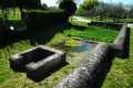
Built on the lower slopes of Grande Champagne, Genté offers its residents proximity to the town of Cognac, 8 km away, and the charms of rural life. Point 101 is an iconic location in the commune of Genté, where the orientation table is located. This site was once home to an old mill, some remains of which are still buried in the ground around the site. Point 101 is also the reference point for sea level.
Circuit Romain in Segonzac
 8.92 mi
+482 ft
-459 ft
4h 30
Moderate
Departure from Segonzac (Charente)
8.92 mi
+482 ft
-459 ft
4h 30
Moderate
Departure from Segonzac (Charente)
Segonzac: the root of its name means 'strength, courage' in Gaulish.
Archaeological digs have revealed a Neolithic inhabitation (approx. 5000 B.C)
The Hundred Years' War persuaded the construction of numerous underground passages, which enabled the inhabitants to take refuge from extreme violence.
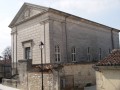
Protestantism has, without a doubt, left its mark in the area, particularly with the Segonzacais. The first Reformed church was founded in 1558. Troubles occurred in 1562 and the parish church was burnt down. Today's Temple is the third constructed since the Edict of Nantes.
According to a legend at the start of the 17th century, it was at Segonzac that a vintner named Chevalier de la Croix Maron invented double distillation.
Crêtes de Segonzac circuit
 6.08 mi
+358 ft
-341 ft
3h 05
Moderate
Departure from Segonzac (Charente)
6.08 mi
+358 ft
-341 ft
3h 05
Moderate
Departure from Segonzac (Charente)
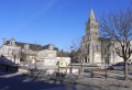
The Gaul root of its name means 'strength, courage'. The Hundred Years War persuaded the construction of numerous underground passages, which enabled the inhabitants to take refuge from extreme violence. Without a doubt Protestantism has left its mark in the area, particularly with the Segonzacais. The first Reformed church was founded in 1558. Troubles occurred in 1562 and the parish church was burnt down. Today's Temple church is the third constructed since the Edict of Nantes.
Merpins - Sentier François Ier
 5.68 mi
+62 ft
-62 ft
2h 40
5.68 mi
+62 ft
-62 ft
2h 40
 Easy
Departure from Merpins (Charente)
Easy
Departure from Merpins (Charente)
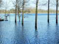
Located at the confluence of the Né and Charente rivers, the Merpins commune has been permanently occupied by men from very early times: arrowheads, pottery shards, and later an imposing medieval fortress, an 11th century church and an abbey dating back to the 12th century are the living proof. These fertile lands are home to meadows, cereal fields and a Grande-Champagne listed vineyard.
Gimeux - Sentier du Fanaud
 6.44 mi
+377 ft
-374 ft
3h 15
Easy
Departure from Gimeux (Charente)
6.44 mi
+377 ft
-374 ft
3h 15
Easy
Departure from Gimeux (Charente)
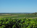
Gimeux was built on a hillside overlooking the valley and marshlands of the river Né and enjoys a flourishing farming activity: meadows and cereal fields in the valley, vineyards on the hills. Ancient burial sites and the outline of the old Roman road called ‘Chemin Boisné’ are revealing of the ancestral occupation of the land. The parish church dates back to the 12th century. Also marking the landscape are an old chapel as well as the remains of a windmill on the Fanaud hillside.
Circuit des Trois Pierres
 5.91 mi
+125 ft
-125 ft
2h 50
Easy
Departure from Angeac-Champagne (Charente)
5.91 mi
+125 ft
-125 ft
2h 50
Easy
Departure from Angeac-Champagne (Charente)
A lovely walk through the Charentais vineyards, passing beautiful buildings and around the village of Roissac.
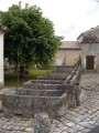
Angeac- Champagne counts numerous prosperous-looking Charentais houses, witness to the wealth which lies in the local economy producing cognac, its principal occupation. The entrances to the estates are marked by a gate or porch way: there are at least 50. They are unique and typical of our local heritage. At Roissac village they embellish the main street.
The Sentier du Biau starting from Ars
 5.55 mi
+23 ft
-23 ft
2h 35
Easy
Departure from Ars (Charente)
5.55 mi
+23 ft
-23 ft
2h 35
Easy
Departure from Ars (Charente)
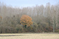
A pleasant walk starting from Ars-en-Saintonge, exploring a very natural area including the Bois de la Grande Prée and the Né. The route features some fine examples of built heritage, such as the school complex and the Bûcher d’Ars, the Château d’Ars at the start of the walk, and the Church of Saint-Maclou on the return journey.
Paths through sparse woodland
 8.12 mi
+95 ft
-98 ft
3h 50
Moderate
Departure from Sigogne (Charente)
8.12 mi
+95 ft
-98 ft
3h 50
Moderate
Departure from Sigogne (Charente)
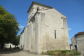
A route to explore the Charente wine-growing landscape of the Fins Bois and traces of the past (Gallo-Roman era, 12th-century church, lime kiln, porches of Charente properties).
Côt Route
 10.86 mi
+463 ft
-453 ft
5h 25
10.86 mi
+463 ft
-453 ft
5h 25
 Difficult
Departure from Juillac-le-Coq (Charente)
Difficult
Departure from Juillac-le-Coq (Charente)
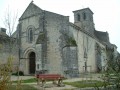
Juillac-Le-Coq is crossed by the Mothe stream, a tributary of the Charente. The village has a population of around 667. Wine-growing is its main industry.
The Côt Route (short circular route)
3.77 mi
+69 ft
-69 ft
1h 45
Easy
Departure from Juillac-le-Coq (Charente)
Juillac-Le-Coq is crossed by the Mothe stream, a tributary of the Charente. The village has a population of around 667. Wine-growing is its main industry.
Saint-Sulpice-de-Cognac / Cherves-Richemont - Sentier des Chauffeurs
 7.45 mi
+381 ft
-377 ft
3h 45
Moderate
Departure from Saint-Sulpice-de-Cognac (Charente)
7.45 mi
+381 ft
-377 ft
3h 45
Moderate
Departure from Saint-Sulpice-de-Cognac (Charente)
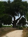
Saint-Sulpice-de-Cognac is pleasantly located between the marshlands of the Antenne River and limestone hillsides. There, are hidden the remains of the Agrippa Roman road as well as forgotten local railroad.
Cherves-Richemont is graced with the Antenne River and offers an unexpected diversity of landscapes. Its historic heritage is particularly rich: Romanesque churches, Château Chesnel, watermills, manor houses….
The Templars’ Route in Angles
 6.27 mi
+236 ft
-207 ft
3h 05
Easy
Departure from Salles-d'Angles (Charente)
6.27 mi
+236 ft
-207 ft
3h 05
Easy
Departure from Salles-d'Angles (Charente)
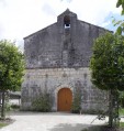
It was in December 1856 that Salles de Segonzac joined forces with the Commanderie d'Angles, a small village nestled in a bend of the River Le Né. Angles lived in harmony with the river, whilst Salles, resembling a large village, centred its life around wine-growing.
Route of Fountains and Washhouses – Orange-marked variant
3.31 mi
+190 ft
-190 ft
1h 40
Easy
Departure from Saint-Preuil (Charente)
This route offers the chance to discover small-scale rural heritage (fountains, wash houses). Exploring this route also allows you to appreciate the area’s scenic, floral and wildlife features.
Circuit of Open-air Wash Houses and Water Sources
 12.11 mi
+840 ft
-843 ft
6h 20
Moderate
Departure from Saint-Preuil (Charente)
12.11 mi
+840 ft
-843 ft
6h 20
Moderate
Departure from Saint-Preuil (Charente)
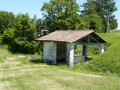
This circuit gives you the chance to discover rural heritage (springs, water sources, open air wash houses); and at each place, a description of its history is displayed. The route also highlights the architectural and historical heritage of the 13th century (Eglise Saint-Prohet, the Place Jacquaire, the protestant stele, the Chateau de Segeville) plus the various hamlets in the locality, flora and fauna.
Route of Fountains and Washhouses – Purple-marked variant
 7.95 mi
+482 ft
-512 ft
4h 05
Moderate
Departure from Saint-Preuil (Charente)
7.95 mi
+482 ft
-512 ft
4h 05
Moderate
Departure from Saint-Preuil (Charente)
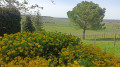
This route allows you to discover the area’s small-scale rural heritage (fountains, wash houses). Each water point features a historical and/or anecdotal description. The route also incorporates architectural and historical heritage (the 13th-century Saint-Projet Church, Place Jacquaire, Ségeville Castle and the scattered hamlets of the commune).
Exploring this route also allows you to appreciate the area’s scenic, floral and wildlife attractions.