La Ravoire – Arêches Alpine Refuge

First (easy) stage of a two-day tour of the Grand Mont.
A well-marked path forming part of the Tour du Beaufortain.
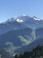
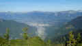
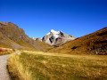
Magnificent views of Mont Blanc from the Col de la Bâthie

This walk is part of a multi-day hike: Circuit and summit of the Grand Mont starting from La Ravoire

Details

n°3771391
Creation:
Last update:
Last review:
  • Walking
    Activity: Walking
  • ↔
    Distance: 5.05 mi
  • ◔
    Average duration: 4h 25 
  • ▲
    Difficulty: Moderate

  • ⚐
    Back to start: No
  • ↗
    Ascent: + 2,425 ft
  • ↘
    Descent: - 961 ft

  • ▲
    Highest point: 6,873 ft
  • ▼
    Lowest point: 5,108 ft

Photos

Description of the walk

Park in the La Ravoire car park above La Bâthie.

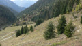
(S) Begin the ascent of the Col de la Bâthie via a signposted path that crosses a large mountain pasture.

(1) Walk past the Chalet du Soufflet before reaching the Col de la Bâthie at the junction withthe GRP® Tour du Beaufortain trail.

(2) Turn right onto this path and continue along the hillside on the Beaufortain side until you reach the Chalet-Refuge des Arolles.

(3) Pass underneath it and continue south, then east, at the Légette du Grand Mont to reach, on the left, the junction with the path leading up to Les Combettes.

(4) Continue along theGRP®, ignoring the path to Lac de Brassa on the right.
A visit to the lake is possible and the round trip will only add about an hour to the route.
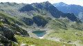
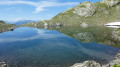
Carry on and, after a 90° left-hand bend, head for Lac Tournant.

(5) Turn left for a short climb before a pleasant walk along the hillside to the Bonnets Rouges chairlift station. Below, you’ll see the Chalet-Refuge de l’Alpage, today’s destination. Reach it via the road or by cutting across the meadows below the ski lifts (E).

Waypoints

  1. S : mi 0 - alt. 5,108 ft - La Ravoire
  2. 1 : mi 0.9 - alt. 5,922 ft - Challet du Soufflet (1819m)
  3. 2 : mi 1.31 - alt. 6,207 ft - Col de la Bäthie (1889m)
  4. 3 : mi 2.15 - alt. 6,227 ft - Refuge des Arolles
  5. 4 : mi 2.98 - alt. 6,375 ft - Start of the path towards the - Lac Brassa
  6. 5 : mi 3.71 - alt. 6,585 ft - Lac Tournant
  7. E : mi 5.05 - alt. 6,542 ft - Refuge L'Alpage

Notes

There are no difficulties on this well-signposted route, which has very little elevation gain.

Worth a visit

(3) Refuge-Chalet des Arolles: this is the top station of the Piapolay chairlift.

Reviews and comments

ChZambaux
ChZambaux

Hello

It’s perfectly possible to do a day trip, particularly if you stop off at Lac Tournant. The return journey is mainly downhill and should take less than two hours.

Machine-translated

marmotte62
marmotte62

Hi, is it possible to do this hike as a day trip, there and back? Stopping off, for example, at Lac Tournant

Machine-translated

Other walks in the area

For more walks, use our search engine .

The GPS track and description are the property of this route's author. Please do not copy them without permission.