


Refine your search for walks in Refuge de la Cantonnière
Refuge de la Cantonnière walks


No walk here yet
There are no hikes starting from or close to “Refuge de la Cantonnière”
Walks near Refuge de la Cantonnière
 Col de la Cayolle – Lac d’Allos Mountain Hut
 Visorando Member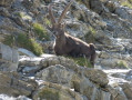
 4.49 mi
 +1,204 ft
 -1,312 ft
 3h 05
3h 05
 Moderate
 Departure from Uvernet-Fours (Alpes-de-Haute-Provence)
A climb to a pass, followed by a descent of roughly the same length, with two beautiful lakes to admire. This walk also gives you the chance to compare the two sides of the mountain, which are quite different.
Mont Pelat - Allos via Le Cimet
 13.63 mi
+2,405 ft
-7,661 ft
8h 20
13.63 mi
+2,405 ft
-7,661 ft
8h 20
 Very difficult
Departure from Allos (Alpes-de-Haute-Provence)
Very difficult
Departure from Allos (Alpes-de-Haute-Provence)
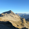
Second part of the circular. This second stage will take you to the village of Allos, starting from Mont Pelat, via the Trou de l'Aigle, the Cimet and its many waterfalls, including the Cascade du Pich and the Bois de Vacheresse.
From Restefond to Sestrière via Cime de la Plate and Col de la Braïssa
 8.53 mi
+2,067 ft
-3,399 ft
5h 45
Moderate
Departure from Jausiers (Alpes-de-Haute-Provence)
8.53 mi
+2,067 ft
-3,399 ft
5h 45
Moderate
Departure from Jausiers (Alpes-de-Haute-Provence)
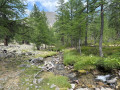
A very beautiful high-mountain hike at the foot of Cime de la Bonette between the Alpes Maritimes and Alpes de Haute Provence. Very little traffic. Magnificent, rocky landscape. The upper Braissette lake is a very beautiful spot for bivouacking.
Allos - Mont Pelat
 10.09 mi
+5,577 ft
-328 ft
9h 30
10.09 mi
+5,577 ft
-328 ft
9h 30
 Difficult
Departure from Allos (Alpes-de-Haute-Provence)
Difficult
Departure from Allos (Alpes-de-Haute-Provence)
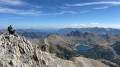
The first part of this two-day circular is challenging and breathtaking, taking you through the heart of Mercantour National Park from the village of Allos, via Lac d'Allos and its refuge, Mont Pelat, Lac du Trou de l'Aigle, Le Cimet and its many waterfalls, including Cascade du Pich and Les Bois de Vacheresse.
From Allos to Colmars via the Autapie ridge
 7.35 mi
+659 ft
-4,324 ft
3h 55
Moderate
Departure from Allos (Alpes-de-Haute-Provence)
7.35 mi
+659 ft
-4,324 ft
3h 55
Moderate
Departure from Allos (Alpes-de-Haute-Provence)
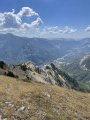
An easy hike starting from the Gros Tapi chairlift terminus. A ridge walk offering constantly stunning and unforgettable panoramic views of the Haut Verdon mountain ranges. An easy route with a final descent to Colmars through the forest on signposted paths. Best undertaken in summer whilst the chairlifts are operating.
Camp des Fourches - Ferrere Refuge
 6.25 mi
+1,381 ft
-2,615 ft
4h 05
Moderate
Departure from Saint-Dalmas-le-Selvage (Alpes-Maritimes)
6.25 mi
+1,381 ft
-2,615 ft
4h 05
Moderate
Departure from Saint-Dalmas-le-Selvage (Alpes-Maritimes)
This first stage of the Tour du Mont Aiga starts from Camp des Fourches on the Bonette road and, via the Col des Fourches, descends into the large Salso Moreno valley, which you climb back up to the Col de Pouriac. From the Col de Pouriac, you quickly reach Bassa di Colombart and then, after a long descent through the mountain pastures, the charming village of Ferrere. You may encounter flocks of sheep in Salso Moreno and, at night, the wolves that prey on them.
Saint-Etienne-de-Tinée - Lacs de Vens - Small Pass of Tortisse
 7.52 mi
+5,942 ft
-1,342 ft
7 hrs
Very difficult
Departure from Saint-Étienne-de-Tinée (Alpes-Maritimes)
7.52 mi
+5,942 ft
-1,342 ft
7 hrs
Very difficult
Departure from Saint-Étienne-de-Tinée (Alpes-Maritimes)
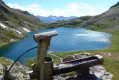
First stage of a two-day hike in the Haute-Tinée.
Ascent to the magnificent Lacs de Vens and the small pass of Tortisse via the Claï valley and Lac des Babarottes.
Plenty of marmots and chamois around the Lacs de Vens and below the small pass of Tortisse.
Le Pra – Vens Mountain Hut
4.69 mi
+2,792 ft
-417 ft
4h 35
Moderate
Departure from Saint-Dalmas-le-Selvage (Alpes-Maritimes)
A first day to stretch your legs and discover the magnificent natural setting of the Vens lakes.
Note: as this route ends in Saint-Étienne-de-Tinée, it is advisable, if possible, to park a second car in Saint-Étienne-de-Tinée to shuttle back to the starting point. Otherwise, allow around €25 for the taxi journey from Saint-Étienne-de-Tinée to Le Pra, but please note that booking is required a few hours in advance.
Saint-Étienne-de-Tinée - Rabuons Refuge
 4.55 mi
+4,951 ft
-423 ft
6h 25
Difficult
Departure from Saint-Étienne-de-Tinée (Alpes-Maritimes)
4.55 mi
+4,951 ft
-423 ft
6h 25
Difficult
Departure from Saint-Étienne-de-Tinée (Alpes-Maritimes)
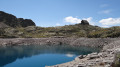
This first stage will take you to the Rabuons mountain hut, on the shores of the largest lake in the Alpes-Maritimes.The landscape is very rocky. You’ll come across plenty of Italians, as just across the border there are several mountain huts offering lovely routes via the nearby Pas de l’Ischiator.
⚠️ Allow around 4 hours for an average hiker in good physical condition to complete this walk.
Auron – Longon dairy farm
 16.41 mi
+5,928 ft
-4,970 ft
10 hrs
Very difficult
Departure from Saint-Étienne-de-Tinée (Alpes-Maritimes)
16.41 mi
+5,928 ft
-4,970 ft
10 hrs
Very difficult
Departure from Saint-Étienne-de-Tinée (Alpes-Maritimes)
A long but beautiful stage combining the austere landscape of Mont Mounier with the green mountain pastures of Longon.Look up to watch the vultures.A gentle finish at the Vacherie de Longon, surrounded by animals.