Refuge de la Cantonnière – Col de la Cayolle

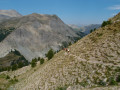
A climb that offers views of different levels of the mountain: meadows, coniferous forest and alpine pastures.

This walk is part of a multi-day hike: Around Les Garrets

Details

n°35079468
Creation:
Last update:
Last review:
  • Walking
    Activity: Walking
  • ↔
    Distance: 3.32 mi
  • ◔
    Average duration: 3h 00 
  • ▲
    Difficulty: Moderate

  • ⚐
    Back to start: No
  • ↗
    Ascent: + 1,677 ft
  • ↘
    Descent: - 351 ft

  • ▲
    Highest point: 7,641 ft
  • ▼
    Lowest point: 6,142 ft
  • ⚐ Country: France
  • ⚐
    Areas: Alps, Mercantour
  • ⚐ City: Entraunes (06470)
  • ⚑
    Start: N 44.244852° / E 6.757066°
  • ⚑
    End: N 44.263814° / E 6.745053°
  • ❏
    IGN map(s): Ref. 3540ET, 3540OT, 3540OTR
  • Hour-by-hour weather

Photos

Description of the walk

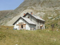
If you’ve driven to the Refuge de la Cantonnière, you cannot leave your car in the refuge car park; you must park it in the car park at the next bend, 200 to 300 metres further on. Alternatively, walk to this bend by following the road.

Yellow markings from the start to the Col de la Cayolle.

(S) Take the path at the bend, then cross a wooden bridge. As you come out of the bridge, turn immediately left towards the Col de la Cayolle and follow the stream. Further up, the path passes under a stone bridge and then crosses the stream via a ford. Head towards the Gîte Forestier du Garret, visible on the left, then reach the junction marked with signpost 293.

(1) Turn left, then after a hairpin bend to the left, you’ll reach a junction with a signpost. Continue straight on to find a tapped spring.

(2) Follow the path on to the edge of a wooded area.

(3) Walk alongside the woodland, turning right and following a few hairpin bends to reach the junction marked by signpost 294.

(4) Turn right and follow the cliff-top path to the Col de la Cayolle, where it joins theGR®56B.

Red and white markings

(5) Cross the road and walk alongside the car park, then take theGR® to the right to reach the Refuge de la Cayolle, today’s stop (E).

Waypoints

  1. S : mi 0 - alt. 6,142 ft - Refuge de la Cantonnière
  2. 1 : mi 0.76 - alt. 6,745 ft - Marker 293
  3. 2 : mi 0.99 - alt. 6,854 ft - Spring
  4. 3 : mi 1.43 - alt. 7,077 ft - Edge of the wood
  5. 4 : mi 2.13 - alt. 7,575 ft - Marker 294
  6. 5 : mi 2.94 - alt. 7,635 ft - Col de la Cayolle
  7. E : mi 3.32 - alt. 7,438 ft - Refuge de La Cayolle

Notes

There are no water sources or shelters, so check the weather forecast before setting off.
The estimated time given at the start of the “Col de la Cayolle” route – 1 hour 45 minutes – seems to me to be significantly underestimated. Personally, it took us 3 hours 5 minutes to complete this section.

To book accommodation at a mountain hut:
Refuge de la Cantonnière
Refuge de la Cayolle

This route passes through multiple protected areas, which may be subject to special regulations:

Worth a visit

One kilometre downstream from the Refuge de la Cantonnière, you can visit Lac d’Estenc and the source of the Var.

Always be cautious and plan ahead when you're outdoors. Visorando and the author of this route cannot be held responsible for any accidents occurring on this route.

The GR® and PR® markings are the intellectual property of the Fédération Française de Randonnée Pédestre.

Reviews and comments

5 / 5
Based on 1 review

Reliability of the description
5 / 5
Ease of following the route
5 / 5
Route interest
5 / 5
User 12168186

Overall rating : 5 / 5

Date of your route : Jul 13, 2026
Reliability of the description : ★★★★★ Very good
Ease of following the route : ★★★★★ Very good
Route interest : ★★★★★ Very good
Very busy route : No

A lovely route with a clear description and an easy-to-follow route

Machine-translated

Other walks in the area

For more walks, use our search engine .

The GPS track and description are the property of this route's author. Please do not copy them without permission.