Col de la Cayolle – Lac d’Allos Mountain Hut

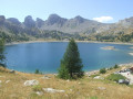
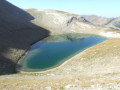
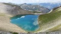
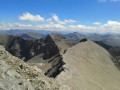
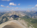
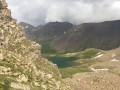
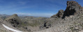
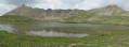
A climb to a pass, followed by a descent of roughly the same length, with two beautiful lakes to admire. This walk also gives you the chance to compare the two sides of the mountain, which are quite different.

This walk is part of a multi-day hike: Autour des Garrets

Details

35077599
Creation:
Last update:
Last review:
  • Walking
    Activity: Walking
  • ↔
    Distance: 4.49 mi
  • ◔
    Average duration: 3h 05 
  • ▲
    Difficulty: Moderate

  • ⚐
    Back to start: No
  • ↗
    Ascent: + 1,204 ft
  • ↘
    Descent: - 1,312 ft

  • ▲
    Highest point: 8,642 ft
  • ▼
    Lowest point: 7,329 ft

Photos

Description of the walk

(S) From the refuge, cross the road and follow theGR® route you took the previous day to reach the Col de la Cayolle.

(1) Turn right and stay on theGR® to reach the Col de la Petite Cayolle.

(2) Descend to Lac de la Petite Cayolle, then continue along the path. Further down, you’ll reach the junction with the path leading to Mont Pelat.

(3) Carry on to the left along theGRP® marked in yellow and red, until you reach another junction at the Pas du Lausson.

(4) Keep to the right, following the signs for Lac d’Allos, to reach a clearing at the GRP® junction.

(5) Turn left and, via a virtually flat stretch, reach the lake and the Lac d’Allos Refuge, today’s stop (E).

Waypoints

  1. S : mi 0 - alt. 7,438 ft - Refuge de La Cayolle
  2. 1 : mi 0.35 - alt. 7,618 ft - Col de la Cayolle
  3. 2 : mi 1.78 - alt. 8,642 ft - Col de la Petite Cayolle
  4. 3 : mi 2.6 - alt. 7,976 ft - Junction (Mont Pelat)
  5. 4 : mi 3.08 - alt. 7,723 ft - Junction (Pas de Lausson)
  6. 5 : mi 3.6 - alt. 7,425 ft - Junction (Mont Pelat and La Laus car park)
  7. E : mi 4.49 - alt. 7,329 ft - Refuge du Lac d'Allos

Notes

This route passes through a protected area, which may be subject to special regulations:

Worth a visit

Always be cautious and plan ahead when you're outdoors. Visorando and the author of this route cannot be held responsible for any accidents occurring on this route.

The GR® and PR® markings are the intellectual property of the Fédération Française de Randonnée Pédestre.

Reviews and comments

5 / 5
Based on 3 reviews

Reliability of the description
5 / 5
Ease of following the route
5 / 5
Route interest
5 / 5
jocelyne77
jocelyne77

Overall rating : 5 / 5

Date of your route : Jul 27, 2026
Reliability of the description : ★★★★★ Very good
Ease of following the route : ★★★★★ Very good
Route interest : ★★★★★ Very good
Very busy route : Yes

A really beautiful lake, and the mountain refuge – wow! The welcome, the food and the price: don’t change a thing, because everything’s perfect 👍

Machine-translated

User 26811980

Overall rating : 5 / 5

Date of your route : Aug 04, 2025
Reliability of the description : ★★★★★ Very good
Ease of following the route : ★★★★★ Very good
Route interest : ★★★★★ Very good
Very busy route : Yes

Machine-translated

Bja
Bja

Overall rating : 5 / 5

Date of your route : Aug 31, 2024
Reliability of the description : ★★★★★ Very good
Ease of following the route : ★★★★★ Very good
Route interest : ★★★★★ Very good
Very busy route : Yes

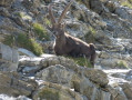
A lovely walk which gave us the chance to see lots of marmots on the ascent, as well as chamois at the Col de la Petite Cayolle. It seems they’re often found in this area. We then spotted some ibex on the descent towards the lake.

Machine-translated

Other walks in the area

For more walks, use our search engine .

The GPS track and description are the property of this route's author. Please do not copy them without permission.