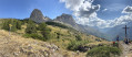
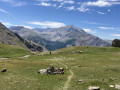
Circuit of the Chapeau de Gendarme via the north face

A lovely hike starting from Super Sauze. The route via the north face of the Chapeau de Gendarme is not recommended for children; the east face is preferable.

Details

n°38637816
Creation:
Last update:
Last review:
  • Walking
    Activity: Walking
  • ↔
    Distance: 7.38 mi
  • ◔
    Average duration: 5h 30 
  • ▲
    Difficulty: Difficult

  • ⚐
    Back to start: No
  • ↗
    Ascent: + 2,385 ft
  • ↘
    Descent: - 3,999 ft

  • ▲
    Highest point: 8,770 ft
  • ▼
    Lowest point: 5,591 ft

Description of the walk

Park in the Brec Chairlift car park at the Super Sauze resort. Take the chairlift to reach the top station.

(S) Head due north for 50 metres from the chairlift’s top station, then follow the path to the left. Follow the signs for ‘Chapeau de Gendarme’ as indicated on the signpost; this path is marked in yellow. You’ll reach a junction of paths by a stream.

(1) Take the path on the left, then turn left again at the next junction. You’ll reach a fork with a signpost.

(2) Continue to the right along the yellow-marked path, following the sign for ‘Chapeau de Gendarme via the north face’. Cross several streams before reaching a beautiful viewpoint over the Ubaye valley.

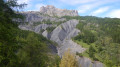
(3) Turn left here and begin a more challenging climb up a stony path with a steep gradient. When you reach the foot of the Chapeau de Gendarme, turn left to reach the summit.

(4) Retrace your steps a few metres to the junction below the Chapeau, then turn right. Descend to reach the Col du Gyp, following the signposts.

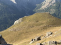
(5) Continue beneath the ridges of the Brecs Second and Premier, with their magnificent rock formations to the left of the route. Reach the end of this ridge.

(6) Turn left and climb for a short distance to reach the Col de Fours at a junction.

(7) Now begin the descent, following the yellow markings. Walk alongside the Col de Fours ski lift at a distance. You’ll come to a crossroads near the ski lift.

(8) Turn left and, following an almost level path, head towards the top station of the Grand Quartier ski lift. Continue on and you will then reach the top station of the Brec chairlift.

(S) Here you have two options:
- take the chairlift down to the Super Sauze car park.
- follow the same route as on the way there until you reach thefirst junction.

(1) Turn right and head down through the forest to reach a junction situated below the Brec chairlift.

(9) Leave theGR® and head down the yellow-marked path alongside the Brec chairlift. You’ll arrive at the car park at the Super Sauze lower station (E).

Waypoints

  1. S : mi 0 - alt. 7,221 ft - Upper station of the Brec chairlift
  2. 1 : mi 0.58 - alt. 7,152 ft - Junction of the circular loop
  3. 2 : mi 0.86 - alt. 7,533 ft - North face
  4. 3 : mi 1.24 - alt. 7,671 ft - Viewpoint
  5. 4 : mi 1.82 - alt. 8,770 ft - Chapeau de Gendarme (2682m)
  6. 5 : mi 2.4 - alt. 8,028 ft - Col du Gyp (2448m)
  7. 6 : mi 3.63 - alt. 7,257 ft - End of the ridge
  8. 7 : mi 4.01 - alt. 7,592 ft - Col de Fours (2315m)
  9. 8 : mi 4.39 - alt. 7,175 ft - Crossroads near the ski lift
  10. 9 : mi 6.83 - alt. 6,375 ft - Below the chairlift
  11. E : mi 7.38 - alt. 5,591 ft - Super Sauze car park

Notes

(E) Brec Chairlift Lower Station: to reach the start of the hike, take the Brec Chairlift, which departs at 9.00 am; cost (2023): €8. This avoids a rather uninteresting 400-metre climb through the ski slopes; the more adventurous can, of course, walk up.
Please note: tickets for the chairlift must be purchased from a ticket machine using a credit card.

Worth a visit

Herds of livestock and mountain dogs may be present. Take the usual precautions.

Always be cautious and plan ahead when you're outdoors. Visorando and the author of this route cannot be held responsible for any accidents occurring on this route.

The GR® and PR® markings are the intellectual property of the Fédération Française de Randonnée Pédestre.

Reviews and comments

5 / 5
Based on 1 review

Reliability of the description
5 / 5
Ease of following the route
5 / 5
Route interest
5 / 5
User 8521879

Overall rating : 5 / 5

Date of your route : Jul 23, 2026
Reliability of the description : ★★★★★ Very good
Ease of following the route : ★★★★★ Very good
Route interest : ★★★★★ Very good
Very busy route : No

A lovely walk. We saw some young ibex on the way up.
The view from the top is stunning.
The descent on the other side is different – grassy and very beautiful.

Machine-translated

Other walks in the area

For more walks, use our search engine .

The GPS track and description are the property of this route's author. Please do not copy them without permission.