A few places of sacred remembrance around Bussy-en-Othe

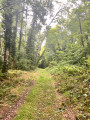
A shaded walk through the Forest of Othe, following in the footsteps of an ancient hermitage and a miraculous spring.

Details

16679125
Creation:
Last update:
Last review:
  • Walking
    Activity: Walking
  • ↔
    Distance: 8.15 mi
  • ◔
    Average duration: 4h 10 
  • ▲
    Difficulty: Moderate

  • ⚐
    Back to start: Yes
  • ↗
    Ascent: + 443 ft
  • ↘
    Descent: - 466 ft

  • ▲
    Highest point: 843 ft
  • ▼
    Lowest point: 505 ft

Photos

Description of the walk

Park in the centre of Bussy-en-Othe on the Place de la Fontaine or near the church.

(S/E) From Saint-Médard Church, with your back to the fountain roundabout, turn right past the war memorial onto Rue de la Procession and follow it to the end, then turn left onto Rue du Vauméré. When you reach the cemetery, leave the street and head downhill, veering slightly to the right, onto a path that leads further into the forest. About 150 m after entering the forest, the path comes to a Y-junction.

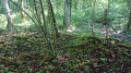
(1) At this junction, take the path on the left. The forest path curves and leads to a fork. Continue to the right; the path soon heads north again. A hunting lodge on the right precedes a junction where several paths meet.

(2) Cross the junction with the Chemin de Villeneuve, ignore the path on the right and follow the sign for ‘Étangs de Saint-Ange’ by taking the path on the left. At the next junction, continue for a few dozen metres through the Bois Bablet, crossing the bed of the Ru Saint-Ange, then leave this path to take the one that climbs slightly to the right. You will soon reach the ruins.

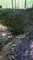
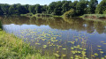
(3) The ruins are those of an old hermitage, of which not a single stone remains standing. Leave them on your left and continue along the same path, heading east. Cross the D77 and go round the pond (Étang du Haut) on the left; the path leads to a second pond (Étang du Milieu).

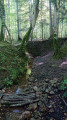
(4) Turn left immediately, walk alongside the “UtopiaLand” summer amusement park and go through the gate onto the path that leads into the forest. After about 250 metres, turn right at a hornbeam marked by the National Forestry Office (“11”) to reach the Vernoue Spring, which feeds the ponds.

(5) Go round the spring and continue to the right, heading south. Some 300 metres further on, the path turns right then left and becomes a forest track again, continuing straight on towards the south-east. Cross the D47 and carry on to the end of this same track, about half a kilometre, to reach a T-junction.

(6) Turn right, heading south-west. When you reach a stone marker, veer slightly to the right and follow the faint markings (red line and orange dot). The path winds through the forest until it reaches a fork. Ignore the path branching off to the right and continue to the left to reach La Ramée at the junction with the D179.

(7) At the junction, turn right, then, about 150 metres further on, veer slightly left onto the path leading towards Bois Harang. It descends to a spring.

(8) Leave the spring on your left, then, a few metres further on, take the path on the left, heading south. Pass a small motocross track on your right and carry on until you emerge from the woods. Continue along the edge of the woods, then turn right to reach Rue des Charmes. Turn left and follow the street for about a hundred metres to enter Bailly at a Y-junction.

(9) Opposite, take the grassy country lane to the left of the old bus shelter, then turn right towards Bussy along Rue de l’Aubépine for about 150 metres.

(10) At the junction, leave the street and head straight down Chemin Chaume Gaillard, then turn left onto Chemin du Vau. Continue right onto Rue Saint-Jean, then turn right to return to Place de la Fontaine in the centre of the village (S/E).


Waypoints

  1. S/E : mi 0 - alt. 541 ft - Place de la Fontaine - Église Saint-Médard (Bussy-en-Othe)
  2. 1 : mi 0.78 - alt. 689 ft - T-junction
  3. 2 : mi 1.76 - alt. 791 ft - Junction with the Chemin de Villeneuve
  4. 3 : mi 2.91 - alt. 771 ft - Saint-Ange Hermitage
  5. 4 : mi 3.47 - alt. 735 ft - Étangs de Saint-Ange
  6. 5 : mi 4.01 - alt. 768 ft - Vernoue Fountain
  7. 6 : mi 5.16 - alt. 814 ft - T-junction
  8. 7 : mi 5.85 - alt. 801 ft - La Ramée – D179
  9. 8 : mi 6.53 - alt. 761 ft - Spring
  10. 9 : mi 7.21 - alt. 797 ft - Bailly
  11. 10 : mi 7.46 - alt. 719 ft - Chemin Chaume Gaillard
  12. S/E : mi 8.15 - alt. 541 ft - Place de la Fontaine - Église Saint-Médard (Bussy-en-Othe)

Worth a visit

(3) Left in ruins during the Revolution, the former Saint-Ange Hermitage, probably dating from the 17th century, had been significant enough to feature on the list of national property: it comprised a chapel, a small bell tower, a small adjoining building consisting of two cells and a heating room, a bakehouse and an attic, along with a garden and orchard.

(5) The Fontaine Vernoue, formerly known as the Fontaine Saint-Ange, which gave its name to the stream and ponds of Saint-Ange, is a former place of pilgrimage reputed to cure eye diseases. The legend, as recounted by Dom Patrice Cousin, tells that “a blind child, lost in the forest and weeping, was approached by a stranger who comforted him, telling him that one day he would see heaven, where he would receive his reward from God. ‘I’d love to see it right now!’ replied the child. ‘Well then, bend down, scoop up some water from this rut and wash your eyes with it.’ The child obeyed and regained his sight; his benefactor vanished: he was an angel. The miraculous puddle of water became a spring; this is the origin of the pond and the Ruisseau Saint-Ange. A chapel was built there, to which people from neighbouring parishes came on pilgrimage.” (The Monastic Epic: A Brief History of Monks and Nuns).

The Orthodox Monastery of Our Lady of All Protection, situated in the heart of Bussy since 1946. The church features frescoes and mosaics, a chapel, and the nuns’ monastic handicrafts.

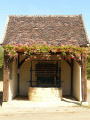
The charming Chapel of the Visitation in Vorvigny, dating from the 17th century, is notable for having been built without foundations! There is a beautiful open-air washhouse in front of the chapel.

Natural attraction: the Mare aux Joncs, between La Ramée and Vorvigny. https://esnon-vorvigny.fr/la-mare-aux-jo....

Reviews and comments

4.2 / 5
Based on 3 reviews

Reliability of the description
4.3 / 5
Ease of following the route
4.3 / 5
Route interest
4 / 5
leperedodu
leperedodu

Overall rating : 4 / 5

Date of your route : Aug 12, 2024
Reliability of the description : ★★★★☆ Good
Ease of following the route : ★★★★☆ Good
Route interest : ★★★★☆ Good
Very busy route : No

A lovely circular route to do in hot weather. Three-quarters of the route is through woodland. In this particular case, we did the walk on a day of scorching heat and really appreciated the shade of the woodland. The route winds through lush greenery, passing ponds that are ideal for a picnic or simply a break for walkers. An unpretentious but pleasant walk.

Machine-translated

Groenendael
Groenendael

Overall rating : 3.7 / 5

Date of your route : Jul 23, 2023
Reliability of the description : ★★★★☆ Good
Ease of following the route : ★★★★☆ Good
Route interest : ★★★☆☆ Average
Very busy route : No

A very pleasant walk through wooded countryside

Machine-translated

remi2000
remi2000

Overall rating : 5 / 5

Date of your route : Jul 31, 2022
Reliability of the description : ★★★★★ Very good
Ease of following the route : ★★★★★ Very good
Route interest : ★★★★★ Very good
Very busy route : No

A lovely, shaded route – three-quarters of the way is in the shade. Thanks to whoever mapped it out.

Machine-translated

Other walks in the area

For more walks, use our search engine .

The GPS track and description are the property of this route's author. Please do not copy them without permission.