


 Country:
 City:
City:


Start at the bottom of Chemin de la Colinière in Joigny. Parking is available along the street.
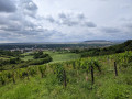
(S/E) Coming from the bottom of Rue de la Collinière, head up Chemin de la Voie Grasse on the left. It passes between a few houses before opening out onto the vineyard. Continue straight on, between the vineyards, until you reach a double row of trees. Then head up to the right between the two rows of trees until you reach the orientation table, which is very close by.
(1) Then take the path on the right, following the upper edge of the vineyard. Go round a clump of trees on the left, ignore a fork on the right and continue straight on with a view of the Yonne valley on your right. You’ll come to a sharp bend to the left.
(2) Turn left, immediately ignore a path branching off to the right and stay along the edge of the vineyard until you reach a copse. The path has a fork in it: take the left-hand path (north-north-east) which leads into the copse.
(3) Cross a road (the D20) and continue straight on until you reach the airfield fence: go round it on the left. The path then enters a woodland and descends slightly.
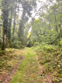
(4) Turn right and cross the woodland along a wide path that climbs up the Val Aubry. At the end of the path, take a cross-path on the right. After about 150m, turn left and walk alongside the airfield until you reach the road (cross).
(5) Follow the road to the right for about 200 metres. At the day-care centre, leave the road and take a path to the left. Walk alongside the day-care centre, go down a sunken path and ignore all the turnings on the left. This will take you back to the starting point (S/E).


 Visorando Member

 Moderate
