Refine your search for walks in Col des Béraudes
Col des Béraudes walks


 The Cerces tour
 Visorando Member
 10.62 mi
 +3,261 ft
 -3,235 ft
 7h 45
7h 45
 Difficult
 Departure from Névache (Hautes-Alpes)
A beautiful, challenging hike that takes you around the Cerces Massif, from lake to lake...
There are a few tricky sections for those who are afraid of heights
4 days in the Clarée Valley (Cerces and Thabor)
 30.15 mi
+12,549 ft
-12,520 ft
4 days
30.15 mi
+12,549 ft
-12,520 ft
4 days
 Very difficult
Departure from Névache (Hautes-Alpes)
Very difficult
Departure from Névache (Hautes-Alpes)
This 4-day circular bivouac is for experienced hikers.
It does, of course, follow sections of marked trails (GR®,GRP®), but the nature of the terrain when off-trail requires extreme caution (rock falls) and a solid knowledge of navigation, especially in unpredictable weather. The daily summit climb is obviously dependent on your equipment (crampons?), weather conditions (snowfields?) and your physical fitness.
To take in the full spectrum of colours from the Pont de l’Alpe
 10.73 mi
+3,816 ft
-3,799 ft
8h 15
Difficult
Departure from Le Monêtier-les-Bains (Hautes-Alpes)
10.73 mi
+3,816 ft
-3,799 ft
8h 15
Difficult
Departure from Le Monêtier-les-Bains (Hautes-Alpes)
This is a walk that will take you through a whole range of colours. From the green and blue of the lakes – the Grand Lac, Lac de la Ponsonnière, Lac de la Mine, etc. – to the green, red, grey and white of the Pic de la Moulinière, and the black of the old graphite mine. Panoramic views of the Écrins and Cerces massifs.This route is a variation on the ‘Lac et Col de la Ponsonnière’ hike via the Grand Lac, which we have extended.
A circular route via the Col du Chardonnet and Col des Béraudes, starting from Fontcouverte
 10.00 mi
+3,494 ft
-3,484 ft
8 hrs
Very difficult
Departure from Névache (Hautes-Alpes)
10.00 mi
+3,494 ft
-3,484 ft
8 hrs
Very difficult
Departure from Névache (Hautes-Alpes)
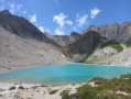
A fairly challenging circular route in the Clarée Valley, classified as very difficult due to a long stretch of unstable scree and exposed sections with or without handrails; whilst these are few in number, they may put off those prone to vertigo. Magnificent views from the Col du Chardonnet and the Col des Béraudes. Lovers of rocky terrain and high-altitude lakes will not be disappointed.
Please note: this circular route is reserved for experienced hikers.
Laval car park - Lac des Cerces
 7.23 mi
+3,537 ft
-2,254 ft
7 hrs
Very difficult
Departure from Névache (Hautes-Alpes)
7.23 mi
+3,537 ft
-2,254 ft
7 hrs
Very difficult
Departure from Névache (Hautes-Alpes)
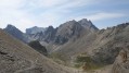
First day of a 4-day circular starting from the Laval car park in the Upper Clarée Valley. As with the other parts of this circular, this route is intended for experienced hikers who are accustomed to high mountains.
Chalet de Laval - Alpe du Lauzet
8.12 mi
+2,785 ft
-3,793 ft
6h 10
Difficult
Departure from Névache (Hautes-Alpes)
A traverse of the Cerces massif via one of its highest passes (Béraudes) and some very beautiful lakes.And a chance to see much of the previous day’s descent route, as well as the many lakes on the other side.In early summer, the route can be made difficult by the presence of snow in the Lac des Béraudes cirque or a snow cornice on the Col des Béraudes (speaking from experience).