Tour of the Arêtes de la Bruyère

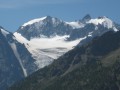
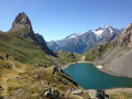
A circular route through spectacular scenery, with the added thrill of a challenging cable-assisted section. Panoramic views of the glaciers, a large lake, soaring peaks, a refuge and chalets – everything you need for a wonderful experience.

Details

41672640
Creation:
Last update:
Last review:
  • Walking
    Activity: Walking
  • ↔
    Distance: 5.02 mi
  • ◔
    Average duration: 4h 30 
  • ▲
    Difficulty: Difficult

  • ⚐
    Back to start: Yes
  • ↗
    Ascent: + 2,503 ft
  • ↘
    Descent: - 2,490 ft

  • ▲
    Highest point: 8,094 ft
  • ▼
    Lowest point: 5,591 ft

Photos

Description of the walk

On the RD1091, between Monêtier-les-Bains and the Col du Lautaret, try to park in the car parks at Pont de l’Alpe.

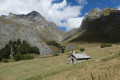
(S/E) Take the wide track at the bridge – this is theGR®50– and head uphill towards L’Alpe du Lauzet. After a few hairpin bends, you’ll come out onto a plateau. Continue straight on until you reach the chalets, pass them, and you’ll then come to a crossroads of paths.

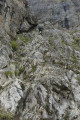
(1) Leave theGR® here and turn left, cross the Torrent du Rif via the bridge, then continue the climb along the left bank of the Torrent du Plan Chevalier, taking care to stay on the main path. After a few hairpin bends, you’ll reach the cable-assisted section.

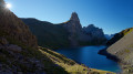
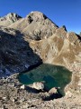
(2) Watch out for the rocks and make good use of the cable. You’ll emerge onto a ledge overlooking the Grand Lac. Descend to the lake and look out for a discreet path on the right that leads uphill.

(3) Ignore the path running due north along the lake and take the one on the right instead. Join the inconspicuous path, which climbs quite steeply at first. Continue until you reach theGR®57.

(4) Turn left onto it, emerge onto a ridge, then reach a shepherd’s hut. Pass the hut and continue a little further along the ridge until you reach a fountain.

(5) Return to theGR® junction you passed earlier.

(4) Keep left on theGR® and continue down a very gentle slope to reach the Clôt des Vaches clearing and the junction leading to the refuge.

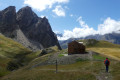
(6) Turn right, cross the Torrent du Rif to reach the refuge.

(7) Carry on, passing the Clôt des Vaches junction once more.

(8) Turn right to begin a well-marked descent between the large boulders from the mountain’s various scree slopes, arriving at the initial junction you passed on the way there.

(1) Follow the route you took on the way there in the opposite direction to return to the Pont de l’Alpe car park (S/E).

Waypoints

  1. S/E : mi 0 - alt. 5,591 ft - Car park at the - Pont de l'Alpe
  2. 1 : mi 0.79 - alt. 6,394 ft - Junction of the circular loop
  3. 2 : mi 1.59 - alt. 6,867 ft - Corridor equipped with a cable
  4. 3 : mi 1.86 - alt. 7,523 ft - Monêtier crossroads - Le Grand Lac
  5. 4 : mi 2.07 - alt. 7,989 ft - Small pass. Return to the fountain
  6. 5 : mi 2.3 - alt. 8,094 ft - Fountain
  7. 6 : mi 3.18 - alt. 7,421 ft - Crossroads at the Clôt des Vaches mountain hut
  8. 7 : mi 3.3 - alt. 7,382 ft - Refuge du Clot des Vaches
  9. 8 : mi 3.56 - alt. 7,218 ft - Clôt des Vaches junction
  10. S/E : mi 5.01 - alt. 5,604 ft - Car park at the - Pont de l'Alpe

Notes

Water points:
(1) at the Chalets de L’Alpe du Lauzet,
(5) past the shepherd’s hut,
(7) at the Clôt des Vaches mountain refuge.

  • The Clôt des Vaches mountain hut (7) is under construction until autumn 2024.

This route passes through multiple protected areas, which may be subject to special regulations:

Worth a visit

(2) at the cable crossing, the via ferrata equipment can be used but is not essential. However, you must be comfortable on this type of steep, rugged terrain where you will need to use your hands.
(5) At the shepherd’s hut, please respect the shepherd’s privacy when the hut is in use.
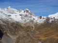
Enjoy the panoramic views throughout the hike.

Always be cautious and plan ahead when you're outdoors. Visorando and the author of this route cannot be held responsible for any accidents occurring on this route.

The GR® and PR® markings are the intellectual property of the Fédération Française de Randonnée Pédestre.

Reviews and comments

5 / 5
Based on 2 reviews

Reliability of the description
5 / 5
Ease of following the route
5 / 5
Route interest
5 / 5
AqualiJu
AqualiJu

Overall rating : 5 / 5

Date of your route : Aug 29, 2025
Reliability of the description : Not used / Not applicable
Ease of following the route : ★★★★★ Very good
Route interest : ★★★★★ Very good
Very busy route : Yes

A very beautiful hike on a marked trail. I loved it! It took me 3 hours and 40 minutes to complete.
The "difficult" section is quite steep, so it is not recommended for people who are prone to vertigo, and it is best to walk in this direction.

I met quite a few people at the car park (start/finish) and then on the trail once I had passed the lake.

Machine-translated

Philou9008
Philou9008

Overall rating : 5 / 5

Date of your route : Aug 23, 2025
Reliability of the description : ★★★★★ Very good
Ease of following the route : ★★★★★ Very good
Route interest : ★★★★★ Very good
Very busy route : Yes

Steep climb and impressive slope before reaching the cable. Be careful at the difficult section, where you will need to use your hands to hold onto the cable.

Machine-translated

Other walks in the area

For more walks, use our search engine .

The GPS track and description are the property of this route's author. Please do not copy them without permission.