


Refine your search for walks in Le Grand Lac
Le Grand Lac walks


 The Grand Lac and the Lac de la Ponsonnière
 Visorando Member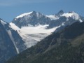
 7.20 mi
 +2,835 ft
 -2,835 ft
 5h 45
5h 45
 Moderate
 Departure from Le Monêtier-les-Bains (Hautes-Alpes)
20 minutes from the town of Monêtier-les-Bains. A lovely day’s hike with a magnificent view at the end. Views over the Grand Lac and the Écrins massif.Return to the car park via the same route.
Lac et Col de la Ponsonnière via the Grand Lac
 8.33 mi
+3,084 ft
-3,087 ft
6h 30
8.33 mi
+3,084 ft
-3,087 ft
6h 30
 Difficult
Departure from Le Monêtier-les-Bains (Hautes-Alpes)
Difficult
Departure from Le Monêtier-les-Bains (Hautes-Alpes)
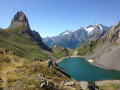
An alternative route for the round trip to Le Grand Lac and Lac de la Ponsonnière allows for a circular route involving a chimney passage, but this restricts access to those with at least some mountain experience.A breathtaking, panoramic view of the Écrins Massif: Mont Pelvoux, the Barre des Écrins, the Pic de Neige Cordier, the Meije, the Rateau and more.
Grand Galibier from the Pont de l'Alp
 11.67 mi
+5,348 ft
-5,341 ft
8 hrs
11.67 mi
+5,348 ft
-5,341 ft
8 hrs
 Very difficult
Departure from Le Monêtier-les-Bains (Hautes-Alpes)
Very difficult
Departure from Le Monêtier-les-Bains (Hautes-Alpes)
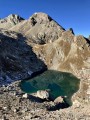
A magnificent hike leading to the legendary Grand Galibier viewpoint, from where you can admire almost the entire French Alps. Part of the hike is off-trail and often on poorly marked paths, but the most difficult part of the route is well marked with cairns.
On the agenda: unique panoramic views, numerous crystal-clear lakes, friendly wildlife, wild valleys dating back to the Ice Age, all under the deep blue skies of the Hautes-Alpes.
To take in the full spectrum of colours from the Pont de l’Alpe
 10.73 mi
+3,816 ft
-3,799 ft
8h 15
Difficult
Departure from Le Monêtier-les-Bains (Hautes-Alpes)
10.73 mi
+3,816 ft
-3,799 ft
8h 15
Difficult
Departure from Le Monêtier-les-Bains (Hautes-Alpes)
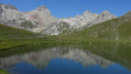
This is a walk that will take you through a whole range of colours. From the green and blue of the lakes – the Grand Lac, Lac de la Ponsonnière, Lac de la Mine, etc. – to the green, red, grey and white of the Pic de la Moulinière, and the black of the old graphite mine. Panoramic views of the Écrins and Cerces massifs.This route is a variation on the ‘Lac et Col de la Ponsonnière’ hike via the Grand Lac, which we have extended.
Tour of the Arêtes de la Bruyère
 5.02 mi
+2,503 ft
-2,490 ft
4h 30
Difficult
Departure from Le Monêtier-les-Bains (Hautes-Alpes)
5.02 mi
+2,503 ft
-2,490 ft
4h 30
Difficult
Departure from Le Monêtier-les-Bains (Hautes-Alpes)
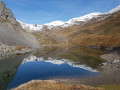
A circular route through spectacular scenery, with the added thrill of a challenging cable-assisted section. Panoramic views of the glaciers, a large lake, soaring peaks, a refuge and chalets – everything you need for a wonderful experience.
Refuge des Drayères – Pont de l’Alpe
 9.08 mi
+2,014 ft
-3,563 ft
5h 55
Moderate
Departure from Névache (Hautes-Alpes)
9.08 mi
+2,014 ft
-3,563 ft
5h 55
Moderate
Departure from Névache (Hautes-Alpes)
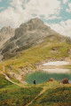
3rd and final stage. Starting from the Refuge des Drayères, head up to the source of the Clarée and return to Pont de l’Alpe via the Col de la Ponsonnière. A tour of the Massif des Cerces taking in numerous lakes, each more beautiful than the last: in turn, the Clarée, Rond, Grand Ban, Cerces, Ponsonnière and, finally, the Grand Lac.
Tête de Colombe
 9.36 mi
+4,757 ft
-4,757 ft
8 hrs
Very difficult
Departure from Le Monêtier-les-Bains (Hautes-Alpes)
9.36 mi
+4,757 ft
-4,757 ft
8 hrs
Very difficult
Departure from Le Monêtier-les-Bains (Hautes-Alpes)
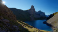
The Tête de Colombe (3,022 m) is a magnificent vantage point accessible to walkers, situated on the ridge running from the eponymous Roche Colombe to the Grand Galibier. Ibex are abundant here; there are no signposted paths leading to this ridge, with the exception of a few cairn-marked tracks.
The spectacular panorama over the highest peaks of the Écrins, Grandes Rousses, Cerces and Queyras stretches as far as Mont Blanc and Viso.