


Refine your search for walks in Perelli
Perelli walks
 The Pianellu Waterfall and La Punta di Caldane
 Visorando Member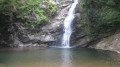
 8.47 mi
 +3,757 ft
 -3,740 ft
 7h 10
7h 10
 Difficult
 Departure from Pianello (Haute-Corse)
A little-known but magnificent waterfall. It is situated on the outskirts of the village of Pianello on the D16, on the road to Matra, just past the bridge. It is an oasis of coolness and flows in the shade of trees so leafy that they barely let any sunlight through.
Next comes Punta di Caldane, offering a magnificent view of the sea, passing through the forgotten hamlet of Saint-Vincent and its chapel, then the I Peri sheepfolds. You can, of course (!!), shorten the walk.
Pointe de l’Orsaja, starting from Pianello via the Peri huts
 7.81 mi
+2,477 ft
-2,477 ft
5h 45
7.81 mi
+2,477 ft
-2,477 ft
5h 45
 Moderate
Departure from Pianello (Haute-Corse)
Moderate
Departure from Pianello (Haute-Corse)
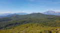
A circular route on the southern slope of the Caldane massif, the southern boundary of the Castagniccia. Breathtaking views of the Corsican mountains, from Monte Cardo to the Aiguilles de Bavella in the distance and the beaches of the Costa Verde. The Pointe de l’Orsaja is the lowest peak in the massif; climbing it opens up views of the Alesani valley and, in the distance, its dam and the beaches of Alistro.
You’ll come across plenty of birds along this route, as well as cows and sheep....
Carchetu circular
 1.88 mi
+394 ft
-384 ft
1h 10
1.88 mi
+394 ft
-384 ft
1h 10
 Easy
Departure from Carcheto-Brustico (Haute-Corse)
Easy
Departure from Carcheto-Brustico (Haute-Corse)
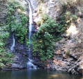
This circular loop can be done with the family, for example, or simply to discover the Orezza region on a short and easy hike. During this walk, you can discover the region's natural heritage (waterfall) as well as its architectural heritage.
Circular walk starting from the village of Parata
 4.53 mi
+2,041 ft
-2,054 ft
3h 50
Moderate
Departure from Parata (Haute-Corse)
4.53 mi
+2,041 ft
-2,054 ft
3h 50
Moderate
Departure from Parata (Haute-Corse)
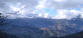
Nestled in the Castaniccia region at the end of the D46 departmental road lies the rural village of Parata, which serves as the starting point for several walks. The walk suggested here climbs up to the ridges, passing by the Chapel of San Bartolomeu. The views on either side of the ridge you follow offer vistas of both the Tyrrhenian Sea and the Castaniccia region with its villages.
Circular walk through the chestnut grove at Santa-Reparata-Di-Moriani
 4.85 mi
+1,883 ft
-1,860 ft
3h 50
Difficult
Departure from Santa-Reparata-di-Moriani (Haute-Corse)
4.85 mi
+1,883 ft
-1,860 ft
3h 50
Difficult
Departure from Santa-Reparata-di-Moriani (Haute-Corse)
A superb circular walk in Castagniccia, in the shade of chestnut and beech trees and amidst ferns. At a bend in the path, panoramic views of the southern side of Castagniccia, the eastern plain and the Étang de Diane in the background. Majestic trees and strange sculptures formed by vegetation on the remains of immense chestnut trees.
Three villages in Castagniccia starting from Piedicroce
 4.04 mi
+1,148 ft
-1,142 ft
2h 50
Moderate
Departure from Piedicroce (Haute-Corse)
4.04 mi
+1,148 ft
-1,142 ft
2h 50
Moderate
Departure from Piedicroce (Haute-Corse)
This circular route in Castagniccia offers both a remarkable natural and cultural setting. Passing through villages and other built-up areas, it allows you to discover Corsican heritage: houses, chapels, churches, a convent (near Piedicroce), as well as wash houses and fountains. The circular path, mostly in the woods, is shaded while offering exceptional views of the various villages in the region. Small streams provide refreshing breaks in summer, while remaining passable in winter.
Summit of Monte San Petrone in a circular route from Pie-d'Orrezza
 9.10 mi
+3,960 ft
-3,960 ft
7h 40
Difficult
Departure from Pie-d'Orezza (Haute-Corse)
9.10 mi
+3,960 ft
-3,960 ft
7h 40
Difficult
Departure from Pie-d'Orezza (Haute-Corse)
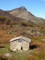
This alternative route to Monte San Petrone from the village of Pie-d'Orezza is much more challenging, but also more beautiful than the classic route via the Col de Prato. At 1,767 metres, San Petrone is the highest peak in Castaniccia. The summit offers a remarkable 360° panorama. You will have a view of Cap Corse to the east coast, the whole of Castaniccia and the mountain range of the island's highest peaks. This hike can be classified as very difficult for hikers who are not used to fairly long distances and significant elevation gains. You can shorten it by avoiding the return trip to the summit of San Petrone from the Col de Bocca di San Pietro. Nevertheless, it will still be a very beautiful circular hike with varied landscapes and unobstructed views.
The Zalana-Matra Trail
 3.66 mi
+1,555 ft
-1,552 ft
3h 00
Moderate
Departure from Zalana (Haute-Corse)
3.66 mi
+1,555 ft
-1,552 ft
3h 00
Moderate
Departure from Zalana (Haute-Corse)
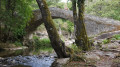
Following this Zalana-Matra trail, you will cross a chestnut grove, then take a steep, sloping path that winds through thick scrubland and overlooks impressive precipices in places. Along the way, you will admire a very old mill, then cross an authentic Genoese bridge over the Bravone, the Alisu bridge. Then climb back up through a chestnut forest and finish your walk at the Matra cross (the return point of the hike).
Circular route starting from Campodonico
 5.11 mi
+1,844 ft
-1,854 ft
3h 55
Moderate
Departure from Pie-d'Orezza (Haute-Corse)
5.11 mi
+1,844 ft
-1,854 ft
3h 55
Moderate
Departure from Pie-d'Orezza (Haute-Corse)
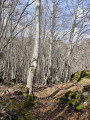
This circular route starting from Campodonico traverses varied mountain landscapes in the heart of Castagniccia. On the plateau, a breathtaking view allows you to admire the mountain range of central Corsica and the remarkable villages of Castagniccia, whilst enjoying a distant view of the sea. Furthermore, there are traces of ancient buildings to admire at Bocca al Prato.
Monte San Petrone, starting from Campodonicio
 6.65 mi
+3,143 ft
-3,153 ft
5h 50
Difficult
Departure from Pie-d'Orezza (Haute-Corse)
6.65 mi
+3,143 ft
-3,153 ft
5h 50
Difficult
Departure from Pie-d'Orezza (Haute-Corse)
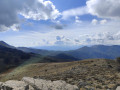
This walk is an alternative route to the summit of San Petrone. It offers varied scenery, different from the route via the Col de Pratu, and is less busy. There are numerous viewpoints along the route, particularly overlooking the Castagniccia.
Circular route starting from Cervione
 5.87 mi
+2,287 ft
-2,290 ft
4h 40
Moderate
Departure from Cervione (Haute-Corse)
5.87 mi
+2,287 ft
-2,290 ft
4h 40
Moderate
Departure from Cervione (Haute-Corse)
Located above Cervione, this hike offers a chance to admire varied landscapes and vegetation. The viewpoints, on either side of the mountains, also allow you to gaze from afar at built heritage, such as the Chapel of Scupiccia, for example, or the village of Santa-Maria Poggio. In the distance, out at sea, the Island of Monte Cristo can also be seen.
Circular Piazzole route via San Damianu and San Bertuli
 9.07 mi
+2,799 ft
-2,785 ft
6h 35
Difficult
Departure from Piazzole (Haute-Corse)
9.07 mi
+2,799 ft
-2,785 ft
6h 35
Difficult
Departure from Piazzole (Haute-Corse)
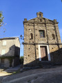
This circular walk in Castagniccia offers the chance to discover both the natural and built heritage of our island. The walk passes through the villages of Piazzole, Bonifaziu, San Damianu and Mont d’Olmu – jewels of the region – and also takes you past the Chapel of San Bertuli. During the summer months, you can also stop there for a welcome and a bite to eat before heading back down to Piazzole. Alongside the built heritage, the route offers natural beauty, with a section through the woodland that provides cool respite in summer, as well as sections along the ridges offering unrivalled views of Castagniccia.
Return trip to Fiuminale, a village in ruins
3.35 mi
+991 ft
-991 ft
2h 25
Moderate
Departure from Velone-Orneto (Haute-Corse)
A shaded walk along the Canapajo stream to the ruins of the village of Fiuminale, a restored village accessible only on foot, by donkey or on horseback. Round-trip hike.
Tallone Trail
 4.20 mi
+791 ft
-791 ft
2h 35
Easy
Departure from Tallone (Haute-Corse)
4.20 mi
+791 ft
-791 ft
2h 35
Easy
Departure from Tallone (Haute-Corse)
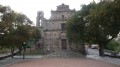
The village of Tallone will charm you with its view of the natural heritage of the coastline, where the Tyrrhenian Sea meets the ponds of Diane, Urbinu, del Sale and Terrenzana.
The lower part of the village opens onto an imposing square where the Baroque church of Saint-Cézaire stands, its forecourt built with a particular type of rock called gneiss.
Its carved door and bell tower are truly admirable.
San-Nicolao (San Niculaiu) circular loop
 2.07 mi
+420 ft
-413 ft
1h 20
Easy
Departure from San-Nicolao (Haute-Corse)
2.07 mi
+420 ft
-413 ft
1h 20
Easy
Departure from San-Nicolao (Haute-Corse)
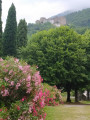
Starting from the parish church of San Niculaiu, a listed historical monument, this short, easy, shaded circular family walk will take you through part of the municipality of San Nicolao with its two small hamlets.
Bucatoghju Waterfall in Santa-Maria-Poggio
 1.23 mi
+79 ft
-262 ft
0h 40
Easy
Departure from Santa-Maria-Poggio (Haute-Corse)
1.23 mi
+79 ft
-262 ft
0h 40
Easy
Departure from Santa-Maria-Poggio (Haute-Corse)
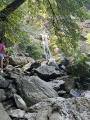
This trail, starting from a pay-and-display car park (€5), takes you to the Bucatoghju Waterfall and also allows you to see a Genoese bridge. It is an easy, family-friendly walk, though it does involve several (structured) stream crossings.
The Ucelluline Waterfall or Bucatoggio Waterfall
 4.70 mi
+1,388 ft
-1,421 ft
3h 20
Easy
Departure from Santa-Maria-Poggio (Haute-Corse)
4.70 mi
+1,388 ft
-1,421 ft
3h 20
Easy
Departure from Santa-Maria-Poggio (Haute-Corse)
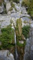
When nature becomes a spectacle.
Secret yet welcoming, the Ucelluline waterfall (meaning "little bird" in Corsican) offers a striking setting that will leave a lasting impression. Between the villages of Santa Maria Poggio and San Nicolao, discover this wild and unspoilt site where fresh, clear water flows before your eyes and continues its journey to the sea. This walk is very popular during the day, but also at night, when its misty veil is fully illuminated and will fill you with wonder.
The Erbajolo Heritage Trail
 Association / Club / Walk leader
 3.31 mi
+846 ft
-843 ft
2h 15
Easy
Departure from Erbajolo (Haute-Corse)
3.31 mi
+846 ft
-843 ft
2h 15
Easy
Departure from Erbajolo (Haute-Corse)
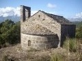
This trail will take you through time in search of what life was like a few decades ago in this wonderful part of Corsica.
The scenery is beautiful and the course is very pleasant...
The Erbajolo ridges circular loop
5.51 mi
+1,381 ft
-1,388 ft
3h 45
Moderate
Departure from Erbajolo (Haute-Corse)
The second circular ridge loop is of intermediate difficulty and takes three and a half hours to complete.
It is marked in blue and will guide you along the ridges before reaching the abandoned village of Casella in the central part of the valley. From Casella, the markings change to orange, leading to Petra a u Moru and finally on to Erbajolo via a very gentle 1-hour climb.
In the abandoned village of Casella, you can shorten the circular route by taking the alternative route via the San Martinu chapel, a 30-minute climb also marked in orange.
Santa Lucia di Moriani Circular Route
 6.91 mi
+1,709 ft
-1,706 ft
4h 40
Moderate
Departure from Santa-Lucia-di-Moriani (Haute-Corse)
6.91 mi
+1,709 ft
-1,706 ft
4h 40
Moderate
Departure from Santa-Lucia-di-Moriani (Haute-Corse)
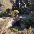
The walk takes place mainly in woodland, particularly chestnut trees. It is very pleasant to walk alongside various streams such as the Ruisseau de Canapajo, after the Pont de l'Enfer. The ruins of an old mill are also visible. The route also passes through the hamlet of Serrale.
Croce Niolo and Monte Taglio ridges via Fiuminale
 9.53 mi
+2,756 ft
-2,746 ft
6h 45
Difficult
Departure from Pero-Casevecchie (Haute-Corse)
9.53 mi
+2,756 ft
-2,746 ft
6h 45
Difficult
Departure from Pero-Casevecchie (Haute-Corse)
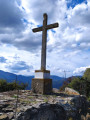
This circular hike, which is not difficult but does require a certain level of fitness, will take you through varied and unspoilt vegetation. Along the way, you will discover the two hamlets of Fiuminale and forests of hundred-year-old chestnut trees. From the summit of Croce Niolo at an altitude of 995 m, you will have a 360° panorama. To the west, you can see Monte San Petrone, the highest peak in Castagniccia. To the east, the Tuscan archipelago: Elba and Monte Cristo. To the north, Casinca and the Bastia region. Unspoilt by mass tourism, you will have the opportunity to visit three traditional villages in the upper Costa Verde region.