Circular walk through the chestnut grove at Santa-Reparata-Di-Moriani

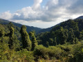
A superb circular walk in Castagniccia, in the shade of chestnut and beech trees and amidst ferns. At a bend in the path, panoramic views of the southern side of Castagniccia, the eastern plain and the Étang de Diane in the background. Majestic trees and strange sculptures formed by vegetation on the remains of immense chestnut trees.

Details

2431405
Creation:
Last update:
Last review:
  • Walking
    Activity: Walking
  • ↔
    Distance: 4.85 mi
  • ◔
    Average duration: 3h 50 
  • ▲
    Difficulty: Difficult

  • ⚐
    Back to start: Yes
  • ↗
    Ascent: + 1,883 ft
  • ↘
    Descent: - 1,860 ft

  • ▲
    Highest point: 3,392 ft
  • ▼
    Lowest point: 1,890 ft

Photos

Description of the walk

The start of the walk is accessible by road from the village of Penti in the municipality of Santa-Reparata-Di-Moriani. You can park 100 metres before the start, in the car park of the Penti stopover lodge.

The walk is very well signposted in orange.

(S/E) The walk begins at the U Mezu fountain: follow the road to the hamlet of Forci. Walk through the hamlet to a gate and go through it towards the bottom of the valley.

(1) At the junction, take the path on the right marked ‘difficult’ towards Col Frate Morto. The climb is sometimes steep but, in the shade of the chestnut trees, the path is occasionally on a slope. Take care and don’t forget to stop and admire the valley as it opens out towards the coast.

(2) When you reach the Mare a Mare junction, head uphill to enjoy the panoramic view opening out to the south. Take the path on the left (east), which leads to Monte Negrine. Along the way, you’ll catch a glimpse of the A Scupiccia chapel above Cervioni.

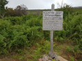
(3) At the junction, turn left. A sign marks a moment in the history of theSecond WorldWar : the plateau (covered in ferns) was the drop zone for weapons for the Corsican Resistance.

(4) At the junction, veer left and head back down towards Forci, passing through a beech forest.

(1) Turn right and follow the route you took on the way out back to the starting point (S/E).

Waypoints

  1. S/E : mi 0 - alt. 1,988 ft - Fontana di U Mezu
  2. 1 : mi 0.53 - alt. 1,896 ft - Junction of the circular loop
  3. 2 : mi 1.5 - alt. 3,179 ft - Viewpoint
  4. 3 : mi 2.89 - alt. 3,297 ft - Sign: ORVET parachuting
  5. 4 : mi 3.02 - alt. 3,245 ft - Turn left at the fork
  6. S/E : mi 4.85 - alt. 1,988 ft - Fontana di U Mezu

Notes

There is no parking further up in the village of Forci.

Between (1) and (2), the path is at times very steep on ground that is sometimes very soft (though not dangerous), and it is not recommended to walk the circular route in the opposite direction, as the descent could be very difficult.
Hiking boots are essential; walking poles are very useful for conserving energy and also for pushing aside brambles (between (1) and (2)).

Reviews and comments

4.2 / 5
Based on 3 reviews

Reliability of the description
4.3 / 5
Ease of following the route
3.7 / 5
Route interest
4.7 / 5
Fugeasse
Fugeasse

Overall rating : 3.3 / 5

Date of your route : Jun 29, 2022
Reliability of the description : ★★★★☆ Good
Ease of following the route : ★☆☆☆☆ Very disappointing
Route interest : ★★★★★ Very good
Very busy route : No

Took the path in the opposite direction. A flawless climb. A pleasant walk through the trees. Then the path leading back down – which is marked as ‘difficult’ on the ascent – is virtually impassable. Very few, if any, signposts. Extremely difficult to find; hidden by the vegetation and ferns that obscure the path. No markers to indicate changes in direction. Cows are destroying the path on the slopes. Not to mention the brambles, tall ferns and fallen trees blocking the way. In short, as things stand, ascending or descending in this direction is not recommended. It’s better to do a round trip.

Machine-translated

arena64
arena64

Overall rating : 4.7 / 5

Date of your route : Jul 21, 2021
Reliability of the description : ★★★★☆ Good
Ease of following the route : ★★★★★ Very good
Route interest : ★★★★★ Very good
Very busy route : No

Hike completed on 21/07/21
Do not enter the hamlet of Penti; the car park at the start of the walk is located by the side of the road, and you can also park near the U MEZU fountain by the roadside just before you reach it
From the ‘Col Frate Morto’ sign at the junction with the ‘Mare a Mare’ route (points 1 to 2 on the map), this is where things get tricky – no pun intended. The path, which is fortunately well signposted, is overgrown with tall ferns, brambles and stinging nettles,we had to crush them and whip them aside with our walking sticks on several occasions. When we reached the pass, the ‘Mare a Mare’ sign had been torn down and lay hidden in the tall ferns; you could hardly see it… In short, that was the hardest part of this hike, but the view up there is magnificent; the rest of the route is very well maintained and very well signposted.

Machine-translated

Sam Kdo
Sam Kdo

Overall rating : 4.7 / 5

Date of your route : Jul 02, 2020
Reliability of the description : ★★★★★ Very good
Ease of following the route : ★★★★★ Very good
Route interest : ★★★★☆ Good
Very busy route : No

The steep climb at the start of the route is currently being cleared of undergrowth and was impassable when I was there.
On the way back, you can follow the signs for ‘village martyr’ and join the Mare à Mare trail (orange markings) to return to the starting point.

Machine-translated

Other walks in the area

For more walks, use our search engine .

The GPS track and description are the property of this route's author. Please do not copy them without permission.